M'Bengué
M'Bengué is a town in northern Ivory Coast. It is a sub-prefecture of and the seat of M'Bengué Department in Poro Region, Savanes District. M'Bengué is also a commune.
M'Bengué | |
|---|---|
Town, sub-prefecture, and commune | |
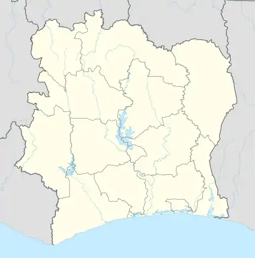 M'Bengué Location in Ivory Coast | |
| Coordinates: 10°0′N 5°54′W | |
| Country | |
| District | Savanes |
| Region | Poro |
| Department | M'Bengué |
| Population (2014)[1] | |
| • Total | 49,928 |
| Time zone | UTC+0 (GMT) |
In 2014, the population of the sub-prefecture of M'Bengué was 49,928.[2]
Villages
The 32 villages of the sub-prefecture of M'Bengué and their population in 2014 are:[2]
- Foundo 1 (584)
- Foundo 2 (903)
- M'bengue (22 242)
- Sanhara (1 067)
- Sindjougou (213)
- Souhoua (1 187)
- Boropekaha (187)
- Bougounougo (502)
- Kaloa (2 141)
- Kanofa (234)
- Kanofa 1 (200)
- Kanonon (762)
- Kassalgue (816)
- Katala 1 (442)
- Katala 2 (285)
- Legoun (369)
- Masseguere (1 406)
- Nafoun (1 304)
- Nambira (1 017)
- N'diengbala (709)
- Poungbe (1 830)
- Sandregue (1 533)
- Sekonkaha (869)
- Soleya (898)
- Tiebila (965)
- Tietougou (654)
- Tiolo 1 (486)
- Tiolo 2 (464)
- Tongon (3 929)
- Vononloho (519)
- Zangbanou (353)
- Zeguere (858)
Notes
- "Côte d'Ivoire". geohive.com. Retrieved 11 December 2015.
- "RGPH 2014, Répertoire des localités, Région Poro" (PDF). ins.ci. Retrieved 5 August 2019.
Regional seat: Korhogo | ||
| Dikodougou Department | 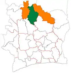 | |
| Korhogo Department | ||
| M'Bengué Department | ||
| Sinématiali Department | ||
* also a commune | ||
This article is issued from Wikipedia. The text is licensed under Creative Commons - Attribution - Sharealike. Additional terms may apply for the media files.