Mae Sariang District
Mae Sariang District (Thai: แม่สะเรียง, pronounced [mɛ̂ː sā.rīa̯ŋ]) is a small town and district (amphoe) on the narrow valley along Yuam River in Mae Hong Son Province, northern Thailand, along the Myanmar border. The areas around Mae Sariang are mountainous and forested; flat terrain that suits population or agriculture is scarce. The local population of Mae Sariang is of mixed origin. The main ethnicity in the low land plain, town center and its satellite villages along the river is Tai Yuan (Northern Thai or Lanna people) with some cross-marriage with other ethnicities. There are also Tai Yai or Shan people in the town center; they are among the first groups that inhabited the area. Red Karen and Karen descendants also reside in the town with a high density in the Christian quarter of the town. There is a sizable Bengali Muslim community and a mosque near the central market. The area has many links to Burma, such as its architecture and a large population of Burmese Muslims. Mae Sariang represents the westernmost area where Lanna culture and architecture dominated which also well assimilated with Burmese/ Shan.
Mae Sariang
แม่สะเรียง | |
|---|---|
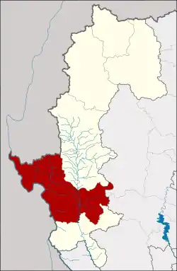 District location in Mae Hong Son Province | |
| Coordinates: 18°9′34″N 97°56′1″E | |
| Country | Thailand |
| Province | Mae Hong Son |
| Seat | Mae Sariang |
| Area | |
| • Total | 2,587.4 km2 (999.0 sq mi) |
| Population (2010) | |
| • Total | 50,937 |
| • Density | 20.1/km2 (52/sq mi) |
| Time zone | UTC+7 (ICT) |
| Postal code | 58110 |
| Geocode | 5804 |
Geography
Neighboring districts are (from north clockwise): Mae La Noi of Mae Hong Son Province; Mae Chaem and Hot of Chiang Mai Province; Sop Moei of Mae Hong Son Province; and Kayin State and Kayah State of Myanmar.
Salawin National Park is in the district. The important river of Mae Sariang is the Yuam River.
Climate
| Climate data for Mae Sariang (1981–2010) | |||||||||||||
|---|---|---|---|---|---|---|---|---|---|---|---|---|---|
| Month | Jan | Feb | Mar | Apr | May | Jun | Jul | Aug | Sep | Oct | Nov | Dec | Year |
| Record high °C (°F) | 35.8 (96.4) |
39.6 (103.3) |
42.1 (107.8) |
42.8 (109.0) |
42.7 (108.9) |
37.7 (99.9) |
36.3 (97.3) |
36.2 (97.2) |
36.8 (98.2) |
37.1 (98.8) |
37.1 (98.8) |
37.1 (98.8) |
42.8 (109.0) |
| Average high °C (°F) | 31.4 (88.5) |
34.0 (93.2) |
36.5 (97.7) |
37.9 (100.2) |
34.9 (94.8) |
31.6 (88.9) |
30.7 (87.3) |
30.7 (87.3) |
32.1 (89.8) |
32.8 (91.0) |
32.0 (89.6) |
30.5 (86.9) |
32.9 (91.2) |
| Daily mean °C (°F) | 20.4 (68.7) |
22.2 (72.0) |
26.0 (78.8) |
29.3 (84.7) |
28.4 (83.1) |
26.8 (80.2) |
26.2 (79.2) |
26.2 (79.2) |
26.5 (79.7) |
26.1 (79.0) |
23.9 (75.0) |
20.9 (69.6) |
25.2 (77.4) |
| Average low °C (°F) | 13.6 (56.5) |
13.8 (56.8) |
17.5 (63.5) |
22.3 (72.1) |
23.9 (75.0) |
23.6 (74.5) |
23.2 (73.8) |
23.1 (73.6) |
23.0 (73.4) |
22.3 (72.1) |
19.2 (66.6) |
15.3 (59.5) |
20.1 (68.2) |
| Record low °C (°F) | 6.9 (44.4) |
6.3 (43.3) |
10.8 (51.4) |
15.5 (59.9) |
19.9 (67.8) |
21.2 (70.2) |
20.1 (68.2) |
20.4 (68.7) |
19.8 (67.6) |
15.2 (59.4) |
7.3 (45.1) |
3.3 (37.9) |
3.3 (37.9) |
| Average rainfall mm (inches) | 1.5 (0.06) |
6.5 (0.26) |
14.2 (0.56) |
44.7 (1.76) |
162.3 (6.39) |
183.0 (7.20) |
181.2 (7.13) |
220.4 (8.68) |
177.1 (6.97) |
115.2 (4.54) |
22.1 (0.87) |
7.6 (0.30) |
1,135.8 (44.72) |
| Average rainy days | 0.5 | 0.6 | 1.4 | 5.1 | 16.5 | 24.9 | 26.7 | 26.5 | 20.9 | 13.5 | 4.1 | 1.4 | 142.1 |
| Average relative humidity (%) | 78 | 69 | 62 | 62 | 75 | 84 | 86 | 86 | 85 | 84 | 82 | 80 | 78 |
| Mean monthly sunshine hours | 257.3 | 305.1 | 350.3 | 279.0 | 198.4 | 60.0 | 58.9 | 58.9 | 108.0 | 145.7 | 183.0 | 254.2 | 2,258.8 |
| Mean daily sunshine hours | 8.3 | 10.8 | 11.3 | 9.3 | 6.4 | 2.0 | 1.9 | 1.9 | 3.6 | 4.7 | 6.1 | 8.2 | 6.2 |
| Source 1: Thai Meteorological Department[1] | |||||||||||||
| Source 2: Office of Water Management and Hydrology, Royal Irrigation Department (sun and humidity)[2] | |||||||||||||
History
In 1900 the administration in the area was formalized as a district under Mae Hong Son. Originally the district was named Mueang Yuam (เมืองยวม), which was changed in 1917 to Mae Sariang.[3]
Administration
The district is divided into seven sub-districts (tambons), which are further subdivided into 77 villages (mubans). Mae Sariang is also a sub-district municipality (thesaban tambon) which covers parts of tambons Ban Kat and Mae Sariang. There are a further seven tambon administrative organizations (TAO).
| No. | Name | Thai | Villages | Pop.[4] |
|---|---|---|---|---|
| 1. | Ban Kat | บ้านกาศ | 13 | 11,283 |
| 2. | Mae Sariang | แม่สะเรียง | 9 | 9,968 |
| 3. | Mae Khong | แม่คง | 11 | 4,154 |
| 4. | Mae Ho | แม่เหาะ | 13 | 7,813 |
| 5. | Mae Yuam | แม่ยวม | 13 | 9,273 |
| 6. | Sao Hin | เสาหิน | 6 | 2,691 |
| 8. | Pa Pae | ป่าแป๋ | 12 | 5,755 |
Number 7 is not used.
References
- "Climatological Data for the Period 1981–2010". Thai Meteorological Department. p. 1. Retrieved 31 July 2016.
- "ปริมาณการใช้น้ำของพืชอ้างอิงโดยวิธีของ Penman Monteith (Reference Crop Evapotranspiration by Penman Monteith)" (PDF) (in Thai). Office of Water Management and Hydrology, Royal Irrigation Department. p. 10. Retrieved 31 July 2016.
- ประกาศกระทรวงมหาดไทย เรื่อง เปลี่ยนชื่ออำเภอ (PDF). Royal Gazette (in Thai). 34 (0 ก): 40–68. 1917-04-29.
- "Population statistics 2010". Department of Provincial Administration. Archived from the original on 2011-08-10.
External links
 Mae Hong Son travel guide from Wikivoyage
- Mae Hong Son Loop travel guide from Wikivoyage
- amphoe.com (Thai)
- http://www.maesariang.go.th/ Website of Mae Sariang municipality
- Salawin National Park