Magapit Suspension Bridge
The Magapit Bridge is suspension bridge spanning 257 meters (843 ft) that connects the east and west sides of the Cagayan River in Lal-lo, Cagayan, Philippines. Opened in 1978, it carries Maharlika Highway, linking Barangays Bangag and Magapit in Lal-lo. The bridge was also named by the locals as the "Golden Gate of Cagayan". This bridge is one of the only two bridges in the province that runs across the mighty waterway of the Cagayan River.
Magapit Suspension Bridge | |
|---|---|
 Magapit Suspension Bridge at dusk in 2007 | |
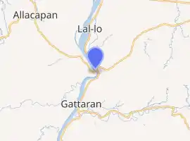
| Coordinates | 18.122258°N 121.672672°E |
| Carries | 2 lanes of |
| Crosses | Cagayan River |
| Locale | Lal-lo, Cagayan |
| Official name | Magapit Suspension Bridge |
| Other name(s) | Magapit Bridge |
| Maintained by | Department of Public Works and Highways |
| Characteristics | |
| Design | Suspension bridge |
| Total length | 449.14 m (1,473.6 ft) |
| Longest span | 257 m (843 ft) |
| Load limit | 20 metric tons (20 long tons; 22 short tons) |
| No. of lanes | Two-lane single carriageway |
| History | |
| Opened | 1978 |
| Location | |
| |
The late Engr. Angel G. Villanueva was the project engineer of Magapit suspension bridge under IWCDC (owned by the Dys) and Japanese consultants.
Rehabilitation
The bridge undergone rehabilitation that started on May 16, 2012 and ended November 20, 2012. Traffic in that area were serviced by ferry boats in lieu of the rehabilitation. The rehabilitation project had an estimated cost of ₱100 million .[1]
References
- DPWH: Magapit Bridge closed starting May 16 for repair "Archived copy". Archived from the original on 2012-08-05. Retrieved 2012-05-28.CS1 maint: archived copy as title (link)