Maine State Route 181
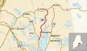
State Route 181 (SR 181) is a 12.45-mile (20.04 km) route in the US state of Maine from SR 180 near Mariaville to SR 9 in Amherst. It serves as the main through route through Mariaville.[2]
| ||||
|---|---|---|---|---|
| Mariaville Road | ||||
 | ||||
| Route information | ||||
| Maintained by MaineDOT | ||||
| Length | 12.45 mi[1] (20.04 km) | |||
| Major junctions | ||||
| South end | ||||
| North end | ||||
| Location | ||||
| Counties | Hancock | |||
| Highway system | ||||
| ||||

Major junctions
The entire route is in Hancock County.
| Location | mi[1] | km | Destinations | Notes | |
|---|---|---|---|---|---|
| Otis | 0.00 | 0.00 | |||
| Amherst | 12.45 | 20.04 | |||
| 1.000 mi = 1.609 km; 1.000 km = 0.621 mi | |||||
References
- "Maine DOT Map Viewer". Maine Office of GIS. Retrieved August 29, 2017.
- Google (August 29, 2017). "Maine State Route 181" (Map). Google Maps. Google. Retrieved August 29, 2017.
External links
This article is issued from Wikipedia. The text is licensed under Creative Commons - Attribution - Sharealike. Additional terms may apply for the media files.
