Malhuwala, Firozpur tehsil
Malhuwala is a village in the Firozpur district of Punjab, India. It is located in the Firozpur tehsil.[1]
Malhuwala | |
|---|---|
village | |
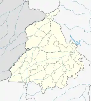 Malhuwala Location in Punjab, India  Malhuwala Malhuwala (India) | |
| Coordinates: 30.82464345°N 74.53777313°E | |
| Country | India |
| State | Punjab |
| District | Firozpur |
| Tehsil | Firozpur |
| Elevation | 190 m (620 ft) |
| Population | |
| • Total | 614 |
| Time zone | UTC+5:30 (IST) |
| 2011 census code | 34773 |
Demographics
According to the 2011 census of India, Malhuwala has 117 households. The effective literacy rate (i.e. the literacy rate of population excluding children aged 6 and below) is 72.58%.[2]
| Total | Male | Female | |
|---|---|---|---|
| Population | 614 | 323 | 291 |
| Children aged below 6 years | 67 | 42 | 25 |
| Scheduled caste | 245 | 128 | 117 |
| Scheduled tribe | 0 | 0 | 0 |
| Literates | 397 | 216 | 181 |
| Workers (all) | 200 | 187 | 13 |
| Main workers (total) | 197 | 184 | 13 |
| Main workers: Cultivators | 119 | 116 | 3 |
| Main workers: Agricultural labourers | 54 | 51 | 3 |
| Main workers: Household industry workers | 3 | 3 | 0 |
| Main workers: Other | 21 | 14 | 7 |
| Marginal workers (total) | 3 | 3 | 0 |
| Marginal workers: Cultivators | 0 | 0 | 0 |
| Marginal workers: Agricultural labourers | 3 | 3 | 0 |
| Marginal workers: Household industry workers | 0 | 0 | 0 |
| Marginal workers: Others | 0 | 0 | 0 |
| Non-workers | 414 | 136 | 278 |
References
- "Punjab village directory" (PDF). Government of India. Retrieved 8 October 2015.
- "District Census Handbook – Firozpur (incl. Fazilka)". 2011 Census of India. Directorate of Census Operations, Punjab. Archived from the original on 6 October 2015. Retrieved 8 October 2015.
This article is issued from Wikipedia. The text is licensed under Creative Commons - Attribution - Sharealike. Additional terms may apply for the media files.