Maliolio River
The Maliolio (or Mali'oli'o) River is one of the largest rivers in the Pacific island nation of Samoa. It is located in the northeast of the nation's main island, Savai'i, flowing through the Gaga'emauga district.
| Maliolio River | |
|---|---|
| Location | |
| Country | Samoa |
| Physical characteristics | |
| Source | |
| • location | Slopes of Mount Mata'aga |
| • coordinates | 13°36′10″S 172°25′20″W |
| • elevation | 1,270 metres (4,170 ft)[1] |
| Mouth | |
• coordinates | 13°30′05″S 172°16′35″W |
• elevation | 0.0 metres (0 ft) |
| Length | 26 kilometres (16 mi) |
The river is prone to flooding, often isolating villages such as Samalae'ulu and Patamea which lie close to the river and are only accessible via fords. The river is crossed by the main north coast highway at one such ford at Samalae'ulu. As of 2019, a 2017 proposal to realign the highway and build a bridge at Samalae'ulu has yet to commence.[2]
The river initially flows northeastwards from the central volcanic highlands of the island, traversing dense forest for some 18 km. Shortly before it reaches Patamea it is joined by a stream which is its only major tributary, and the now enlarged river turns north. It continues northwards for about 5 km to Samalae'ulu. Here, it turns east for its final 3 kilometres before reaching the Pacific Ocean.[1]
References
- "Maliolio River," Mapcarta. Retrieved 6 March 2019.
- "Construction of the new access road and bridge crossing of Mali’oli’o River, Samalaeulu, Savaii," Samoa Land Transport Authority. Retrieved 6 March 2019.
Traditional center: Saleaula | ||
| Villages | 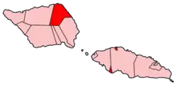 | |
| Landmarks |
| |
| Conservation & Environment | ||
| Education & Schools |
| |
| Electoral constituencies: Faipule Districts |
| |