Manendragarh
Manendragarh is a town of the Koriya district that is a part of the state of Chhattisgarh. The city housing the taluk headquarters along with few important district head offices is sited near the Chhattishgarh-Madhya Pradesh state border.
Manendragarh Railway Station is on the Anuppur-Chirmiri rail route. There are many coal mines around here. Manendragarh was originated by some tribals around 100 years ago; later developed by British Raj for coal excavation. Road and Railway Lines are developed by the British.
Manendragarh | |
|---|---|
Municipal city | |
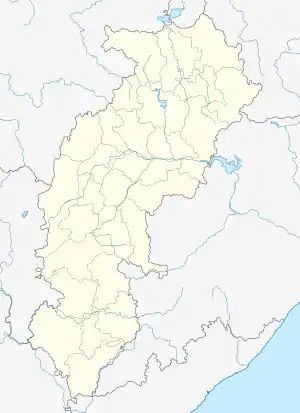 Manendragarh Location in Chhattisgarh, India  Manendragarh Manendragarh (India) | |
| Coordinates: 23.1922°N 82.2003°E | |
| Country | |
| State | Chhattisgarh |
| District | Koriya |
| Government | |
| • MP | JYOTSNA CHARAN DAS MAHANT (Indian National Congress) |
| • MLA | Dr. Vinay Jaiswal (Indian National Congress) |
| • Municipal Chairman | Prabha Patel(Indian National Congress) |
| Area | |
| • Total | 10 km2 (4 sq mi) |
| Population (2011) | |
| • Total | 33,071 |
| • Density | 3,300/km2 (8,600/sq mi) |
| Languages | |
| • Official | |
| Time zone | UTC+5:30 (IST) |
| PIN | 497442 |
| Telephone code | +91 7771 |
| Vehicle registration | CG-16 |
National Highway 43 has its route through Manendragarh. Sirrouli temple is very famous in Manendragarh which is near Udalkachar railway station. Amrit Dhara Waterfall is a nearby attraction. "Sidh-Baba" mount is famous for the Shiva temple.
Demographics
As of the 2011 India census,[1] Manendragarh had a population of 30,748. Males constitute 53% of the population and females 47%. Manendragarh has an average literacy rate of 72%, higher than the national average of 59.5%: male literacy is 79%, and female literacy is 64%. In Manendragarh, 13% of the population is under 6 years of age. Manendragarh is the hub of rural items.
Geology
National geological monument
Marine Gondwana Fossil Park, also called Lower Permian Marine bed at Manendragarh lies nearby and it has been declared the National Geological Monuments of India by the Geological Survey of India (GSI), for their protection, maintenance, promotion and enhancement of geotourism.[2][3][4]
Minerals
Region of Manendragarh has vast reserves of high-grade coal.
. The main coal belts are in the Hasdo basin. There are small deposits of limestone, fire clay and red oxide in Manendragarh.
Ecology
Drainage
A part of Manendragarh region lies in the Ganges basin and the remaining portion is in the Mahanadi basin. Gopad is the major tribute of Son and originates about 10 miles North of Mendra village. It drains the Northern portion of the District. Hasdeo a major tributary of Mahanadi has its origin in Mendra village.
Rivers
The Hasdeo river is the largest river flowing towards the South. It rises from 23°30´ North by 82°30´ East on the Sonhat Plateau and drains the South-Western part of the District. In this District, the river course resembles an upturned 'S' and flows for about 95 km. After a course of about 72 km, it enters Bilaspur District at 23° North. It receives the waters of the Gej and the Chornai on the left bank and the Tan and the Ahiran on the right before it meets the Mahanadi. The total length of the river is 245 km. The valley is narrow. Important settlements along the river are Sonhat, Ghugra, Manendragarh, Kosgain, Korba and Champa.
Forest
Manendragarh has vast range of forests. Up to the last decade of the 19th century. Most common trees of Korea District are Sal, Mahua, Tendu, Palas, Char, Bija, Harra, Bahera, Sisam, Kusum, Salya, Khair, Arun, Gamhar etc. Bamboos are mostly available in the forests.
Economy
The income of Manendragarh Region is based on rural market as well as South Eastern Coal Limited (SECL). Chamber of Commerce is established in Manendragarh for the issues regarding businesses and for the welfare of business owners. Manendragarh is surrounded by 4 out of 11 SECL area namely Hasdeo Area, chrimiri Area, Baikunthpur & jamuna Kotma.
Education
College/School
- Kendriya Vidyalaya Railway, Manendragarh
- Kendriya Vidyalaya SECL, North Jhagrakhand
- Bachpan - A play school
- Bachpan- Academic heights public school
- Govt. Vivekanand college
- Alaska Computer College
- Rajiv Gandhi Computer College
- Universal Public School, Manendragarh
- Cambridge Montessori School Manendragarh (कैम्ब्रिज मॉन्टेसरी स्कूल मनेन्द्रगढ़)
- Sarsawati Shishu Mandir, Manendragarh
- Sarsawati Shishu Mandir, Jhagrakhand
- Saraswati Vikas Vidyalaya
- Sarswati Kanya Maha Vidyalaya
- Shardesh Higher Secondary School
- Saint Patrick Academy
- Saint Joseph's Mission School (Branch of Bijuri)
- Saint Joseph's Convent School (JKD)
- The Gurukul International School
- Gurukul Vidya Mandir (Mouharpara)
- Blossom's Academy
- Vijay English Medium school
Transport
By road
National High way 43 connects Manendragarh with other parts of the state. Bus services operate between the different cities of Madhya Pradesh (like Rewa, Jabalpur), Chhatisgrah (Bilaspur, Raipur), Uttar Pradesh (Allahabad, Varanasi), Jharkhand(Ranchi) and Bihar.
By air
- Nearest airport is Raipur
- Another nearby airport is Jabalpur
By Train
Various trains are available for connectivity to other cities like Bilaspur, Raipur, Durg, Ambikapur Jabalpur, Rewa, Katni etc.
Manendragarh Railway station has direct connectivity with many cities of Madhya Pradesh and Chhattishgarh.
Manendragarh station is situated on the Anuppur - Chirmiri railway line.
References
- "Census of India 2001: Data from the 2001 Census, including cities, villages and towns (Provisional)". Census Commission of India. Archived from the original on 16 June 2004. Retrieved 1 November 2008.
- "National Geological Monument, from Geological Survey of India website". Archived from the original on 12 July 2017. Retrieved 21 January 2019.
- "Geo-Heritage Sites". pib.nic.in. Press Information Bureau. 9 March 2016. Retrieved 15 September 2018.
- national geo-heritage of India, INTACH
