Manitowoc County Airport
Manitowoc County Airport (IATA: MTW, ICAO: KMTW, FAA LID: MTW) is located two miles northwest of Manitowoc, in Manitowoc County, Wisconsin.[1] It is 21 miles from Whistling Straights golf course and 34 minutes from Road America. A great place to stay for EAA. The Federal Aviation Administration (FAA) National Plan of Integrated Airport Systems for 2019–2023 categorized it as a local general aviation facility.[2]
Manitowoc County Airport | |||||||||||||||
|---|---|---|---|---|---|---|---|---|---|---|---|---|---|---|---|
| Summary | |||||||||||||||
| Airport type | Public | ||||||||||||||
| Owner | County of Manitowoc | ||||||||||||||
| Serves | Manitowoc, Wisconsin | ||||||||||||||
| Elevation AMSL | 651 ft / 198 m | ||||||||||||||
| Coordinates | 44°07′44″N 087°40′50″W | ||||||||||||||
| Map | |||||||||||||||
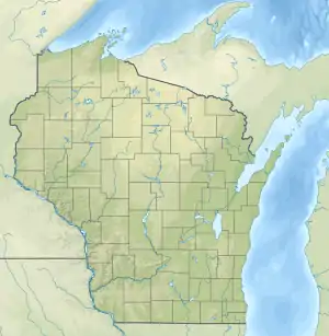 MTW  MTW | |||||||||||||||
| Runways | |||||||||||||||
| |||||||||||||||
| Statistics | |||||||||||||||
| |||||||||||||||
Jet-A available. 100LL with 24 hour availability. Auto-gas. Courtesy vehicle during business hours. Hangar space available.
The first airline flights were North Central DC-3s in 1953-54; successor Republic pulled out in 1981-83.
Facilities
The airport covers 414 acres (168 ha) at an elevation of 651 feet (198 m). It has two asphalt runways: 17/35 is 5,001 by 100 feet (1,524 x 30 m) and 7/25 is 3,341 by 100 feet (1,018 x 30 m).[1]
For the year ending September 13, 2018 the airport had 33,100 aircraft operations, an average of 91 per day: 97% general aviation, 3% air taxi and less than 1% military. In December 2020, 60 aircraft were based at this airport: 55 single-engine, 2 multi-engine, 1 jet and 2 glider.[1]
The Manitowoc (MTW) DME is on the field; the VOR function of this navaid was decommissioned sometime in mid-2019.
Lakeshore Aviation was the fixed-base operator (FBO) until December 1, 2013, when Manitowoc County took over operations.
See also
References
- FAA Airport Form 5010 for MTW PDF. Federal Aviation Administration. effective December 31, 2020.
- "NPIAS Report 2019-2023 Appendix A" (PDF). Federal Aviation Administration. October 3, 2018. Retrieved October 12, 2018.
External links
- Manitowoc County (MTW) at Wisconsin DOT
- FAA Terminal Procedures for MTW, effective January 28, 2021
- Resources for this airport:
- FAA airport information for MTW
- AirNav airport information for KMTW
- ASN accident history for MTW
- FlightAware airport information and live flight tracker
- NOAA/NWS weather observations: current, past three days
- SkyVector aeronautical chart, Terminal Procedures
Civil aviation in Wisconsin | ||
|---|---|---|
| Primary airports | ||
| Airlines | ||
| Museums | ||
| Aviation related | ||
| People | ||