Manly, New Zealand
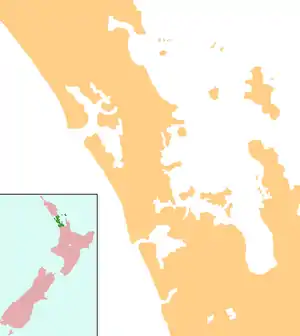
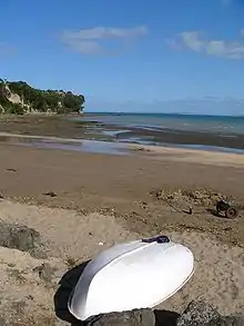
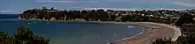
Manly is a suburb on the Whangaparaoa Peninsula, towards the northern end of Auckland, New Zealand.[1] Manly Village is an established shopping centre,[2] with the residential areas of Big Manly to the north and Little Manly to the south. The area was once a seaside holiday location, but has become residential suburbs within commuting distance of central Auckland city. A significant proportion of the population is retired.[3]
Manly | |
|---|---|
Suburb | |
| Country | New Zealand |
| Local authority | Auckland Council |
| Population (2018) | |
| • Total | 5,904 |
| Stanmore Bay | (Waiau Bay) | Tindalls Beach |
|
|
(Matakatia Bay) | |
| Wade Heads | (Hauraki Gulf) |
Demographics
| Year | Pop. | ±% p.a. |
|---|---|---|
| 2006 | 5,253 | — |
| 2013 | 5,643 | +1.03% |
| 2018 | 5,904 | +0.91% |
| Source: [4] | ||
Manly, comprising the statistical areas of Manly West and Manly East, had a population of 5,904 at the 2018 New Zealand census, an increase of 261 people (4.6%) since the 2013 census, and an increase of 651 people (12.4%) since the 2006 census. There were 2,238 households. There were 2,829 males and 3,075 females, giving a sex ratio of 0.92 males per female, with 1,065 people (18.0%) aged under 15 years, 993 (16.8%) aged 15 to 29, 2,562 (43.4%) aged 30 to 64, and 1,284 (21.7%) aged 65 or older.
Ethnicities were 92.7% European/Pākehā, 9.5% Māori, 3.1% Pacific peoples, 3.8% Asian, and 1.5% other ethnicities (totals add to more than 100% since people could identify with multiple ethnicities).
The proportion of people born overseas was 26.2%, compared with 27.1% nationally.
Although some people objected to giving their religion, 55.8% had no religion, 33.6% were Christian, and 3.7% had other religions.
Of those at least 15 years old, 1,005 (20.8%) people had a bachelor or higher degree, and 720 (14.9%) people had no formal qualifications. The employment status of those at least 15 was that 2,280 (47.1%) people were employed full-time, 696 (14.4%) were part-time, and 165 (3.4%) were unemployed.[4]
Education
Whangaparaoa School is a coeducational contributing primary (years 1-6) school with a roll of 704 students as of March 2020.[5][6] The school celebrated its centenary in 2002.[7]
Notes
- Roger Smith, GeographX (2005). The Geographic Atlas of New Zealand. Robbie Burton. pp. map 35. ISBN 1-877333-20-4.
- "Manly Village". Archived from the original on 14 October 2008. Retrieved 17 October 2008.
- "Description of the School's Community". Whangaparaoa School. Archived from the original on 14 October 2008. Retrieved 17 October 2008.
- "Statistical area 1 dataset for 2018 Census". Statistics New Zealand. March 2020. Manly West (115200) and Manly East (115800). 2018 Census place summary: Manly West 2018 Census place summary: Manly East
- "New Zealand Schools Directory". New Zealand Ministry of Education. Retrieved 26 April 2020.
- Education Counts: Whangaparaoa School
- "Jubilees & reunions - Whangaparaoa School". Education Gazette New Zealand. 81 (4). 11 March 2002. Retrieved 17 October 2008.