Mannweiler-Cölln
Mannweiler-Cölln is a municipality in the Donnersbergkreis district, in Rhineland-Palatinate, Germany.
Mannweiler-Cölln | |
|---|---|
 Coat of arms | |
Location of Mannweiler-Cölln within Donnersbergkreis district 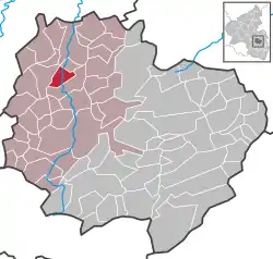 | |
 Mannweiler-Cölln  Mannweiler-Cölln | |
| Coordinates: 49°41′35″N 7°48′14″E | |
| Country | Germany |
| State | Rhineland-Palatinate |
| District | Donnersbergkreis |
| Municipal assoc. | Nordpfälzer Land |
| Government | |
| • Mayor | Wolfgang Gillmann |
| Area | |
| • Total | 4.90 km2 (1.89 sq mi) |
| Elevation | 165 m (541 ft) |
| Population (2019-12-31)[1] | |
| • Total | 364 |
| • Density | 74/km2 (190/sq mi) |
| Time zone | UTC+01:00 (CET) |
| • Summer (DST) | UTC+02:00 (CEST) |
| Postal codes | 67822 |
| Dialling codes | 06362 |
| Vehicle registration | KIB |
Culture and sights
- The Protestant Church of Mannweiler-Cölln (built 1860/61)
- Catholic Chapel (Kleiner Böhl 2). Chapel room in old Catholic schoolhouse, made 1741 by conversion of a farmhouse. Timber-framed building with stained-glass, today occasionally used for services
- Randeck Museum (Böhlstraße 5).
- Ruins of Randeck Castle
- Ruins of the Stolzenburg (in the vicinity)
References
- "Bevölkerungsstand 2019, Kreise, Gemeinden, Verbandsgemeinden". Statistisches Landesamt Rheinland-Pfalz (in German). 2020.
This article is issued from Wikipedia. The text is licensed under Creative Commons - Attribution - Sharealike. Additional terms may apply for the media files.
