Manson, Washington
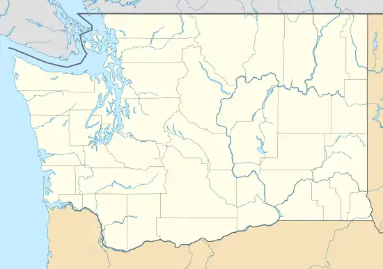
Manson is an unincorporated community and census-designated place in Chelan County in the U.S. state of Washington. It was named in 1912 for Manson F. Backus, president of the Lake Chelan Land Company.[2] Manson is located in the north-central portion of the state on the north shore of Lake Chelan, approximately 7 miles (11 km) northwest of the city of Chelan.
Manson, Washington | |
|---|---|
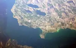 Aerial view of Manson | |
 Manson | |
| Coordinates: 47°53′06″N 120°09′25″W | |
| Country | United States |
| State | Washington |
| County | Chelan |
| Area | |
| • Total | 1.25 sq mi (3.25 km2) |
| • Land | 1.25 sq mi (3.25 km2) |
| • Water | 0.0 sq mi (0.0 km2) |
| Elevation | 1,140 ft (350 m) |
| Population (2010) | |
| • Total | 1,468 |
| • Density | 1,171/sq mi (452.3/km2) |
| Time zone | UTC-8 (Pacific (PST)) |
| • Summer (DST) | UTC-7 (PDT) |
| ZIP code | 98831 |
| Area code(s) | 509 |
| GNIS feature ID | 1522682[1] |
| FIPS code | 53-42835 |
Manson is part of the Wenatchee–East Wenatchee Metropolitan Statistical Area.
The USPS ZIP code for Manson is 98831. As of the 2010 census, the population in the Manson was 1,468.[3] 2010 was the first year that Manson was tracked by the census bureau.
References
- U.S. Geological Survey Geographic Names Information System: Manson, Washington
- Meany, Edmond S. (1923). Origin of Washington geographic names. Seattle: University of Washington Press. p. 158.
- "Geographic Identifiers: 2010 Demographic Profile Data (G001): Manson CDP, Washington". U.S. Census Bureau, American Factfinder. Retrieved August 26, 2015.
External links
- Manson Chamber of Commerce
- Lake Chelan Chamber of Commerce
- Manson Village Tribune, online newspaper
- Video tour of Manson - Tour town, waterfront, and wineries.
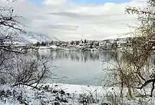
View of Manson from Wapato Point
Municipalities and communities of Chelan County, Washington, United States | ||
|---|---|---|
| Cities | 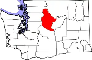 Map of Washington highlighting Chelan County | |
| CDPs | ||
| Other unincorporated communities | ||
| Indian reservation | ||
| Ghost towns | ||
| Footnotes | ‡This populated place also has portions in an adjacent county or counties | |
| ||
| Authority control |
|
|---|
This article is issued from Wikipedia. The text is licensed under Creative Commons - Attribution - Sharealike. Additional terms may apply for the media files.
