Marcali District
Marcali (Hungarian: Marcali járás) is a district in north-western part of Somogy County. Marcali is also the name of the town where the district seat is found. The district is located in the Southern Transdanubia Statistical Region.
Marcali District
Marcali járás | |
|---|---|
 Coat of arms | |
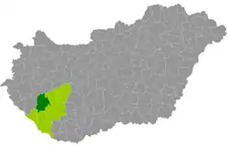 Marcali District within Hungary and Somogy County. | |
| Country | |
| Region | Southern Transdanubia |
| County | Somogy |
| District seat | Marcali |
| Area | |
| • Total | 904.24 km2 (349.13 sq mi) |
| Area rank | 2nd in Somogy |
| Population (2011 census) | |
| • Total | 34,472 |
| • Rank | 3rd in Somogy |
| • Density | 38/km2 (100/sq mi) |
Geography
Marcali District borders with Keszthely District (Zala County) to the north, Fonyód District and to the east, Kaposvár District to the southeast, Nagyatád District to the south, Csurgó District to the southwest, Nagykanizsa District (Zala County) to the west. The number of the inhabited places in Marcali District is 37.
Municipalities
The district has 1 town and 36 villages. (ordered by population, as of 1 January 2013)[1]
- Balatonberény (1,091)
- Balatonkeresztúr (1,605)
- Balatonmáriafürdő (691)
- Balatonszentgyörgy (1,614)
- Balatonújlak (503)
- Böhönye (2,380)
- Csákány (227)
- Csömend (303)
- Főnyed (78)
- Gadány (341)
- Hollád (235)
- Hosszúvíz (46)
- Kelevíz (315)
- Kéthely (2,299)
- Libickozma (31)
- Marcali (11,733) – district seat
- Mesztegnyő (1,384)
- Nagyszakácsi (423)
- Nemesdéd (739)
- Nemeskisfalud (146)
- Nemesvid (?)
- Nikla (746)
- Pusztakovácsi (868)
- Sávoly (541)
- Somogysámson (752)
- Somogysimonyi (91)
- Somogyszentpál (797)
- Somogyzsitfa (577)
- Szegerdő (215)
- Szenyér (302)
- Szőkedencs (249)
- Tapsony (743)
- Táska (412)
- Tikos (130)
- Varászló (153)
- Vése (758)
- Vörs (459)
The bolded municipality is city.
See also
References
- "A KSH 2013. évi helységnévkönyve". ksh.hu. Retrieved 2018-01-22.
External links
This article is issued from Wikipedia. The text is licensed under Creative Commons - Attribution - Sharealike. Additional terms may apply for the media files.