Marktleugast
Marktleugast is a municipality in the district of Kulmbach in Bavaria in Germany.
Marktleugast | |
|---|---|
 Coat of arms | |
Location of Marktleugast within Kulmbach district 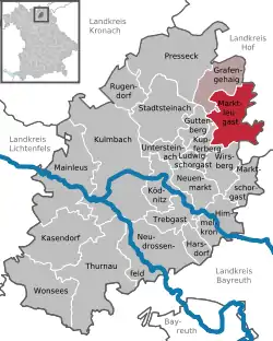 | |
 Marktleugast  Marktleugast | |
| Coordinates: 50°10′N 11°37′E | |
| Country | Germany |
| State | Bavaria |
| Admin. region | Oberfranken |
| District | Kulmbach |
| Municipal assoc. | Marktleugast |
| Subdivisions | 23 Ortsteile |
| Government | |
| • Mayor | Franz Uome |
| Area | |
| • Total | 33.89 km2 (13.09 sq mi) |
| Highest elevation | 627 m (2,057 ft) |
| Lowest elevation | 544 m (1,785 ft) |
| Population (2019-12-31)[1] | |
| • Total | 3,113 |
| • Density | 92/km2 (240/sq mi) |
| Time zone | UTC+01:00 (CET) |
| • Summer (DST) | UTC+02:00 (CEST) |
| Postal codes | 95352 |
| Dialling codes | 09255 |
| Vehicle registration | KU |
| Website | www.marktleugast.de |
Geography
Marktleugast is located on the southeastern edge of the Frankenwald Nature Park.
City arrangement
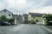
Marktleugast
Marktleugast is arranged in the following boroughs:
- Baiersbach
- Filshof
- Großrehmühle
- Hanauerhof
- Hermes
- Hinterrehberg
- Hohenberg
- Hohenreuth
- Kleinrehmühle
- Kosermühle
- Mannsflur
- Marienweiher
- Marktleugast
- Mittelrehberg
- Neuensorg
- Ösel
- Roth
- Steinbach
- Tannenwirtshaus
- Traindorf
- Vorderrehberg
- Weihermühle
- Zegastmühle
References
- "Tabellenblatt "Daten 2", Statistischer Bericht A1200C 202041 Einwohnerzahlen der Gemeinden, Kreise und Regierungsbezirke". Bayerisches Landesamt für Statistik und Datenverarbeitung (in German). July 2020.
| Authority control |
|---|
This article is issued from Wikipedia. The text is licensed under Creative Commons - Attribution - Sharealike. Additional terms may apply for the media files.
