Marseille–Ventimiglia railway
The Marseille–Ventimiglia railway (French: Ligne de Marseille-Saint-Charles à Vintimille; Italian: Ferrovia Marsiglia-Ventimiglia) is a French, Monégasque and Italian 259-kilometre (161 miles) long railway line. The railway was opened in several stages between 1858 and 1872.[3]
.jpg.webp)
It is used for passenger (express, regional and suburban) and freight traffic as the primary railway line serving the French Riviera; a new high-speed line, the LGV Provence-Alpes-Côte d'Azur, is planned for opening around 2035 to offer quicker travel times between Marseille, Toulon, Cannes and Nice.
History
The Marseille–Ventimiglia railway was built and used by the Chemins de fer de Paris à Lyon et à la Méditerranée. The first section that was opened in 1858 led from Marseille to Aubagne. The line was extended to Toulon in 1859 and to Les Arcs in 1862. Cagnes-sur-Mer was reached in 1863 and Nice in 1864. The line was extended to Monaco in 1868 and to Menton in 1869.[3] Finally in 1872 the section to Ventimiglia was opened.
Main stations
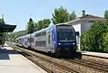
The line's main stations are: Marseille-Saint-Charles, Marseille-Blancarde, Aubagne, La Ciotat, Toulon, Fréjus, Cannes, Juan-les-Pins, Antibes, Nice-Saint-Augustin, Nice-Ville, Nice-Riquier, Monaco-Monte-Carlo (underground), Menton and Ventimiglia.
Gallery
.JPG.webp)
 TGV Duplex in the Massif de l'Esterel
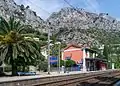
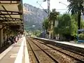
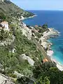 Line near Ventimiglia
References
- "RFF - Network map" (PDF). Archived from the original (PDF) on 2011-07-18.
- "RFF - Map of electrified railway lines" (PDF).
- Direction Générale des Ponts et Chaussées et des Chemins de Fer (1869). Statistique centrale des chemins de fer. Chemins de fer français. Situation au 31 décembre 1869 (in French). Paris: Ministère des Travaux Publics. pp. 146–160.