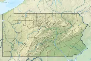
Martins Creek (Delaware River tributary, Bucks County)
Martins Creek is a tributary of the Delaware River in Bucks County, Pennsylvania meeting its confluence at the Delaware River 122 river mile.[1]
| Martins Creek | |
|---|---|
 Martins Creek | |
| Location | |
| Country | United States |
| State | Pennsylvania |
| County | Bucks |
| Township | Falls |
| Physical characteristics | |
| Source | |
| • coordinates | 40°11′18″N 74°50′11″W |
| • elevation | 100 feet (30 m) |
| Mouth | |
• coordinates | 40°8′3″N 74°48′56″W |
• elevation | 0 feet (0 m) |
| Length | 5.11 miles (8.22 km) |
| Basin size | 11.5 square miles (30 km2) |
| Basin features | |
| Progression | Martins Creek → Delaware River → Delaware Bay |
| River system | Delaware River |
| Landmarks | Fairless Hills, Levittown |
| Tributaries | |
| • left | Rock Run |
| Bridges | Trenton Road Vermillion Way New Falls Road Thornridge Way Falls Tullytown Road U.S. Route 13 East Penn Valley Road Mill Creek Road Old Bristol Pike Bordentown Road (Main Street, Tullytown) |
| Slope | 19.57 feet per mile (3.706 m/km) |
Statistics
Martins Creek has a watershed of 11.5 square miles (30 km2). It was entered into the Geographic Names Information System of the U.S. Geological Survey as identification number 1180503,[2] U.S. Department of the Interior Geological Survey I.D. is 02920.[1]
Course
Martins Creek is contained wholly with in Falls Township. It rises just north of Trenton Road in the north portion of the township at an elevation of 100 feet (30 m) and flows southeast while joining with two tributaries, one from the left and one from the right. Just after it passes under New Falls Road, it joins with another unnamed tributary from the right, at which it makes a left turn then bends right again flowing southeast until it passes under U.S. Route 13 where it meets with Rock Run from the left where Martins turns right flowing almost due south. Just north of Mill Creek road it connects with the Pennsylvania Canal (Delaware Division) and continues on the other side of the canal, flowing south until it meets at the Delaware River's 122.4 river mile at an elevation of 0 feet (0 m), resulting in an average slope of 19.57 feet per mile (3.706 m/km).[3]
Municipalities
Crossings and Bridges
| Crossing | NBI Number | Length | Lanes | Spans | Material/Design | Built | Reconstructed | Latitude | Longitude |
|---|---|---|---|---|---|---|---|---|---|
| Trenton Road | - | - | - | - | - | - | - | - | - |
| Vermillion Way | - | - | - | - | - | - | - | - | - |
| New Falls Road | 7164 | 13 metres (43 ft) | 2 | 1 | prestressed concrete box beam or girders - multiple | 1957 | 2011 | 40°10'50.1"N | 74°49'25.49"W |
| Thornridge Way | - | - | - | - | - | - | - | - | - |
| Falls Tulleytown Road | 6769 | 13 metres (43 ft) | 2 | 1 | prestressed concrete box beam or girders - multiple | 1955 | - | 40°9'24.8"W | 74°48'44.7"W |
| U.S. Route 13 | 6772 | 12 metres (39 ft) | 2 | 1 | Concrete Tee Beam | 1955 | 2004 | 40°10'38.2"N | 74°48'43.7"W |
| East Penn Valley Road | 7290 | 12 metres (39 ft) | 2 | 2 | concrete culvert | 1978 | - | 40°10'18"N | 74°48'12"W |
| Mill Creek Road | 7489 | 24 metres (79 ft) | 2 | 2 | concrete culvert | 1961 | - | 40°9'26.8"N | 74°48'24"W |
| Old Bristol Pike | 7292 | 14 metres (46 ft) | 2 | 1 | Concrete Tee Beam | 1945 | - | 40°9'0.2"N | 74°48'33.44"W |
| Bordentown Road (Main Street, Tullytown) | 7295 | 11 metres (36 ft) | 2 | 1 | 1901 | 1979 | - | - | - |
