Maryland Route 168
Maryland Route 168 (MD 168) is a state highway in the U.S. state of Maryland. Known as Nursery Road, the highway runs 1.28 miles (2.06 km) from Hammonds Ferry Road in Linthicum east to MD 648 in Pumphrey in northern Anne Arundel County. MD 168 was built in the late 1920s.
| ||||
|---|---|---|---|---|
| Nursery Road | ||||
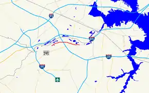 Maryland Route 168 highlighted in red | ||||
| Route information | ||||
| Maintained by MDSHA | ||||
| Length | 1.28 mi[1] (2.06 km) | |||
| Existed | 1929–present | |||
| Major junctions | ||||
| West end | Hammonds Ferry Road in Linthicum | |||
| East end | ||||
| Location | ||||
| Counties | Anne Arundel | |||
| Highway system | ||||
| ||||

Route description
_at_Maryland_State_Route_648_(Baltimore-Annapolis_Boulevard)_in_Linthicum%252C_Anne_Arundel_County%252C_Maryland.jpg.webp)
MD 168 begins at an intersection with Hammonds Ferry Road in a mixed commercial and industrial area at the northern end of the unincorporated community of Linthicum. Access between MD 168 and eastbound Interstate 695 (I-695) (Baltimore Beltway) is via the county highway between the state highway and the Patapsco River to the north. The west leg of the intersection is county-maintained West Nursery Road, which curves to the south, has a diamond interchange with MD 295 (Baltimore–Washington Parkway), and serves a business district near Baltimore/Washington International Thurgood Marshall Airport. MD 168 heads east as a two-lane undivided road that passes underneath the Beltway and intersects Fairview Avenue, which is unsigned MD 969A and provides access to westbound I-695. The state highway enters a residential area after it crosses MD 295. MD 168 reaches its eastern terminus at its junction with MD 648 (Baltimore–Annapolis Boulevard) in Pumphrey. Nursery Road continues east into the parking lot for the Nursery Road station of MTA Maryland's Baltimore Light RailLink.[1][2]
_from_the_overpass_for_Interstate_695_(Baltimore_Beltway)_in_Linthicum%252C_Anne_Arundel_County%252C_Maryland.jpg.webp)
History
MD 168 was paved in concrete in 1929 from Hammonds Ferry Road—which was built contemporaneously and was designated MD 167—to the Baltimore–Annapolis Boulevard, which was then part of MD 3.[3][4][5]
Junction list
The entire route is in Anne Arundel County.
| Location | mi [1] | km | Destinations | Notes | |
|---|---|---|---|---|---|
| Linthicum | 0.00 | 0.00 | Western terminus | ||
| 0.21 | 0.34 | Fairview Avenue is unsigned MD 969A | |||
| Pumphrey | 1.28 | 2.06 | Eastern terminus; officially MD 648E | ||
| 1.000 mi = 1.609 km; 1.000 km = 0.621 mi | |||||
See also
 Maryland Roads portal
References
- Highway Information Services Division (December 31, 2013). Highway Location Reference. Maryland State Highway Administration. Retrieved 2012-11-17.
- Anne Arundel County (PDF).
- Google (2012-11-29). "Maryland Route 168" (Map). Google Maps. Google. Retrieved 2012-11-29.
- Uhl, G. Clinton; Bruce, Howard; Shaw, John K. (October 1, 1930). Report of the State Roads Commission of Maryland (1927–1930 ed.). Baltimore: Maryland State Roads Commission. p. 196. Retrieved 2012-11-29.
- Maryland Geological Survey (1930). Map of Maryland Showing State Road System: State Aid Roads and Improved County Road Connections (Map). Baltimore: Maryland Geological Survey.
- Maryland State Roads Commission (1939). General Highway Map: State of Maryland (Map). Baltimore: Maryland State Roads Commission.