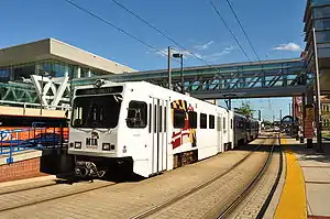
Baltimore Light RailLink
Light RailLink (formerly Baltimore Light Rail, and also known simply as the "Light Rail") is a light rail system serving Baltimore, Maryland, United States, as well as its surrounding suburbs. It is operated by the Maryland Transit Administration (MTA Maryland). In downtown Baltimore, it uses city streets. Outside the central portions of the city, the line is built on private rights-of-way, mostly from the defunct Northern Central Railway, Baltimore and Annapolis Railroad and Washington, Baltimore and Annapolis Electric Railway.
 | |
| Overview | |
|---|---|
| Locale | Baltimore, Maryland, United States |
| Transit type | Light rail |
| Number of lines | 3 |
| Number of stations | 33 |
| Daily ridership | 27,537 (weekday boardings, FY 2013) [1] |
| Annual ridership | 8,105,743 (FY2014) |
| Operation | |
| Began operation | April 1992 |
| Operator(s) | Maryland Transit Administration |
| Technical | |
| System length | 30.0 mi (48.3 km) |
| Track gauge | 4 ft 8 1⁄2 in (1,435 mm) (standard gauge) |
| Minimum radius of curvature | 100 feet (30.5 m) |
| Electrification | 750 V DC, overhead lines |
History
Initial segment
The origins of the Light Rail ultimately lie in a transit plan drawn up for the Baltimore area in 1966 that envisioned six rapid transit lines radiating out from the city center. By 1983, only a single line was built: the "Northwest" line, which became the current Baltimore Metro Subway. Much of the plan's "North" and "South" lines ran along right-of-way that was once used by interurban streetcar and commuter rail routes—the Northern Central Railway, Washington, Baltimore and Annapolis Electric Railway and Baltimore and Annapolis Railroad—that still remained available for transit development.
Beginning in the late 1980s, Governor William Donald Schaefer (a former mayor of Baltimore) pushed for building a transit line along this corridor, motivated in part by a desire to establish a rail transit link to the new downtown baseball park being built at Camden Yards for the Baltimore Orioles. The Light Rail lines were built quickly and inexpensively and without money from the U.S. federal government, a rarity in late 20th century U.S. transit projects. The initial system was a single 22.5-mile (36.2 km) line, all at-grade except for a bridge over the Middle Branch of the Patapsco River just south of downtown Baltimore. The line ran from Timonium in Baltimore County in the north to Glen Burnie in Anne Arundel County in the south.
The line opened in stages over a 14-month period. The initial segment from Timonium to Camden Yards opened for limited service for Orioles games on April 2, 1992, and for full service on May 17.[2][3] A three-station extension to Patapsco opened on August 20, 1992, followed by a 4-station extension to Linthicum on April 2, 1993, and an additional 2-station extension to Glen Burnie on May 20, 1993.[2][3]
Station placement and design were intended to be flexible and change over time, as stations could be built or closed at low cost. However, they were at times dictated by politics rather planning: proposed stops in Ruxton, Riderwood, and Village of Cross Keys were not built due to local opposition, while nearly-cut Mt. Royal and Timonium Business Park stations were built because the University of Baltimore and a local business group funded them. Falls Road station was built with less parking than ridership required because community requests and a fence—erected in response to a homeowner objecting to the visual impact of the station—prevented riders from accessing a nearby commercial building.[4]
Expansion
Three extensions to the system were added in 1997. On September 9, the line was extended north 4.5 miles (7.2 km) to Hunt Valley, adding five stations that served a major business park and a mall.[5] On December 6, two short but important branches were added to the system: a 0.3-mile (0.48 km) spur in Baltimore that provided a link to the Penn Station intercity rail hub, and a 2.7-mile (4.3 km) spur to the terminal of BWI Airport.[5][3]
On September 6, 1998, the Hamburg Street station opened as an infill station between the existing Westport and Camden Yards stations.[6][2] Adjacent to M&T Bank Stadium, it was initially only open during Ravens games and other major stadium events; however, it became a full-time stop on July 1, 2005.[3]
To save money, much of the system was built as single-track. While this allowed the Light Rail to be built and opened quickly, it made it difficult to build flexibility into the system: much of the line was restricted to 17-minute headways, with no way to reduce headways during peak hours. Federal money was acquired to make the vast majority of the system double-tracked; much of the line south of downtown Baltimore was shut down in 2004 and north of downtown shut down in 2005 in order to complete this project. The northern section up to Timonium reopened in December 2005; the rest opened in February 2006. The line north of the Gilroy Road station & on the BWI Airport spur remain single tracked.
Incidents
On July 10, 2019, part of the northbound platform at Convention Center station fell into a sinkhole caused by a broken water main.[7] The line was closed between Camden and North Avenue until August 19.[8]
Operation
Routing and schedules
The Light Rail network consists of a main north–south line that serves 28 of the system's 33 stops; a spur in Baltimore City that connects a single stop (Penn Station) to the main line and two branches at the south end of the line that serve two stops apiece. Because of the track arrangement, trains can only enter the Penn Station spur from the mainline heading north and leave it heading south; there are still single-track sections north of Timonium, limiting headways in that section to 15 minutes.
Various routing strategies have been used on the network. As of 2020 there are three basic services (and one additional off-peak service):[9]
- BWI Airport to Hunt Valley
- Camden Yards to Penn Station
- Glen Burnie to Fairgrounds (peak)
- Glen Burnie to Hunt Valley (off-peak)
- Glen Burnie/BWI/Hunt Valley to North Avenue (trains going out of service)
Although these routes are colored blue, red and yellow respectively on some MTA maps and schedules, they do not have official names as such. Some trains heading north from either BWI Airport or Glen Burnie may terminate at North Avenue to go out of service until peak operation hours resume. During these times, ridership is not high enough to send trains all the way through.
The light rail operates 3:30 a.m.–1:30 a.m. on weekdays, 4:15 a.m.–1:15 a.m. Saturdays, and 10 a.m.–10 p.m. on Sundays and major holidays. At peak hours on weekdays (from the first trains of the day until 10 a.m., and from 4 p.m. to 6 p.m.), the BWI–Hunt Valley and Glen Burnie–Fairgrounds routes see 20-minute headways; at other times on weekdays and all day on weekends, there are 30-minute headways on both routes (with Glen Burnie trains traveling all the way to Hunt Valley). The Camden Yards-Penn Station route sees 30-minute headways at all times. Because there is significant overlap on these routes, most of the system sees 10-minute peak and 15-minute off-peak headways; stations in the downtown section between Mt. Royal and Camden Yards are served by six trains an hour off-peak and eight trains an hour at peak. (Paradoxically, the Fairgrounds-Hunt Valley section actually sees longer headways at peak hours.)
Most of the light rail's route is on a dedicated right-of-way, with occasional grade crossings equipped with crossing gates. However, on the downtown portion of the route that runs along Howard Street (between the University of Baltimore/Mt. Royal and Camden Yards stations), trains mix with automobile traffic and their movement is controlled by traffic signals. In 2007, a transit signal priority system was implemented on this portion of the route, resulting in time savings of 25%.[10] From south of Falls Road to North Avenue, the light rail runs parallel to the Jones Falls Expressway, and from Camden Yards to north of Westport, it parallels Interstate 395. North of Falls Road and south of Westport, it follows its own path towards its respective termini.
The space mean speed between Hunt Valley and BWI (based on a scheduled running time of 1:20 and a distance of 30 miles (48 km)) is about 22 miles per hour (35 km/h).
Fares and transit connections
MTA fares are identical for the Metro Subway, the Light Rail, and local buses: a one-way trip costs $1.90. Daily, weekly, and monthly unlimited-ride passes are also available that are good on all three transit modes. A passenger with a one-way ticket can change Light Rail trains if necessary to complete their journey, the only instance of a one-way MTA ticket being good for a ride on more than one vehicle, but transferring to a bus or the Metro Subway requires a new one-way fare or a pass. Automated ticket vending machines that sell tickets and passes are available at all Light Rail stations.
The Light Rail's ticketing is based on a proof-of-payment system. Passengers must have a ticket or pass before boarding. Maryland Transit Administration Police officers ride some trains and randomly check passengers to make sure that they are carrying a valid ticket or pass and can issue criminal citations for those without one. Civilian Fare Inspectors also conduct ticket checks, alighting those without fare.
Most Light Rail stations are served by several MTA bus routes and passengers can make platform-to-platform transfers with the MARC Camden Line at Camden Yards and with the MARC Penn Line at Penn Station. There are no cross-platform connections with the Metro Subway. The Lexington Market subway and light rail stations are a block apart and connected only via surface streets.
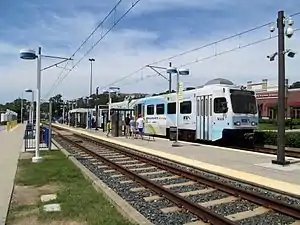
Rolling stock
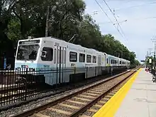
Baltimore's Light Rail vehicles (LRVs) were built by ABB Traction, the U.S. division of Asea Brown Boveri. The initial set was delivered in 1991–1992 as the line was being built; a supplemental order of essentially identical cars was delivered in 1997 when the extensions came into service.
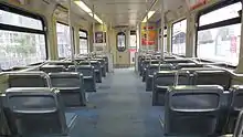
Baltimore LRVs are quite large, much larger than traditional streetcars and bigger even than those used on San Francisco's Muni Metro or Boston's Green Line. The articulated cars are 95 feet (28.96 m) long (over coupler faces), 9.5 feet (2.90 m) wide, 12.5 feet (3.81 m) high (excluding the pantograph) and can accommodate 85 seated and 91 standing passengers. These cars operate on 4 ft 8 1⁄2 in (1,435 mm) standard gauge track. One-, two- and three-car trains are all routinely seen in service. Trains are powered by 750 volt DC which is taken by a pantograph from overhead lines and have a maximum speed of 60 miles per hour (97 km/h). When delivered, they were the first transit vehicles in the United States to employ A/C propulsion. Each LRV is powered by four 275 hp (205 kW) motors (1,100 hp or 820 kW total); the middle truck is unpowered.
The MTA currently owns 53 individual light rail cars. During typical weekday peak-time service, approximately 30 to 35 cars are required; a somewhat higher number of cars are put into service immediately after Orioles and Ravens games. For weekday service, as well as on days of Orioles games or events at the Royal Farms Arena or Baltimore Convention Center, trains going from Hunt Valley to Cromwell and BWI Airport are generally run with two cars, while three-car trains are put into service for Ravens games and major downtown events. Usually the Penn Station-Camden Yards shuttle is operated with one-car trains. The MTA also owns a variety of maintenance of way equipment, which can use diesel power in emergencies.
A mid-life upgrade of the light rail vehicles began in 2013.[15] On September 9, 2013, a contract for mid-life overhauls of the light rail vehicles was awarded to Alstom. Five vehicles at a time were sent for rebuilding, involving testing, removal of all interior and exterior components and replacement with new propulsion systems. The overhaul is scheduled for completion in March 2018.[16] The overhauled cars are expected to begin testing in early 2016.[17]
Future
There are no immediate plans to add track length to the current Light Rail system. An independent commission on Baltimore-area transit made a number of suggestions in a 2002 report for new lines and expansions of existing lines.[18] Newer proposals include expanding service on the existing Central Light Rail line by extending Sunday service via the BaltimoreLink plan, as well as new stations and spurs.[19]
Texas Station
There are plans to add an infill station at Texas, between the existing Timonium and Warren Road stations. An island was built at this point on the line in conjunction with the 2005 double-tracking work to provide a turn-back point for trains not going all the way to Hunt Valley; it would also be relatively simple to convert this into a revenue station.
Stockholm Street station
In the 2015 South Baltimore Gateway Masterplan, the city of Baltimore proposed a new light rail stop along the Central Light Rail line at Stockholm Street, in between Hamburg Street Station and Westport Station. The new station would be located near the also-proposed new station for the MARC Train located west of Russell Street.[20] The new station will provide additional access to the Baltimore Greyhound Bus Terminal, the Horseshoe Casino, and new businesses in the Carroll-Camden Industrial Area.[21]
Port Covington extension
In January 2016, plans were unveiled by Sagamore Development Company, owned by Under Armour CEO Kevin Plank, regarding the redevelopment of Port Covington in South Baltimore.[22] The new plan for Port Covington calls for two proposed new light rail stations, along with new residential and commercial development. The first station would be located west of Hanover Street, and the other would be located at the intersection of East McComas Street and East Cromwell Street, just south of Federal Hill.[23] This proposed extension would create a new spur from the Central Light Rail line by crossing the Middle Branch of the Patapsco River south of Interstate 95.
Red Line
The Red Line was a planned 14.1-mile (22.7 km), 19-station light rail line traveling east–west that would intersect with the existing Light Rail downtown;[24] this would be a separate service, with no track connection to the existing Light Rail, though there would be opportunities for transfer between the two in the vicinity of University Center / Baltimore Street. The line would operate in a total of 4.7-mile (7.6 km) of tunnels through the downtown area (and along Cooks Lane), with the majority of the rest of the system operating at-grade and just a few aerial sections, as well as in the median of the former Interstate 170 freeway; however, the Red Line was cancelled by Governor Larry Hogan on June 25, 2015.[25]
See also
References
- "2013 Annual Report" (PDF). MTA Maryland. p. 3-. Retrieved August 18, 2014.
- Logan, Mary (December 1, 2005). "MAJOR TRANSPORTATION MILESTONES IN THE BALTIMORE REGION SINCE 1940" (PDF). Baltimore Metropolitan Council. p. 13. Archived from the original (PDF) on June 23, 2015. Retrieved October 24, 2017.
- "House Bill 1185: Maryland Transit Administration - Public Transit Services - Efficiency and Performance Standards" (PDF). Department of Legislative Services, Maryland General Assembly. July 1, 2008. p. 4.
- Gunts, Edward (May 17, 1992). "Baltimore's light rail 'more than ready' to roll for regular service MTA says beauty of light-rail system is its flexibility". Baltimore Sun.
- "Maryland Department of Transportation Maryland Transit Administration Media Guide" (PDF). Maryland Department of Transportation Maryland Transit Administration. 2017. pp. 15–16.
- Peckham, Geoff (September 6, 2008). "Stadium Celebrates 10-Year Anniversary" (Press release). Baltimore Ravens. Archived from the original on November 17, 2017. Retrieved November 17, 2017.
- Dance, Scott; Duncan, Ian; Reed, Lillian (July 10, 2019). "Large hole opens in downtown Baltimore street, swallowing part of Light Rail station; crews preparing for heavy rain Thursday". Baltimore Sun.
- Davis, Phil (August 18, 2019). "Light Rail service near Howard and Pratt Street sinkhole to resume Monday". Baltimore Sun.
- "Light rail". Department of Transportation Maryland Transit Administration. Retrieved April 25, 2015.
- Reflections in Motion Archived February 7, 2009, at the Wayback Machine 2007 MTA Annual Report (PDF), page 12. Retrieved February 9, 2010.
- "Trends in Transit Annual Report 2011" (PDF). Maryland Transit Administration. p. 24. Retrieved April 25, 2015.
- "Transit Matters annual report AR12" (PDF). Maryland Transit Administration. p. 6. Retrieved April 25, 2015.
- "Forward Focus Annual Report 2013 A Year in Review" (PDF). Maryland Transit Administration. p. 4. Retrieved April 25, 2015.
- "MTA Maryland 2014 Annual Report" (PDF).
- A Strategic Plan to Enhance the Howard Street Corridor. Howard Street Steering Committee Recommendations, April 22, 2009 Draft
- Maryland selects Alstom for Baltimore light rail overhaul. Alstom Press Release, September 9, 2013
- "Nate Lawrence – Your light rail more seats leak and the... | Facebook". www.facebook.com. Retrieved August 6, 2015.
- "Baltimore Regional Rail System Plan" (PDF). Maryland Transit Administration. August 2002. Archived from the original (PDF) on September 9, 2011.
- "Home – MTA BaltimoreLink". Mta.maryland.gov. Retrieved June 29, 2016.
- "South Baltimore Gateway Master Plan". South Baltimore Gateway Master Plan. Retrieved June 29, 2016.
- http://www.bizjournals.com/baltimore/blog/real-estate/2016/01/kevin-plank-port-covington-master-plan.html
- "Kevin Plank's Sagamore Development reveals Port Covington master plan". Baltimore Sun. Retrieved June 29, 2016.
- "Baltimore Red Line". Maryland Transit Administration. Archived from the original on December 11, 2008. Retrieved April 25, 2015.
- "Hogan says no to Red Line, yes to Purple". The Baltimore Sun. June 2015.
External links
| Wikimedia Commons has media related to Baltimore Light Rail. |
Maryland Transit Administration rail stations | |
|---|---|
| Metro SubwayLink | |
| Light RailLink |
|
| Purple Line |
|
| |