Masbaraud-Mérignat
Masbaraud-Mérignat (Limousin: Mas Barèu e Mairinhac) is a former commune in the Creuse department in the Nouvelle-Aquitaine region in central France. On 1 January 2019, it was merged into the new commune Saint-Dizier-Masbaraud.[2]
Masbaraud-Mérignat | |
|---|---|
Part of Saint-Dizier-Masbaraud | |
Location of Masbaraud-Mérignat 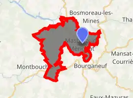
| |
 Masbaraud-Mérignat  Masbaraud-Mérignat | |
| Coordinates: 45°58′35″N 1°44′47″E | |
| Country | France |
| Region | Nouvelle-Aquitaine |
| Department | Creuse |
| Arrondissement | Guéret |
| Canton | Bourganeuf |
| Commune | Saint-Dizier-Masbaraud |
| Area 1 | 20.39 km2 (7.87 sq mi) |
| Population (2017)[1] | 349 |
| • Density | 17/km2 (44/sq mi) |
| Time zone | UTC+01:00 (CET) |
| • Summer (DST) | UTC+02:00 (CEST) |
| Postal code | 23400 |
| Elevation | 370–580 m (1,210–1,900 ft) (avg. 415 m or 1,362 ft) |
| 1 French Land Register data, which excludes lakes, ponds, glaciers > 1 km2 (0.386 sq mi or 247 acres) and river estuaries. | |
Geography
A farming area comprising the village and several hamlets situated in the valley of the river Taurion, some 15 miles (24 km) south of Guéret at the junction of the D61 and the D912 roads.
Population
| Year | Pop. | ±% |
|---|---|---|
| 1962 | 293 | — |
| 1968 | 334 | +14.0% |
| 1975 | 310 | −7.2% |
| 1982 | 315 | +1.6% |
| 1990 | 339 | +7.6% |
| 1999 | 328 | −3.2% |
| 2008 | 371 | +13.1% |
Sights
- Traces of the abbey of Mérignat, dating from the eleventh century.
- The chapel, dating from the twentieth century.
Personalities
- Raymond Poulidor, French racing cyclist, was born here on the family farm in 1936.
See also
References
- Téléchargement du fichier d'ensemble des populations légales en 2017, INSEE
- Arrêté préfectoral 3 December 2018 (in French)
| Wikimedia Commons has media related to Masbaraud-Mérignat. |
| Authority control |
|---|
This article is issued from Wikipedia. The text is licensed under Creative Commons - Attribution - Sharealike. Additional terms may apply for the media files.