Nouvelle-Aquitaine
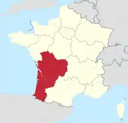
Nouvelle-Aquitaine (French: [nuvɛl akitɛn]; Occitan: Nòva Aquitània [ˈnɔβɔ akiˈtanjɔ] or Novèla Aquitània [nuˈβɛlɔ akiˈtanjɔ]; Basque: Akitania Berria; Poitevin-Saintongeais: Novéle-Aguiéne; "New Aquitaine") is the largest administrative region in France, spanning the west and southwest of the mainland. The region was created by the territorial reform of French Regions in 2014 through the merger of three regions: Aquitaine, Limousin and Poitou-Charentes. It covers 84,036 km2 (32,446 sq mi) – or 1⁄8 of the country – and has 5,956,978 inhabitants (municipal population on 1 January 2017).[2] The new region was established on 1 January 2016, following the regional elections in December 2015.[3]
Nouvelle-Aquitaine
| |
|---|---|
 | |
 Flag  Coat of arms | |
 | |
| Country | |
| Prefecture | Bordeaux |
| Departments | |
| Government | |
| • President of the Regional Council | Alain Rousset (Socialist Party) |
| Area | |
| • Total | 84,036 km2 (32,446 sq mi) |
| Area rank | 1st |
| Population (2017) | |
| • Total | 5,956,978 |
| • Density | 71/km2 (180/sq mi) |
| Demonym(s) | New-aquitanians |
| Time zone | UTC+01:00 (CET) |
| • Summer (DST) | UTC+02:00 (CEST) |
| ISO 3166 code | FR-NAQ |
| GDP () | Ranked |
| Total | € billion (US$ bn) |
| Per capita | € (US$) |
| Official languages | French |
| Website | www |
It is the largest region in France by area, with a territory slightly larger than that of Austria; even French Guiana is smaller. Its largest city, Bordeaux, together with its suburbs and satellite cities, forms the 7th-largest metropolitan area of France, with 850,000 inhabitants. The region has 25 major urban areas, among which the most important after Bordeaux are Bayonne (288,000 inhabitants), Limoges (283,000), Poitiers (255,000), Pau (241,000), and La Rochelle (206,000), as well as 11 major clusters. The growth of its population, particularly marked on the coast, makes this one of the most attractive areas economically in France; the new region outperforms the Île-de-France and Provence-Alpes-Côte d'Azur in demographic dynamism.
After Île-de-France, New Aquitaine is the premier French region in research and innovation, with five universities (Bordeaux, La Rochelle, Limoges, Poitiers and Pau) and several Grandes Ecoles. The agricultural region of Europe with the greatest turnover, it is the French region with the most tourism jobs, as it has three of the four historic resorts on the French Atlantic coast: (Arcachon, Biarritz and Royan), as well as several ski resorts (e.g. Gourette), and is the fifth French region for business creation (all sectors).
Its economy is based on agriculture and viticulture (vineyards of Bordeaux and Cognac), tourism, a powerful aerospace industry, digital economy and design, parachemical and pharmaceutical industries, financial sector (Niort is the fourth-largest financial center in the nation, specialising in mutual insurance companies), and industrial ceramics (Limoges).
The new region includes major parts of Southern France ("Midi de la France"), marked by Basque, Occitan, Poitevin and Saintongeais cultures. Historically, it is the "indirect successor" to medieval Aquitaine, and extends over a large part of the former Duchy of Eleanor of Aquitaine.
Toponymy
The region's interim name Aquitaine-Limousin-Poitou-Charentes was a hyphenated placename, known as ALPC, created by hyphenating the merged regions' names – Aquitaine, Limousin and Poitou-Charentes – in alphabetical order.[4]
In June 2016, a working group headed by historian Anne-Marie Cocula, a former vice-president of Aquitaine, proposed the name "Nouvelle Aquitaine".[5] The decision came after the popular favourite, "Aquitaine",[6] faced resistance by regional politicians from Limousin and Poitou-Charentes. The other popular favourite, "Grande Aquitaine," was rejected for its connotation with a feeling of superiority.[7] Alain Rousset, president of the region, concurred with the working group's conclusion, reaffirming that he considered the acronym "ALPC" no choice at all. For those deploring the loss of "Limousin" and "Poitou-Charentes", he noted that the predecessor region of Aquitaine subsumed the identities of the Périgord or the Pays Basque, which did not disappear during its 40 years of operation.[8]
On 27 June 2016, just a few days ahead of 1 July deadline, the Regional council almost unanimously adopted Nouvelle-Aquitaine as the region's permanent name.[4][9] France's Conseil d'État approved Nouvelle-Aquitaine as the new name of the region on 28 September 2016, effective two days later.[10]
History
- For the recent history of each former administrative regions and departments before 2016,
- For the history of past entities covering much of the area of the region before the French revolution,
Geography
At 84,061 square kilometres, the region Nouvelle-Aquitaine is larger than French Guiana, which makes it the largest region in France (mainland and overseas alike).
Nouvelle-Aquitaine is delimited by four other French regions (Pays de la Loire to the north-west, Centre-Val de Loire to the northeast, Auvergne-Rhône-Alpes to the east, and Occitanie to the south-east), three autonomous communities in Spain to the south (from east to west, Aragon, Navarre, and Basque Country), and the North Atlantic Ocean (the eastern part of Bay of Biscay, Golfe de Gascogne in French) to the west.
Departments
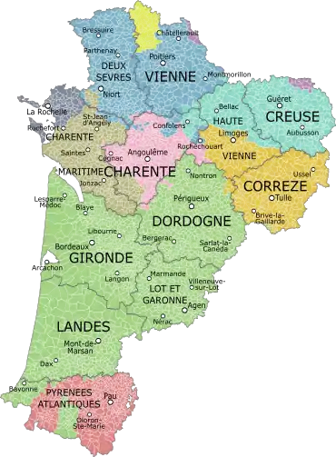
Nouvelle-Aquitaine comprises twelve departments : Charente, Charente-Maritime, Corrèze, Creuse, Dordogne, Gironde, Landes, Lot-et-Garonne, Pyrénées-Atlantiques, Deux-Sèvres, Vienne and Haute-Vienne.
Urban centers
Its largest city and only metropolis is Bordeaux, in the heart of an urban agglomeration of over one million inhabitants. Taking into consideration the urban area, the new region is home to six of the fifty largest metropolitan areas of French territory (population 2011):
- Bordeaux (1,140,668 inhabitants)
- Bayonne (283,571)
- Limoges (282,876)
- Poitiers (254 051)
- Pau (240,898)
- La Rochelle (205,822).
In addition, the region has a network of medium towns scattered throughout its territory, including:
- Angoulême (108,304)
- Agen (79,764)
- Brive-la-Gaillarde (75,925)
- Niort (71,046)
- Périgueux (66,423)
- Bergerac (64,427)
- Villeneuve-sur-Lot (49,354)
- Dax (48,820)
- Mont-de-Marsan (40,269)
Geographical features
The region covers a large part of the Aquitaine Basin and a small portion of the Paris Basin (the border between the two being located at the "Seuil du Poitou") and the Limousin plate (part of the Massif Central) and the western part of the Pyrenees. It is part of five watersheds facing the Atlantic Ocean: Loire, Charente, Garonne and Dordogne (and their extension, the Gironde estuary) and Adour, giving rivers bordering land dedicated mostly to viticulture and to agriculture.
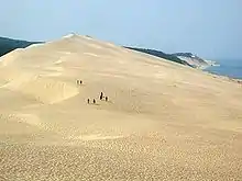
Nouvelle-Aquitaine also relies on the presence of a large open coastline on the Atlantic Ocean, from the National Nature Reserve Aiguillon Bay and the estuary of the Sèvre (north Charron) than Bidasoa (south of Hendaye) and including the islands of the Charentais Archipelago (islands of Ré, Oléron, Aix and Madame) and the wide notch from Arcachon. This diverse area is the area of the oyster (Marennes-Oléron and the Bassin d’Arcachon), mussel (mussels from Baie de l’Aiguillon), and Tourism, evidenced by the presence of famous resorts such Arcachon (Côte d’Argent), Biarritz (Côte Basque) and Royan (Côte de Beauté).
From the Arvert peninsula to the coast of Labourd, the coastline, almost straight, is lined with high dunes, rising to the Dune du Pilat, large lakes (Lac d'Hourtin-Carcans, étang de Lacanau, étang de Cazaux et de Sanguinet , lac de Biscarrosse et de Parentis...) and wetlands (réserve naturelle nationale des dunes et marais d'Hourtin) above vast pine forests planted in the nineteenth century. The Landes forest, by far the most extensive, covering almost one million hectares (nearly 950,000 of maritimes pins), making it the largest artificial forest of Western Europe. Forming a vast triangle starting from the Pointe de Grave, north of Soulac-sur-Mer to Hossegor in the south and east Nérac, it replaced the thankless, sandy and marshy moorland that characterised the region for centuries. The Landes forest is partially included in the Landes de Gascogne Regional Natural Park, which begins south of Bordeaux.
Further north, in the wake of the Landes forest, on the right bank of the Gironde estuary, the forest of la Coubre presents the same characteristics, forming the main "green lung" of Royan on nearly 8000 hectares. Other important forests cover the region: in the Basque Country, the Irati Forest covers over 17,000 hectares; at the borders of the Charente, Charente-Maritime and Dordogne, the forest of the Double, punctuated by nearly 500 lakes, spans about 50,000 hectares; further north, near Poitiers, Moulière forest stretches nearly 6,800 hectares. Further east, close to Guéret, the Chabrières forest reaches 2000 hectares.
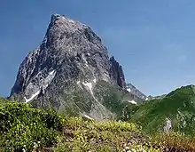
The extreme southern region has a mountainous character with the presence of the Pyrenees. If its western part (mountains of Labourd) is made more high green hills generally struggling to reach 1000 meters (La Rhune, near Bayonne, is 905 meters high, but further east, the culmination of French Basque Country, the pic d'Orhy, nevertheless amounts to 2017 m), the Pau region is marked by more mineral landscapes, and is surrounded by high peaks often exceeding 2000 meters. The highlight of the region, the Pic Palas (2974 m) is located not far away. Other Pyrenean peaks located in the region are also spectacular Pic du Midi d'Ossau (2884 meters), the Pic d'Arriel (2824 m), the Pic de Ger (2613 m) near the Winter resort Gourette, Pic d'Anie (2504 m), the Latte de Bazen (2472 m), the Pic d'Ansabère (2377 m), the Pic de l'Arraille (2147 m) or the Pic d'Arlas (2044 m).
This hilly region is traversed many mountain streams, called gaves: among these include the Gave de Pau, the Gave de Bious the Gave d'Ossau or the Gaves réunis, on the border of Landes and Pyrénées-Atlantiques. Ossau Valley, one of the three valleys of Béarn, extends from the suburbs of Pau to Col du Pourtalet to the Spanish border. Glacial lakes, its fauna and flora exceptional explain its integration into the Pyrénées National Park.
Belonging to the Massif Central, Limousin also has a marked relief, with its high plateaux and some hedgerow eroded peaks that dominate green valleys and forests of oak and chestnut trees. Limousin plateau, cut by the valleys of the Vienne (who waters his capital, Limoges) Isle, Vézère or the picturesque Corrèze, with its cashed reliefs, hardly exceeds 500 meters. It marks the watershed line between the Loire basin to the north (the sources of the Briance, the Aixette, the Grêne or the Gorre), the basin south of the Dordogne (sources of Dronne, of Isle and of Auvézère) and maritime watershed of the Charente, in the west.
The mountains of Limousin, which include a series of small mountains (mont Fayat, Monedières Hills, mont de Châlus) peak at Mont Bessou (976 m), in Corrèze. Further north, the mountains of Marche, which are divided into mountains of monts de Guéret, mont d'Ambazac and monts de Blond, are more like high wooded hills dotted with pastures, as real peaks. They culminate in Signal de Sauvagnac (701 m), in Haute-Vienne. Southwest of Limousin and Périgord northwest since 1998 are integrated to the Parc naturel régional Périgord Limousin.
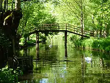
The northern part of the region, which corresponds to the Haut-Poitou history, is organised around a tray agricultural and viticultural (vineyard of Haut-Poitou) irrigated by the Vienne, Clain or the Gartempe, which form so little valleys, often lined with oak forests. Further south, the Niortais this open landscapes (openfields) in grain dominant, but also rich wetland areas such as the Marais Poitevin, a legacy of an old marine gulf filled with alluvium, which is divided into wet marshes (we speaks more readily of "Green Venice") and marshes dried up, converted into mixed farming. Niort, on the Sèvre Niortaise, main town of the Haut-Poitou outside Poitiers, is like a door of this "Green Venice" much of which belongs to the parc naturel régional du Marais poitevin, established in 1979, classified "Grand site de France".
Further south lie the Charentes, which correspond to the former provinces of Aunis, Angoumois and Saintonge. Aunis is not unlike the landscape of Niortais, with large marshes that extend from either side of La Rochelle and Rochefort (Baie d'Yves, marais de Rochefort, Broue and Brouage) but also the islands of Ré and Aix, with varied landscapes where pine forests mingle, sandy beaches or the curious lagoon of Fier d'Ars, the sands in constant motion, which houses a bird sanctuary. The interior of the territory is marked by the presence of a rich plain cereal evoking the Beauce by its open relief on the horizon. At the center of this space, the city of Surgères remained a pastureland where dairy farming has retained its importance: the small city is thus a production centers butter, Beurre de Charentes-Poitou.
The Angoumois forms a transitional space between the coastal plains of Aunis, large "champagne" of Saintonge and Limousin plateau. Dotted with small hills, he seems to live to the rhythm of the Charente, real artery watering its major cities, Angoulême, Cognac and Jarnac. Great wine region, internationally renowned alcohol is produced there, cognac, and a water spirits called Pineau des Charentes. The western quarter of Charentes consists of Saintonge, organised territory around the towns of Saintes, the first capital of Aquitaine in Roman times, and Royan.
In continuation of the Angoumois, the Dordogne approximately corresponds to the former province of Périgord. Taking its name from the river of the same name, which flows Bergerac but not its prefecture, Périgueux (the edge of the Isle), the area with varied landscapes has a large afforestation rate (45%) making it the third most wooded department France. The great forests of oak and chestnut trees of green Périgord, organised around Nontron, meet the great grain fields of the White Périgord, nicknamed "the breadbasket of the Périgord", the oak, walnut and black Périgord truffle, around Sarlat-la-Caneda and vineyards of Bergerac or purple Périgord, which produces Bergerac, monbazillac or pécharmant.
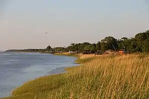
The Gironde estuary, which acts as a link between Saintonge, Blayais, Médoc and western Guyenne, is in itself a world apart. Wild largest estuary in Europe, being classified in the marine park with the "Pertuis charentais", it is lined with large marshes ("Petite Camargue" and hillsides which produces most of the great Bordeaux wines from the Côtes-de-Bordeaux and Côtes-de-Bourg on the right bank to the great wines of the left bank Médoc (Pauillac, Margaux, Saint-Estèphe, Saint-Julien. The vineyards of Bordeaux, with international reputation, has done for centuries the reputation of the region. His productions are exported worldwide.
Farther south lies the vast plain Landes (south of Gironde and Landes), which begins near Bordeaux and go to the Pyrénées. Largely occupied by the Landes forest, it is also a major agricultural area (maize farming) and hosts a spa of international reputation, Dax, also the capital of Chalosse, important breeding ground.
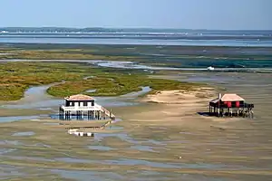
The coastline subject to severe erosion, remained very wild. Some resorts have been built in the dunes from Soulac-sur-Mer in the north of the Gironde, via Lacanau, Hourtin, Biscarrosse, Mimizan and Capbreton, without forgetting those bordering the Bay of Arcachon: Arcachon, Andernos-les-Bains, Lège-Cap-Ferret, Pyla-sur-Mer. This vast lagoon, wide open ocean, houses since 2014 the marine natural park of Arcachon basin.
Eastern Guyenne corresponds in part to the department of Lot-et-Garonne. Rich agricultural and farming area watered by both the Lot and the Garonne, it is famous for its "pruneaux", who took the name of its capital, Agen (nearly 8000 hectares of land are dedicated to Ente plum orchards) while Marmande is famous for its tomatoes. The mild climate explains that also cultivated tobacco, as well as strawberries ("gariguettes") and vines, used to produce the Côtes du marmandais the buzet or Côte de Brulhois, that relate to the broad vineyard of the Southwest. But the real glory of this land is Armagnac, a famous brandy, exported around the world. Its vineyards cover some of the departments of Lot-et-Garonne, Landes but also the Gers (in the neighbouring region of Occitanie). It also produces the floc de Gascogne, with delicate floral accents.
The extreme south of the region consists of two territories in strong identity, the Basque Country (Northern Basque Country or "Iparralde") and Béarn. The first, which is organised around Bayonne, Biarritz, Saint-Jean-de-Luz (Labourd) Mauléon-Licharre (Soule) and Saint-Jean-Pied-de-Port (Lower Navarre) has its warm and humid climate its green side, the Atlantic rains from butter against the Pyrenean barrier. The coast, with its posh resorts or family, makes it a popular holiday resort. The interior, more rural, retains a strong agricultural tradition and a solid wine region, symbolised by the vineyard irouléguy but also by traditional liquors such as izarra and patxaran, eau-de-vie characteristic of Navarre .
Anchored in the heart of the Pyrenees, the Béarn opposes his Gascon traditions. Has a succession of gently accented hills and valleys (that of Pau river, which concentrates the capital, Pau, and several cited as Orthez and Navarrenx, being the most populated), it comprises the Aspe, the Barétous and Ossau valleys with the Col du Soulor. Agriculture will always prominently, as viticulture (jurançon, Madiran) even if the aeronautical and petrochemical sectors are also represented. It was in Béarn that are concentrated the main ski resorts in the area, such Artouste, Gourette, Issarbe, La Pierre Saint-Martin and Le Somport.
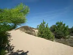 Sands dune in Île d'Oléron (Charente-Maritime)
 The Barétous Valley (Pyrénées-Atlantiques)
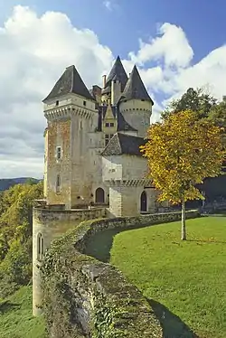
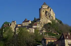 Medieval city of Castelnaud-la-Chapelle (Dordogne)
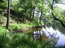
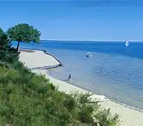 The main lake of Biscarrosse (Landes)
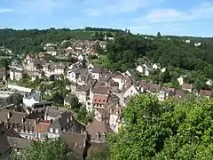
Languages
In 2008, the region Aquitaine made a survey on the languages in the region, and gave the following results.[11]
| Language | First languages | Total languages |
|---|---|---|
| French | 86.1% | 91.8% |
| English | 8.7% | 58.7% |
| Spanish | 2.8% | 44.1% |
| Occitan and other regional languages | 0.6% | 16.1% |
| German | 0.4% | 8.3% |
| Italian | 0.3% | 5.1% |
| Arabic | 0.3% | 2.9% |
| Basque | 0.1% | 1.7% |
| Other languages | 0.7% | 7.6% |
| Total | 100.0% | 236.3% |
Climate
The region Nouvelle-Aquitaine essentially has a more or less altered oceanic climate. We distinguish the Aquitaine oceanic climate, which concerns most of the territory (Charentes to Landes), the Paris oceanic climate (Poitou), Limousin oceanic climate, tinged with semi-continental influences (Limousin) and basque microclimate, wetter (western half of the Pyrénées-Atlantiques and southern Landes). The Pyrenees has a specific climate that varies with altitude: the Pyrenean climate, which is a variation of mountain climate.

In the north of the region, the Paris oceanic climate is marked by moderate rainfall, warm summers and cool winters, but moderately so. The Seuil du Poitou acts as a relative climatic barrier and regions further south belong to the Aquitaine oceanic climate area. Coastal areas are wetter overall, with moderate rainfall spread throughout the year, except for the summer months, where droughts are not uncommon. Summer, which is relatively warm, is tempered by sea breezes, and winters are cool-mild. Frosts and snow are unusual. Sunshine is quite high, with around 2,000 to 2,200 hours per year, which is comparable to some Mediterranean regions (Perpignan). Summer precipitation often take the form of thunderstorms, possibly violent, while winter is sometimes marked by storms, some of which have marked the area with their exceptional: Martin in 1999 (record of 198 km / h in Saint-Denis-d'Oléron), Klaus in 2009 (172 km / h to Biscarrosse) and Xynthia in 2010 (160 km / h on the Île de Ré).
The climate in Angoumois and Limousin is wetter and cooler, remains temperate with warm spring and has relatively warm summers, with variations due to altitude. The annual sunshine averages at 1850 hours. The climate of the Basque country and southern Landes is marked by its warm summers, mild winters but especially by its high rainfall, with Atlantic depressions that hit the Pyrenean foothills. This Microclimate explains the presence of lush vegetation and the green aspect of the region. Fogs are not rare, but usually dissipate very quickly.
As for the Pyrenean climate, suboceanic trend Béarn, it is subject to frequent "cap effect" when the north-west of disturbances abut against the Pyrenean mountains. Valley bottoms, true "funnels clouds" are particularly watered. The winter snow is important above 1200 meters. Pau valley has a microclimate, however, marked by strong sunlight (about 1900 hours a year) but high rainfall (1100 mm per year) and a near absence of frost in winter. Rainfall is usually brief there, but regular, and spread throughout the year.
Transport
Nouvelle-Aquitaine is a region of transit between the Paris Basin (including the Ile-de-France) and the Iberian Peninsula, but also between the Rhône Valley and the Atlantic and Mediterranean regions (noon Toulouse). This situation implies several years developing roads and major highways, especially in the context of the road Estuaries, but also the high-speed Paris-Bordeaux-Toulouse-Spain, which should help significantly shorten rail journeys.
Roads and highways
Many roads and highways in the region radiate from Bordeaux and just attach to its peripheral belt (Bordeaux ring road or A630). The main lines used for reinforcing roads and highways are in addition some terminal bonds designed to streamline access to two major resorts in the area, Arcachon (via Highway A660) and Royan (by via the N150, partly making 2X2 routes).

The A10 autoroute (the "Aquitaine") is the major artery between Bordeaux and Paris, commissioned in 1981. It is part of to the network of "autoroutes du Sud de la France" and provides access to several cities: Saintes, Niort or Poitiers. From Saintes, highway A837 allows drivers to reach the town of Rochefort. Further north, in Niort, an interchange provides access to the A83 motorway, the Vendée and Nantes (Pays de la Loire). The N10 is the main road of the Charente and an important road for connecting between Bordeaux and Poitiers including Angoulême.
Connecting the east of Bordeaux (Libourne) to Greater Lyon, the A89 motorway (called "La transversale") irrigates the eastern part of the region, facilitating travel between the cities of Bordeaux and Périgueux, Brive-la-Gaillarde, Tulle and Ussel. A little further south, the D936, which roughly follows the course of the Dordogne, is grafted on the Bordeaux ring road via an interchange at the municipalities of Cenon and Floirac. It gives access to the towns of Branne, Castillon-la-Bataille and Sainte-Foy-la-Grande (Gironde) and Bergerac (Dordogne).
Southeast of Bordeaux, an exchanger arranged at the ring road in the municipality of Gradignan allows access to the A62, western part "Entre-Deux-Mers" motorway. Next a lateral axis at the Garonne, it can reach Langon, Marmande, Agen and beyond, Toulouse. She just double the D10, on the right bank of the Garonne, which serves the southeast of the Gironde before heading down to the Landes. South of Langon, the A65 motorway was commissioned in December 2010. Going through Bazas, Mont-de-Marsan and Aire-sur-Adour, she joined the Greater Pau at Lescar.
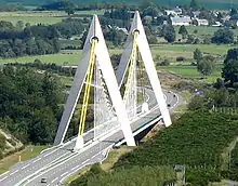
Southwest of Bordeaux, the A63 is a major focus of the regional motorway network. Forming a large artery almost straight through the vast expanses of flat Landes de Gascogne, it crosses the south of Gironde and Landes (passes near Dax but avoids the prefecture, Mont-de-Marsan) before joining Bayonne and the Basque Country, to Irun, on the Spanish border, the main border crossing. Particularly popular, especially during the summer, it supports an average daily traffic of 34,000 vehicles (8,000 trucks), increasing to 50,000 vehicles (10,000 trucks) during the months of summer. The other border crossings, less frequented but less direct, are the Somport tunnel and Col du Pourtalet.
The Basque country and Béarn are also served by a road parallel to the Pyrenees, which facilitates access to Toulouse and the Mediterranean regions: the A64, called "La Pyrénéenne". It starts from Briscous (in the outskirts of Bayonne), continues to Pau before reaching Tarbes in the neighbouring region of Occitanie) and the Toulouse ring road.
The eastern region is well served by the A20 north-south axis between Paris and Toulouse and opens up Limousin. It thus goes through La Souterraine, Limoges and Brive-la-Gaillarde. Another important way, the European route E603 connects Limoges to Angoulême and Saintes. It represents one of the key elements of the road Central Europe Atlantic important channel of communication between the Rhône Valley and the Atlantic coast, which is divided into multiple plots at Angoulême and Saintes (Bordeaux, Royan and La Rochelle).
Rail network
The regional rail network is organised around the main towns: Bordeaux, Limoges, Poitiers, La Rochelle and Bayonne. The main line is the one between Paris and Madrid via Poitiers, Bordeaux and Hendaye; then comes the line Lille-Brive-la-Gaillarde, which serves Limoges, both served by TGV trains. Other lines are served mostly by the TER network of TER Nouvelle-Aquitaine.
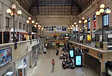
The largest station in the region is Bordeaux-Saint-Jean, which accommodates 10 million passengers per year; then comes the Limoges-Bénédictins station and its 2.5 million passengers. Poitiers has two stations: Poitiers station and Futuroscope station serving the technology park Futuroscope. Angoulême station sees around 1.45 million passengers per year; Agen station links the Occitanie region and hosts more than 1.3 million passengers per year; Pau station sees nearly 1 million passengers each year while the number of users of Dax station reached 820,000.
The implementation of the LGV Sud Europe Atlantique, which is part of a priority program initiated by the state, should facilitate trade. The journey time between Bordeaux and Paris (Montparnasse) is expected to reduce from three hours in 2015 to just over two hours in 2017. At the same time, the journey time between Poitiers and Paris should reduce from 1:30 to 1:15, between Angoulême and Paris from a little over two hours to 1:40 and between La Rochelle and Paris from just under three hours to 2:30. Journey times between several cities in the region will also be shortened, between Bordeaux and Angoulême reducing from just under an hour to a little over half an hour, and between Bordeaux and Poitiers reducing to approximately half-an-hour.
Another important project for the region, the LGV Bordeaux - Spain extends of the South Europe Atlantic TGV line to connect with the Basque Y (high-speed line linking the Spanish cities of Bilbao, Vitoria, San Sebastian and Irun). It is part of the great South West Rail project and should facilitate regional connections between Bordeaux, Mont-de-Marsan, Dax and Bayonne, long distance connections between the south of the region and the Île-de-France, and also international links to Spain (including Madrid).
The LGV Bar project between Poitiers - Limoges is part of this context, and should significantly shorten travel between the two cities (from just over an hour and a half to 45 minutes), facilitate interregional connections and access to the Ile-de-France. This project is one of the links of "Transline project" (Transversal Auvergne Atlantic Alpes), still under study.
Airports
The region benefits from the presence of several airport infrastructure. The main airport is Bordeaux-Merignac, world class, which hosts nearly four and a half million passengers per year and offers flights to many destinations; It is the seventh metropolitan France Airport (fifth if we except the Paris airports).
.jpg.webp)
The second airport is Biarritz-Anglet-Bayonne, which offers flights to several European countries and hosts a little over a million passengers; it ranks in 17th position at Metropolitan France. Third airport in the region, Pau Pyrénées Airport welcomes approximately 650,000 passengers per year. Then the airport of Limoges-Bellegarde, hosting nearly 300,000 passengers per year and Bergerac Dordogne Périgord Airport, created in 1990 and whose attendance has increased from 16,000 passengers a year in 2002 to 260,000 in 2010.
The airport of La Rochelle - Île de Ré offers flights to several French and European cities and welcomes approximately 215,000 passengers per year. Smaller, airports Poitiers-Biard (100,000 annual passengers), Brive Dordogne (60,000 passengers), Agen-La Garenne (40,000 passengers) and Périgueux-Bassillac (8000 passengers) offer mainly domestic flights. Airports Angoulême-Cognac and Rochefort-Charente-Maritime are only turned to business flights in the absence of regular commercial lines.
Harbours
Cruise ships mostly dock in the ports of La Rochelle (terminal La Pallice), Verdon-sur-Mer (shuttles for Royan), Pauillac, Bordeaux and Bayonne.
.jpg.webp)
Many marinas are open to smaller boats. The main ones are those of La Rochelle (4800 rings), Arcachon (2600 rings), Port-Médoc (1200 rings), Royan (1000 rings), of Capbreton (950 rings), Hendaye (800 rings), Saint-Denis-d'Oléron (750 rings) and Anglet-Biarritz (425 rings).
River transport is active on several rivers in the region: Charente (mainly between Rochefort and Angoulême), Gironde estuary, Garonne, Dordogne, Lot, Baise and Adour.
Landmark river tourism, the Canal de Garonne is an extension of the Canal du Midi (which together form the "Canal des Deux-Mers" between the Atlantic and the Mediterranean). It passes including Agen (Agen aqueduct) and continues until Castets-en-Dorthe (Gironde).
The entire watershed of the Dordogne is classified as a biosphere reserve by UNESCO since 11 July 2012 with the co-ordination structure Institution of regional public Dordogne basin. The basin of the Dordogne is one of the few places in France where the presence of eight migratory fish species proved with Atlantic salmon, sea trout, river lamprey, sea lamprey, Allis shad, shad feigned, eel, and sturgeon in Europe. Other species associated with water, such as the common otter and the European mink, or the penny whistle swimming, are also present.
Two water agencies (Adour-Garonne and Loire-Bretagne) are involved in water management in the region.
Economy
The Gross domestic product (GDP) of the region was 177.0 billion euros in 2018, accounting for 7.5% of French economic output. GDP per capita adjusted for purchasing power was 26,500 euros or 88% of the EU27 average in the same year. The GDP per employee was 101% of the EU average.[12]
The economy of the region is based on several pillars: diversified agriculture, a set of famous vineyards (Bordeaux wine, brandies of Cognac and Armagnac), but also a decisive role in the industry sectors aerospace, defence, biotechnology, chemistry and more generally for scientific research, relying on a network of universities and Grandes Ecoles.
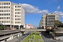
Nouvelle-Aquitaine can also count on a large image and digital sector ("Campus de l'Image" of Angoulême, future "Cité Numérique" of Bègles), a dense network of small and medium enterprises, the presence in its territory of large agribusiness as well as a port network including three major commercial ports being balanced due to their geographical position (Grand Port maritime de La Rochelle in the north, Grand Port maritime de Bordeaux and port of Bayonne in the south). In 2013, a survey conducted by the weekly "L'Express" classed Bordeaux as second best of most French cities "business friendly" in the category of cities with over 500,000 inhabitants (and the best economic environment), Poitiers, La Rochelle and Bayonne respectively in second, third and fourth in population centers from 100,000 to 200,000 inhabitants. In 2014, a new survey, conducted this time by the "Great Place To Work" Institute, gives Bordeaux as a city considered the most attractive by salaried workers.
The new area boasts natural and heritage assets that make it a tourist destination of foreground, materialised by a wide ocean frontage structured around three major resorts "historical" (Arcachon, Biarritz and Royan), a series of winter sports stations in the heart of the Pyrenean massif (Gourette, Le Somport) and leading historical sites (Lascaux caves, medieval city - and "wine Mecca" - of Saint-Émilion, martyr village of Oradour-sur-Glane) visited by hundreds of thousands of visitors each year.
Agricultural and wine sectors
An important rural Region, Nouvelle-Aquitaine has a varied agriculture. Cattle breeding (regional races: Limousin, Bordelais, Parthenais, Blonde d'Aquitaine, Gasconne, Bazadais and Béarnais) is predominant in the Bressuirais and Confolentais grove and in the Aunisienne plain, on the high Limousin plateau, in the Bazadaises and Chalossiennes Hills and is used both in the production of meat to milk production. There are also two other bovine regional breeds do not belong to the list of official French breeds (Marinelandaise and Betizu) endangered. The area has many quality labels ("Veau fermier élevé sous la mère", Limousin beef ...).

Goats (regional breeds: Poitevine, Pyrenees and Massif Central) are mainly concentrated in the north of the region (Charente, Charente-Maritime, Deux-Sèvres and Vienne) and are used for cheese production (chabichou, mothais sur feuille, jonchée). These four departments alone account for 30% of French goat herd, more than 200,000 heads. Some departments complement this area (Corrèze and Dordogne with a part of the production of Rocamadour AOC). Sheep farming (regional races: Basque-béarnaise, Landes, limousine, manech black head, red head and Xaxi Ardia) is well represented in the Limousin (Limousin lamb) the Charentes (lamb Poitou-Charentes), the Médoc (Pauillac lamb) and the Basque and Bearn Pyrenees.
Pig farming, which represents a significant part of the agri-food sector is distributed throughout the region (regional races: black ass Limousin, Gascon pork pie black Basque) and is guaranteed by the label "porc du Sud-Ouest ". The pigs in the region are used to produce many meat products, starting with the famous Bayonne ham. Many farms have also specialised in poultry production including yellow chicken Saint-Sever and poultry of Sèvres val (regional races Barbezieux, Limousin, Gascony, Landes and Marans) and fat waterfowl (mule ducks and geese), primarily designed for the production of foie gras and confit. Nouvelle-Aquitaine is the first European region for foie gras (more than half the French production). The label "Canard à foie gras du Sud-Ouest" occupies a large part of the region.
The region is the birthplace of many other breeds (regional donkey breeds: the Pyrenees and Poitou, regional equine: Poitevin mule, Landais and Pottock).
The area is also an important oyster production center, with oysters " de Claires" from Marennes-Oléron (in the estuary of the Seudre) and those of Arcachon and Cap Ferret and a stronghold of the mussel with mussels from Aiguillon Bay (near La Rochelle) and mussel Boyardville and Port-des-Barques.
The decrease in fishery resources has led to a drop in tonnage of fish in the main ports of the region, however, remain very active. In 2014, the first port in the region (port and eighth highest tonnage nationally) is that of Saint-Jean-de-Luz-Ciboure, or share about 7600 tons of fish, and annual business 23 million euros. This is followed by the port of La Cotinière on Oleron island, sixth French fishing port for sales specialising in species 'nobles' (5300 tons of fish landed). Then there are the ports of La Rochelle, Royan, Arcachon, Capbreton and Hendaye.
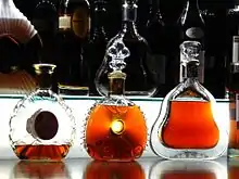
Viticulture is a key sector of the local economy, the region with the presence of some of the most prestigious French vineyards: vineyards of Bordeaux, Bergerac, Cognac (production of Cognac and Pineau des Charentes) and partially, Armagnac (production of Armagnac and Floc de Gascogne), Southwest vineyards in the valleys of the Garonne and Lot, vineyard slopes of the Pyrenees (jurançon, irouléguy) and vineyards of Haut-Poitou. The vineyards of the Limousin, formerly prolific now confidential, but continues to provide quality wines (vineyards Verneuil-sur-Vienne and Correze vineyard, including giving the wine country and the Correze "vin paillé" of Queyssac-les-Vignes).
The region plays a vital role for cereal crops (wheat), herbage and oil (corn, sunflower), which bloom in the valleys of the Adour, Charente and the Garonne. Large agricultural cooperatives are located in the area: Lur Berri, Maïsadour, or Natea Charentes Alliance. In Charente-Maritime, the small town of Saint-Genis-de-Saintonge developed the largest French popcorn production unit: 70% of the national production comes out of his ateliers.
Tobacco production remains important in Langon area around La Réole, Auros, Monségur and Bazas (Gironde) in Bergerac, in Dordogne and in the Lot-et-Garonne, which occurred to him only 14% of the French Tobacco nearly 800 hectares. Mixed farming has led to the establishment of more localised cultures, but nevertheless considered: Périgord walnuts, Limousin apples, strawberries valleys of the Dordogne and Lot, Charentais melons hillsides, beans ("mojhettes") of val d'Arnoult and the Marais Poitevin, the Marmande tomatoes, peppers from Landes and the Basque Country, the most famous representative is the Espelette pepper.
The agri-food sector is characterised by the presence of several national brands and international production sites, including Madrange (Limoges), Blédina (Brive-la-Gaillarde), Marie (Airvault and Mirebeau) Senoble (Aytré, near La Rochelle ), Lu (Cestas, near Bordeaux) Cémoi (Bègles, near Bordeaux), Charal (Égletons, in Corrèze), Valade Group (Lubersac, in Corrèze) or Lindt & Sprüngli (Oloron-Sainte-Marie). Labeyrie headquartered in Came in the Pyrénées-Atlantiques and Delpeyrat in Mont-de-Marsan, in the Landes.
Forest resources
The region has significant forest resources.
The timber industry consists of two main types of activities that mainly use the wood of the Landes forest and secondarily of the Dordogne, Creuse, Corrèze and Haute-Vienne. The primary processing industries (pulp, sawing, slicing, etc.) are very often the result of large companies to perform operations that require large investments. The secondary processing industries (paper / cardboard, furniture, woodwork and plywood, etc.) do not require as many resources. They are more dispersed geographically and in the hands of smaller-scale undertakings or craft.
The timber industry is large enough to get the support of local authorities throughout the years. Thus is explained obtaining national competitiveness cluster label for the "Xylofutur" whose main purpose is to bring innovative projects to benefit the entire industry. Directly related to the timber industry, the Charente stationery has adapted to globalisation by producing special paper (paper packaging, greaseproof paper, recycled paper and corrugated cardboard).
Industries
The region is a major international center in the field of aeronautics and space industry. Together with the neighbouring region Occitanie, it belongs to the Aerospace Valley world-class industry cluster. The regional aerospace sector is closely linked to the defence sector, leading to talk of industry "ASD" (aeronautics, space and defence).
The regional aircraft industry is a world leader for business aircraft, high-tech batteries, high performance composite materials, landing gear systems and turbines for helicopters, the European leader for military aircraft, cockpit equipment and systems, ground tests and flight, launchers, solid propulsion, airborne radars and systems, weapons systems deterrence, atmospheric re-entry technology and national leader in the interior design of 'business aircraft, aircraft maintenance, UAV systems.
The main sites are located in the city of Bordeaux, but also in the Pyrénées-Atlantiques and in Vienne. Of these, Dassault Aviation has five establishments in Mérignac (final assembly and commissioning flight Rafale and Falcon), Martignas-sur-Jalle (wing civilian and military aircraft), Biarritz (composites and assembly of structures), Cazaux (integration and armament test) and Poitiers (production of military aircraft canopy). Thales Group has two sites near Bordeaux: Pessac (aircraft embedded systems: mission computers, airborne radars combat and surveillance, unmanned aerial systems) and Hailsham (design and development of cockpit systems for major aircraft manufacturers in the world ). Airbus Defence and Space (development and production of Ariane launchers and of ballistic missiles for the French nuclear force) is located in Saint-Médard-en-Jalles. Safran has two major production facilities in the region: Turbomeca (world leader in helicopter turbines) near Pau and Snecma (maintenance and repair of military engines) in Châtellerault.
The region is also home to several military airbases, including a command center of the French Air Force. It also hosts major defence-related facilities such as the Megajoule laser and the main rocket testing facility of the Direction générale de l'armement.

The pharmaceutical and parachemical industry is particularly well represented in the city of Bordeaux: Sanofi has three sites on the outskirts of Bordeaux, Ambarès-et-Lagrave (production) Floirac (IT) and Saint-Loubès (logistics); Meda Pharma Group is located in Mérignac; The Merck Group operates a production unit in Martillac. Finally, CEVA Animal Health in Libourne, with more than 500 employees, originally created by Sanofi, now owned by its employees, is (in the company) the ninth largest veterinary pharmaceutical group.
In Agen, the UPSA Company (scientific pharmacology Union applied), sold to the US group Bristol-Myers Squibb (BMS) in 1994, remains one of the biggest local and regional employers with 1,400 employees. Two factories and a logistics platform allow the market to deliver the full range of analgesics from aspirin and paracetamol to morphine. Since 1994, the US group has invested regularly in its two Agenais units that deliver half of their export production.
Limoges, long specialised in manufacturing and luxury (shoes, porcelain ...), is now a major cluster in the field of ceramics research (European Ceramics Pole). Legrand, French industrial group historically based in Limoges in the Limousin, is a world leader in products and systems for electrical installations and information networks. Ester Technology Park, is a business and research center that develops north of the city on several areas: ceramics; materials and surface treatments; electronics, optics and telecommunications; Health biotechnology; water and environment; Engineering in association with the University of Limoges.
Niort has developed over many years a financial sector based economy (insurance), and has now the fourth greatest number of flows in the French financial market (behind Paris, Lyon and Lille). Headquarters of many mutual funds, including the "Three M" (Macif, MAIF and Maaf), the city is also seventh in regard to senior positions. The share of the financial activities sector jobs and insurance is far more important than in the rest of the country, reaching 18% in the urban area of Niort (against 3.7% in the rest of France).
The oil and gas industry is also represented in the region, with the Lacq gas field near Pau, which was France's main source of natural gas in the 1970s.
Tourism
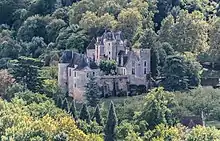
Tourism is an important sector in a region with significant assets, starting with a mild and sunny climate, famous vineyards (wine tourism) and many heritage sites, some of international renown. Its wide ocean frontage, stormed by thousands of vacationers - and surfers - every summer is characterised by sandy beaches that often stretch to the horizon. Indirect consequence of increasingly popular for water sports, many surf-related brands (mainly clothing and equipment) are present in the region, earning him the nickname "Glissicon Valley" in reference to Silicon Valley: Rip Curl, Billabong, Quiksilver, O'Neill.

In the northern part of the coast, the Charente archipelago consists mainly islands of Ré, Oléron and Aix, where alternate sheltered coves and beaches opening onto the open sea. The aunisiennes coast, near La Rochelle, greet some family seaside resorts such as Châtelaillon-Plage or Fouras. Further south, in the heart of the Côte de Beauté (Coast of Beauty), Royan is one of three major seaside resorts in the region. She has five beaches, not to mention those of neighbouring towns and the Côte Sauvage (Wild Coast) of the peninsula of Arvert, Mecca of surfing and board sports.
Beyond the Gironde estuary begins the Côte d’Argent (Silver Coast), large expanse of almost straight sand bordered by pine trees and large lakes Landes, punctuated by small resorts such as Soulac-sur-Mer, Vendays-Montalivet (famous for its naturist center) Hourtin, Lacanau, Biscarrosse, Mimizan, Hossegor or Capbreton. The Bassin d'Arcachon, which forms an indentation between Gironde and Landes coast, focuses on Arcachon, another seaside resort, nestled in the heart of the pine forest. It faces the Cap Ferret, beaten by the waves of the ocean. In continuation of the Côte d'Argent, the Basque coast is structured around Biarritz, Mecca of seaside tourism, Saint-Jean-de-Luz and Hendaye, and is famous for its eroded cliffs and powerful rollers which make it a favourite spot for surfers.
Winter sports enthusiasts are in the Pyrenean several stations where to practice skiing, snowboarding and snowblade. The main ones are Gourette, Artouste, La Pierre Saint-Martin, Issarbe, Le Somport, Iraty or Somport-Candanchu.
Many spas are located in the region, starting with Dax, but also Eaux-Bonnes, Eugénie-les-Bains, Saint-Paul-lès-Dax, Salies-de-Béarn, Cambo-les-Bains, Jonzac, Saujon, Rochefort, La Roche-Posay or Évaux-les-Bains.
Among the other sites with large numbers of visitors, many have higher attendance than one million people a year: the park Futuroscope in Poitiers (1.8 million visitors), the most visited site outside the Île de-France, the old town of Sarlat (1.5 million visitors), Dune du Pilat, near Arcachon, (1.4 million visitors), or the historic town of Saint-Emilion, near Libourne ( about 1 million visitors).
Aquarium de La Rochelle approach (850,000 visitors), as well as the La Palmyre Zoo (700,000 visitors), the largest private zoo in Europe, near Royan. The medieval village of Collonges-la-Rouge (500,000 visitors), the Southwest Walibi theme park in Roquefort, near Agen (300,000 visitors), the small train of Rhune near Bayonne (about 360,000 visitors), the center of memory and martyr village of Oradour-sur-Glane, near Limoges (300,000 visitors), the caves of Lascaux - Lascaux 2 and 3 (250,000 visitors), the Pyrénées National Park (200,000 visitors), the Cité de l’Ecrit of Montmorillon (110,000 visitors), the Centre international de la mer of Rochefort, Chassiron lighthouses on the island of Oleron, and phare des Baleines, on the Ré island (about 100,000 visitors each), or the animal park Mountains Guéret, Creuse, website to observe wolves in parole and attracting about 45,000 visitors a year, are all leading sites in regard to tourism.
References
- "Akitania Berria Euskadi Nafarroa Proiektu-deialdiaren jaurtiketa" (in Basque). Educación Navarra. Nafarroako Gobernua. 27 March 2013. Retrieved 17 November 2020.
- "Comparateur de territoire: Région de la Nouvelle-Aquitaine (75)". Insee. Retrieved 8 September 2020.
- "La carte à 13 régions définitivement adoptée" (in French). Le Monde. Agence France-Presse. 17 December 2014. Retrieved 13 January 2015.
- Loi n° 2015-29 du 16 janvier 2015 relative à la délimitation des régions, aux élections régionales et départementales et modifiant le calendrier électoral (in fr)
- "La nouvelle grande région s'appellera "Nouvelle Aquitaine"" [The new grand region assumes the name "Nouvelle Aquitaine"]. Le Figaro (in French). 9 June 2016. Retrieved 15 June 2016.
- Quel nom pour la nouvelle région ? Vous avez choisi..., Sud-Ouest, 4 December 2014, accessed 2 January 2015
- Benoît Lasserre (8 June 2016). "La nouvelle grande région s'appellera... Nouvelle Aquitaine" [The new grand region assumes the name… Nouvelle Aquitanie]. Sud Ouest (in French). Retrieved 15 June 2016.
- Bertrand Escolin (29 June 2016). "La Nouvelle-Aquitaine est née" [Nouvelle-Aquitaine is born]. Le Moniteur (in French). Retrieved 30 June 2016.
- Baptiste Bize (27 June 2016). "Nouvelle-Aquitaine à la quasi-unanimité" [Nouvelle-Aquitaine in quasi-unanimity]. La Nouvelle République (in French). Tours. Retrieved 27 June 2016.
- Décret n° 2016-1267 du 28 septembre 2016 portant fixation du nom et du chef-lieu de la région Nouvelle-Aquitaine (in fr)
- "RESULTATS DE L'ETUDE SOCIOLINGUISTIQUE : "PRESENCE, PRATIQUES ET REPRESENTATIONS DE LA LANGUE OCCITANE EN AQUITAINE"" (PDF). Institut Bérnais et Guascon. October–November 2008.
- "Regional GDP per capita ranged from 30% to 263% of the EU average in 2018". Eurostat.
External links
| Wikivoyage has a travel guide for Nouvelle-Aquitaine. |
- Official website
 (in French)
 - Merger of the regions - France 3
