Mastic Beach, New York
Mastic Beach is a census-designated place and former village in the southeast part of the town of Brookhaven in Suffolk County, New York, United States. The population was 14,849 at the 2010 census, at which time it was an unincorporated census-designated place for the first time.[4][5] The village is located in the general vicinity of the hamlet of Mastic Beach.
Mastic Beach, New York | |
|---|---|
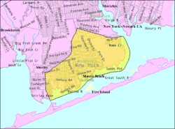 U.S. Census Bureau Map | |
 Mastic Beach, New York U.S. Census Bureau Map | |
| Coordinates: 40°45′41″N 72°50′47″W | |
| Country | United States |
| State | New York |
| County | Suffolk |
| Town | Brookhaven |
| Incorporated | August 31, 2010[1] |
| Dissolved | December 31, 2017[2] |
| Government | |
| • Type | Board of Trustees |
| Area | |
| • Total | 5.3 sq mi (13.8 km2) |
| • Land | 4.2 sq mi (11.0 km2) |
| • Water | 1.1 sq mi (2.8 km2) |
| Elevation | 7 ft (2 m) |
| Population (2010) | |
| • Total | 14,849 |
| • Estimate (2019)[3] | 14,850 |
| • Density | 2,800/sq mi (1,100/km2) |
| Time zone | UTC−5 (Eastern (EST)) |
| • Summer (DST) | UTC−4 (EDT) |
| ZIP Code | 11951 |
| Area code(s) | 631 |
| FIPS code | 36-46085 |
| GNIS feature ID | 0970340 |
Mastic Beach is located on the South Shore of Long Island 70 miles (110 km) from New York City, and accessible via the Long Island Rail Road. Nearby are Smith Point County Park and the Fire Island National Seashore.
Mastic Beach is on a peninsula extending into Moriches Bay. Created in 1928, there are marinas, private docks, and several historic sites. There is sailing, swimming, fishing, birding, hiking, camping and shopping.
Mastic Beach is served by the William Floyd School District.
History
In 2010, a group of residents sought to incorporate Mastic Beach as a village. Petitioners blamed the town of Brookhaven for not doing enough code enforcement on blighted streets and eyesore buildings, believing more diligent code enforcement under village control would improve the community aesthetics. Opponents were concerned that creating the village would increase taxes, and that estimates for the proposed village's total budget were low. At $549,500 annually, the village would take up building code enforcement, leaving police, fire, and sanitation to Brookhaven.[6]
After a vote on August 31, 2010, incorporation was approved. The proposed incorporation needed to be passed by a majority in order for the hamlet to become a village. The first elected mayor was Paul Breschard.
The boundaries of the village of Mastic Beach differed from those of the previous census-designated place (CDP). The village did not include the William Floyd House grounds as well as a few blocks in the extreme southwest of the CDP, but it added several blocks west of Mastic Road and Commack Road.[7]
Dissolution
Residents voted 1,922 to 1,215 on November 8, 2016, to revert to an unincorporated area with services handled by the Town of Brookhaven.[8][9]
A formal dissolution plan was developed over several months and approved by the Village Board (4–1) at a special meeting on March 16, 2017. The dissolution took place on January 1, 2018.[2][10]
Geography
According to the United States Census Bureau, the CDP had a total area of 5.3 square miles (14 km2), of which 4.2 square miles (11 km2) was land and 1.1 square miles (2.8 km2), or 20.34%, was water.
Demographics
| Historical population | |||
|---|---|---|---|
| Census | Pop. | %± | |
| 2010 | 14,849 | — | |
| 2019 (est.) | 14,850 | [3] | 0.0% |
| U.S. Decennial Census[11] | |||
As of the census of 2000, there were 11,543 people, 3,755 households, and 2,793 families residing in the CDP. The population density was 2,727.9 per square mile (1,053.6/km2). There were 4,375 housing units at an average density of 1,033.9/sq mi (399.3/km2). The racial makeup of the CDP was 88.16% White, 5.02% African American, 0.49% Native American, 0.91% Asian, 0.01% Pacific Islander, 2.64% from other races, and 2.77% from two or more races. Hispanic or Latino of any race were 10.59% of the population.[4]
There were 3,755 households, out of which 42.6% had children under the age of 18 living with them, 51.3% were married couples living together, 16.1% had a female householder with no husband present, and 25.6% were non-families. 18.4% of all households were made up of individuals, and 6.3% had someone living alone who was 65 years of age or older. The average household size was 3.07 and the average family size was 3.49.[4]
In the CDP, the population was spread out, with 31.8% under the age of 18, 8.5% from 18 to 24, 32.4% from 25 to 44, 19.7% from 45 to 64, and 7.5% who were 65 years of age or older. The median age was 32 years. For every 100 females, there were 99.8 males. For every 100 females age 18 and over, there were 96.4 males.[4]
The median income for a household in the CDP was $44,937, and the median income for a family was $49,219. Males had a median income of $37,871 versus $27,853 for females. The per capita income for the CDP was $17,046. About 9.2% of families and 11.3% of the population were below the poverty line, including 14.3% of those under age 18 and 8.1% of those age 65 or over.[4]
References
- 24/7 Wall St., America’s Nine Newest Cities, December 30, 2011 Retrieved Jul. 6, 2017.
- Newsday, Mastic Beach holds election despite move to dissolve village by Deon J. Hampton, March 15, 2017, Retrieved Jul. 6, 2017.
- "Population and Housing Unit Estimates". Retrieved May 21, 2020.
- "U.S. Census website". United States Census Bureau. Retrieved 2008-01-31.
- "Geographic Identifiers: 2010 Demographic Profile Data (G001): Mastic Beach CDP, New York". U.S. Census Bureau, American Factfinder. Archived from the original on February 12, 2020. Retrieved December 20, 2012.
- Berger, Joseph (March 28, 2010). "A Hamlet's Eyesores Prompt a Revolt". The New York Times. Retrieved January 20, 2013.
- "Mastic Beach Village Exploratory Committee". Mastic Beach Village Exploratory Committee. Archived from the original on March 31, 2009. Retrieved July 6, 2009.
- http://www.newsday.com/long-island/suffolk/mastic-beach-voters-go-to-polls-today-to-decide-their-village-s-future-1.12627537
- CBS New York, "Mastic Beach Residents Vote To Dissolve Village", November 17, 2016, Retrieved January 17, 2017.
- Hampton, Deon. "Mastic Beach locks up for the last time as village dissolves". Retrieved January 2, 2018.
- "Census of Population and Housing". Census.gov. Retrieved June 4, 2015.
External links
- Mastic Beach Property Owners Association
- Boundary Map and Geodata for the Village of Mastic Beach in New York, U.S.A.
- Tri Hamlet News, online news for Mastics • Shirley • Moriches
| Authority control |
|---|