Matherville, Illinois
Matherville is a village in Mercer County, Illinois, United States. The population was 723 at the 2010 census.
Matherville | |
|---|---|
.jpg.webp) 2012 aerial photo of Matherville | |
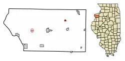
 Location of Matherville in Mercer County, Illinois. | |
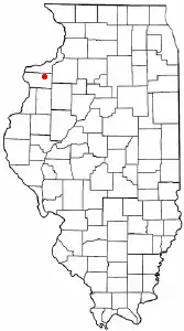
.svg.png.webp) Location of Illinois in the United States | |
| Coordinates: 41°15′37″N 90°36′21″W | |
| Country | United States |
| State | Illinois |
| County | Mercer |
| Area | |
| • Total | 0.40 sq mi (1.03 km2) |
| • Land | 0.39 sq mi (1.01 km2) |
| • Water | 0.01 sq mi (0.02 km2) |
| Population (2010) | |
| • Total | 723 |
| • Estimate (2019)[2] | 662 |
| • Density | 1,693.09/sq mi (653.68/km2) |
| Time zone | UTC-6 (CST) |
| • Summer (DST) | UTC-5 (CDT) |
| ZIP Code(s) | 61263 |
| Area code(s) | 309 |
| FIPS code | 17-47527 |
| Wikimedia Commons | Matherville, Illinois |
| Website | mathervilleil |
Geography

Matherville is located at 41°15′37″N 90°36′21″W (41.260255, -90.605874).[3]
According to the 2010 census, Matherville has a total area of 0.398 square miles (1.03 km2), of which 0.39 square miles (1.01 km2) (or 97.99%) is land and 0.008 square miles (0.02 km2) (or 2.01%) is water.[4]
Demographics
| Historical population | |||
|---|---|---|---|
| Census | Pop. | %± | |
| 1920 | 886 | — | |
| 1930 | 399 | −55.0% | |
| 1940 | 565 | 41.6% | |
| 1950 | 590 | 4.4% | |
| 1960 | 612 | 3.7% | |
| 1970 | 699 | 14.2% | |
| 1980 | 793 | 13.4% | |
| 1990 | 708 | −10.7% | |
| 2000 | 772 | 9.0% | |
| 2010 | 723 | −6.3% | |
| 2019 (est.) | 662 | [2] | −8.4% |
| U.S. Decennial Census[5] | |||
At the 2000 census there were 772 people, 290 households, and 216 families living in the village. The population density was 1,968.7 people per square mile (764.3/km2). There were 301 housing units at an average density of 767.6 per square mile (298.0/km2). The racial makeup of the village was 98.45% White, 0.26% Asian, 0.52% from other races, and 0.78% from two or more races. Hispanic or Latino of any race were 1.04%.[6] - - Of the 290 households 45.2% had children under the age of 18 living with them, 55.5% were married couples living together, 15.2% had a female householder with no husband present, and 25.5% were non-families. 21.7% of households were one person and 10.7% were one person aged 65 or older. The average household size was 2.66 and the average family size was 3.06. - - The age distribution was 32.4% under the age of 18, 7.1% from 18 to 24, 31.2% from 25 to 44, 18.3% from 45 to 64, and 11.0% 65 or older. The median age was 32 years. For every 100 females, there were 90.6 males. For every 100 females age 18 and over, there were 80.6 males. - - The median household income was $33,438 and the median family income was $39,375. Males had a median income of $37,273 versus $25,179 for females. The per capita income for the village was $14,956. About 14.1% of families and 15.8% of the population were below the poverty line, including 24.5% of those under age 18 and 4.0% of those age 65 or over.
Matherville is part of Sherrard Public Library District. Matherville is served locally by the Library District Bookmobile one day a week with a stop at the Old School Park.
References
- "2019 U.S. Gazetteer Files". United States Census Bureau. Retrieved July 14, 2020.
- "Population and Housing Unit Estimates". United States Census Bureau. May 24, 2020. Retrieved May 27, 2020.
- "US Gazetteer files: 2010, 2000, and 1990". United States Census Bureau. 2011-02-12. Retrieved 2011-04-23.
- "G001 - Geographic Identifiers - 2010 Census Summary File 1". United States Census Bureau. Archived from the original on 2020-02-13. Retrieved 2015-10-26.
- "Census of Population and Housing". Census.gov. Retrieved June 4, 2015.
- "U.S. Census website". United States Census Bureau. Retrieved 2008-01-31.