Maunu, New Zealand
Maunu is a suburb in the south west of Whangarei in Northland, New Zealand. A volcanic hill to the west is also called Maunu and has a peak 395 m above sea level. State Highway 14 runs through the suburb.[1]
Maunu | |
|---|---|
Suburb | |
| Country | New Zealand |
| Local authority | Whangarei |
| Postcode(s) | 0110 |
| Horahora | ||
| Maungatapere |
|
Raumanga |
Demographics
Maunu is split between two statistical areas in the 2018 census. Pukenui is a mostly rural area on the west of the suburb, Maunu-Horohora is mostly urban and goes east towards central Whangarei.
Pukenui
| Year | Pop. | ±% p.a. |
|---|---|---|
| 2006 | 1,302 | — |
| 2013 | 1,638 | +3.33% |
| 2018 | 2,040 | +4.49% |
| Source: [2] | ||
Pukenui, with an area of 19 square kilometres, had a population of 2,040 at the 2018 New Zealand census, an increase of 402 people (24.5%) since the 2013 census, and an increase of 738 people (56.7%) since the 2006 census. There were 735 households. There were 966 males and 1,077 females, giving a sex ratio of 0.9 males per female. Of the total population, 384 people (18.8%) were aged up to 15 years, 288 (14.1%) were 15 to 29, 966 (47.4%) were 30 to 64, and 402 (19.7%) were 65 or older. Figures may not add up to the total due to rounding.
Ethnicities were 88.5% European/Pākehā, 11.2% Māori, 1.2% Pacific peoples, 6.9% Asian, and 2.1% other ethnicities. People may identify with more than one ethnicity.
The percentage of people born overseas was 20.9, compared with 27.1% nationally.
Although some people objected to giving their religion, 47.5% had no religion, 42.8% were Christian, and 3.8% had other religions.
Of those at least 15 years old, 387 (23.4%) people had a bachelor or higher degree, and 246 (14.9%) people had no formal qualifications. The median income was $38,400. The employment status of those at least 15 was that 786 (47.5%) people were employed full-time, 300 (18.1%) were part-time, and 39 (2.4%) were unemployed.[2]
Maunu-Horohora
| Year | Pop. | ±% p.a. |
|---|---|---|
| 2006 | 2,931 | — |
| 2013 | 3,003 | +0.35% |
| 2018 | 3,276 | +1.76% |
| Source: [3] | ||
Maunu-Horahora, with an area of 4 square kilometres, had a population of 3,276 at the 2018 New Zealand census, an increase of 273 people (9.1%) since the 2013 census, and an increase of 345 people (11.8%) since the 2006 census. There were 1,206 households. There were 1,578 males and 1,701 females, giving a sex ratio of 0.93 males per female. Of the total population, 654 people (20.0%) were aged up to 15 years, 540 (16.5%) were 15 to 29, 1,329 (40.6%) were 30 to 64, and 753 (23.0%) were 65 or older. Figures may not add up to the total due to rounding.
Ethnicities were 72.8% European/Pākehā, 20.5% Māori, 2.3% Pacific peoples, 15.5% Asian, and 2.3% other ethnicities. People may identify with more than one ethnicity.
The percentage of people born overseas was 28.0, compared with 27.1% nationally.
Although some people objected to giving their religion, 42.9% had no religion, 43.1% were Christian, and 7.4% had other religions.
Of those at least 15 years old, 594 (22.7%) people had a bachelor or higher degree, and 513 (19.6%) people had no formal qualifications. The median income was $27,700. The employment status of those at least 15 was that 1,173 (44.7%) people were employed full-time, 321 (12.2%) were part-time, and 105 (4.0%) were unemployed.[3]
Education
Pompallier Catholic College is a secondary (years 7-13) school with a roll of 569 students as of March 2020.[4][5] It was founded in 1971 as a private boys' boarding school but became coeducational in 1977. In 1981 it closed the boarding facilities and became state integrated.[6]
Maunu School is a contributing primary (years 1–6) school with a roll of 324 students as of March 2020.[4][7] The school was established in 1884.[8]
Both schools are coeducational.
Amenities
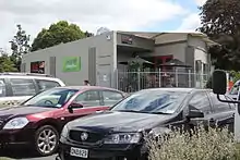
Maunu has Barge Park Showgrounds used for A&P shows and equestrian events on State Highway 14, identified by the Whangarei District Council as a priority recreation hub. Adjacent is Kiwi North; (the Whangarei Museum, Tuatara, Kiwi House and Heritage Park), incorporating the Clarke Homestead and other historical buildings (many relocated from other Whangarei sites), the Northland Observatory and various clubs and societies. Every third Sunday of the month there are train rides, and they often hold Live Days. There is also a garden centre which features Jolt café.

Located on Tui Crescent are a small block of shops. A convenience store, Chinese takeaway, hairdresser and pharmacy. There is also a cemetery located on 49 Cemetery Road. Maunu was first surveyed to be a cemetery in November 1892, Then in 1898 two hectares of land vested in to the Maunu Cemetery Trusties until January 1922 when the Whangarei Borough Council took control. There have since been more additions to the cemetery.
Notes
- Roger Smith, GeographX (2005). The Geographic Atlas of New Zealand. Robbie Burton. pp. map 24. ISBN 1-877333-20-4.
- "Statistical area 1 dataset for 2018 Census". Statistics New Zealand. March 2020. Pukenui (106300). 2018 Census place summary: Pukenui
- "Statistical area 1 dataset for 2018 Census". Statistics New Zealand. March 2020. Maunu-Horahora (106900). 2018 Census place summary: Maunu-Horahora
- "New Zealand Schools Directory". New Zealand Ministry of Education. Retrieved 26 April 2020.
- Education Counts: Pompallier Catholic College
- "Pompallier - History & Special Character". Pompallier Catholic College. Archived from the original on 2008-10-14. Retrieved 2008-04-19.
- Education Counts: Maunu School
- "Greetings - Nga mihi nui ki a koe!". Maunu School. Retrieved 2008-04-19.