Mavisdale, Virginia
Mavisdale is an unincorporated community in Buchanan County, Virginia, United States. Mavisdale is located on State Route 624 7.5 miles (12.1 km) southeast of Grundy. Mavisdale has a post office with ZIP code 24627.[2]
Mavisdale, Virginia | |
|---|---|
Unincorporated community | |
 Mavisdale, Virginia  Mavisdale, Virginia | |
| Coordinates: 37°11′54″N 82°00′28″W | |
| Country | United States |
| State | Virginia |
| County | Buchanan |
| Elevation | 1,365 ft (416 m) |
| Time zone | UTC-5 (Eastern (EST)) |
| • Summer (DST) | UTC-4 (EDT) |
| ZIP code | 24627 |
| Area code(s) | 276 |
| GNIS feature ID | 1499716[1] |
History
Mavisdale may have been first known as Maize Dale, meaning "corn valley".[3] The post office at Mavisdale was established in 1938.[4]
References
- "US Board on Geographic Names". United States Geological Survey. 2007-10-25. Retrieved 2008-01-31.
- ZIP Code Lookup
- Tennis, Joe (2004). Southwest Virginia Crossroads: An Almanac of Place Names and Places to See. The Overmountain Press. p. 3. ISBN 978-1-57072-256-1.
- "Buchanan County". Jim Forte Postal History. Retrieved 28 September 2014.
Municipalities and communities of Buchanan County, Virginia, United States | ||
|---|---|---|
| Town | 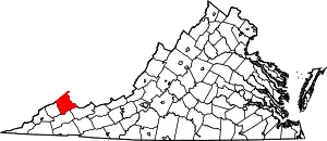 Map of Virginia highlighting Buchanan County | |
| CDP | ||
| Unincorporated communities |
| |
| Footnotes | ‡This populated place also has portions in an adjacent county or counties | |
| ||
This article is issued from Wikipedia. The text is licensed under Creative Commons - Attribution - Sharealike. Additional terms may apply for the media files.