Maybell, Colorado
Maybell is an unincorporated town, a post office, and a census-designated place (CDP) located in Moffat County, Colorado, United States. The Maybell post office has the ZIP Code 81640.[3] At the United States Census 2010, the population of the Maybell CDP was 72, while the population of the 81640 ZIP Code Tabulation Area was 249 including adjacent areas.[4] Moffat County governs the unincorporated town. The coldest ambient air temperature ever recorded in the State of Colorado was −61 °F (−52 °C) at Maybell on February 1, 1985.[5]
Maybell, Colorado | |
|---|---|
 The general store in Maybell. | |
 Location of the Maybell CDP in Moffat County, Colorado. | |
 Maybell Location of the Maybell CDP in the United States. | |
| Coordinates: 40°31′08″N 108°05′20″W[1] | |
| Country | |
| State | |
| County | Moffat County |
| Government | |
| • Type | unincorporated community |
| Area | |
| • Total | 0.518 sq mi (1.342 km2) |
| • Land | 0.518 sq mi (1.342 km2) |
| • Water | 0.000 sq mi (0.000 km2) |
| Elevation | 5,922 ft (1,805 m) |
| Population (2010) | |
| • Total | 72 |
| • Density | 139/sq mi (54/km2) |
| Time zone | UTC-7 (MST) |
| • Summer (DST) | UTC-6 (MDT) |
| ZIP Code[3] | 81640 |
| Area code(s) | 970 |
| GNIS feature[2] | Maybell CDP |
History
The village, founded in the 1880s, was named after May Bell, the wife of a local cattleman. It currently consists of a meat processing plant, general store with gas pumps, a garage, an elementary school, a residential hotel, a restaurant, a post office, and housing. The Post Office, in operation since 1884, serves the ZIP code 81640.[3]
Geography
Maybell is located in the valley of the Yampa River along U.S. Highway 40. Craig is 30 miles (48 km) east along US 40, and Dinosaur is 57 miles (92 km) to the west. State Highway 318 leads northwest from Maybell 61 miles (98 km) to the Utah border, passing Browns Park National Wildlife Refuge.
The Maybell CDP has an area of 332 acres (1.342 km2), all land.[1]
Climate
This climatic region is typified by large seasonal temperature differences, with warm to hot (and often humid) summers and cold (sometimes severely cold) winters. The climate of Maybell is a humid continental climate (Dfb).
The coldest ambient air temperature ever recorded in the State of Colorado was −61 °F (−52 °C) at Maybell on February 1, 1985.[5]
| Climate data for Maybell, Colorado | |||||||||||||
|---|---|---|---|---|---|---|---|---|---|---|---|---|---|
| Month | Jan | Feb | Mar | Apr | May | Jun | Jul | Aug | Sep | Oct | Nov | Dec | Year |
| Record high °F (°C) | 56 (13) |
66 (19) |
75 (24) |
82 (28) |
91 (33) |
96 (36) |
102 (39) |
98 (37) |
94 (34) |
87 (31) |
70 (21) |
61 (16) |
102 (39) |
| Average high °F (°C) | 32.4 (0.2) |
37.3 (2.9) |
48.0 (8.9) |
59.0 (15.0) |
69.5 (20.8) |
79.7 (26.5) |
87.1 (30.6) |
84.6 (29.2) |
74.9 (23.8) |
62.7 (17.1) |
45.9 (7.7) |
34.1 (1.2) |
59.6 (15.3) |
| Average low °F (°C) | 1.8 (−16.8) |
7.1 (−13.8) |
17.9 (−7.8) |
25.8 (−3.4) |
33.4 (0.8) |
40.6 (4.8) |
47.1 (8.4) |
45.6 (7.6) |
36.2 (2.3) |
25.3 (−3.7) |
15.3 (−9.3) |
4.0 (−15.6) |
25.0 (−3.9) |
| Record low °F (°C) | −60 (−51) |
−61 (−52) |
−21 (−29) |
−11 (−24) |
10 (−12) |
22 (−6) |
26 (−3) |
28 (−2) |
8 (−13) |
−10 (−23) |
−26 (−32) |
−50 (−46) |
−61 (−52) |
| Average precipitation inches (mm) | 0.81 (21) |
0.85 (22) |
1.06 (27) |
1.38 (35) |
1.14 (29) |
0.96 (24) |
0.78 (20) |
0.90 (23) |
1.14 (29) |
1.20 (30) |
1.11 (28) |
0.99 (25) |
12.31 (313) |
| Average snowfall inches (cm) | 12.0 (30) |
10.2 (26) |
8.8 (22) |
4.6 (12) |
0.9 (2.3) |
0.1 (0.25) |
0.0 (0.0) |
0.0 (0.0) |
0.4 (1.0) |
1.7 (4.3) |
9.6 (24) |
12.9 (33) |
61.2 (155) |
| Source: [6][7] | |||||||||||||
Demographics
The United States Census Bureau initially defined the Maybell CDP for the United States Census 2010.
| Year | Pop. | ±% |
|---|---|---|
| 2010 | 72 | — |
| 2020 | — | |
| Source: United States Census Bureau | ||
See also
- Outline of Colorado
- State of Colorado
- Colorado cities and towns
References
- "State of Colorado Census Designated Places - BAS20 - Data as of January 1, 2020". United States Census Bureau. Retrieved December 24, 2020.
- "U.S. Board on Geographic Names: Domestic Names". United States Geological Survey. Retrieved December 24, 2020.
- "Look Up a ZIP Code". United States Postal Service. Retrieved December 24, 2020.
- "2010: DEC Summary File 1". United States Census Bureau. Retrieved December 24, 2020.
- "Record Lowest Temperatures by State" (PDF). National Climatic Data Center. 2004-01-01. Archived from the original (PDF) on 2001-11-17. Retrieved 2007-01-11.
- "MAYBELL, COLORADO (055446)". Retrieved October 3, 2018.
- "intellicast The Authority in Expert Weather". intellicast. Retrieved October 3, 2018.
External links
- Maybell, Colorado
- Maybell @ Colorado.com
- Maybell @ UncoverColorado.com
- Maybell @ Moffat County Tourism
- Maybell @ Northwest Colorado Cultural Heritage Program
- Maybell, Colorado Mining Claims And Mines
- Moffat County website
Municipalities and communities of Moffat County, Colorado, United States | ||
|---|---|---|
| City | 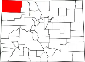 Map of Colorado highlighting Moffat County | |
| Town | ||
| CDP | ||
| Unincorporated communities |
| |
| Ghost town | ||
| ||