Maynard, Iowa
Maynard is a city in Fayette County, Iowa, United States. The population was 518 at the 2010 census.[4]
Maynard, Iowa | |
|---|---|
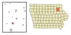 Location of Maynard, Iowa | |
| Coordinates: 42°46′28″N 91°52′42″W | |
| Country | |
| State | |
| County | Fayette |
| Area | |
| • Total | 1.02 sq mi (2.63 km2) |
| • Land | 0.99 sq mi (2.57 km2) |
| • Water | 0.03 sq mi (0.07 km2) |
| Elevation | 1,106 ft (337 m) |
| Population | |
| • Total | 518 |
| • Estimate (2019)[3] | 488 |
| • Density | 491.94/sq mi (189.94/km2) |
| Time zone | UTC-6 (Central (CST)) |
| • Summer (DST) | UTC-5 (CDT) |
| ZIP code | 50655 |
| Area code(s) | 563 |
| FIPS code | 19-50610 |
| GNIS feature ID | 0458870 |
Geography
Maynard is located at 42°46′28″N 91°52′42″W (42.774493, -91.878293)[5] on the Little Volga River.
According to the United States Census Bureau, the city has a total area of 1.02 square miles (2.64 km2), of which 0.99 square miles (2.56 km2) is land and 0.03 square miles (0.08 km2) is water.[6]
Demographics
| Year | Pop. | ±% |
|---|---|---|
| 1880 | 270 | — |
| 1890 | 371 | +37.4% |
| 1900 | 495 | +33.4% |
| 1910 | 382 | −22.8% |
| 1920 | 387 | +1.3% |
| 1930 | 409 | +5.7% |
| 1940 | 432 | +5.6% |
| 1950 | 455 | +5.3% |
| 1960 | 515 | +13.2% |
| 1970 | 503 | −2.3% |
| 1980 | 561 | +11.5% |
| 1990 | 513 | −8.6% |
| 2000 | 500 | −2.5% |
| 2010 | 518 | +3.6% |
| 2019 | 488 | −5.8% |
| Source:"U.S. Census website". United States Census Bureau. Retrieved 2020-03-29. and Iowa Data Center Source: | ||
2010 census
As of the census[2] of 2010, there were 518 people, 228 households, and 141 families living in the city. The population density was 523.2 inhabitants per square mile (202.0/km2). There were 239 housing units at an average density of 241.4 per square mile (93.2/km2). The racial makeup of the city was 98.6% White, 0.2% African American, 0.8% from other races, and 0.4% from two or more races. Hispanic or Latino of any race were 2.5% of the population.
There were 228 households, of which 29.8% had children under the age of 18 living with them, 48.2% were married couples living together, 8.3% had a female householder with no husband present, 5.3% had a male householder with no wife present, and 38.2% were non-families. 31.6% of all households were made up of individuals, and 13.2% had someone living alone who was 65 years of age or older. The average household size was 2.27 and the average family size was 2.82.
The median age in the city was 42.8 years. 24.1% of residents were under the age of 18; 7.3% were between the ages of 18 and 24; 22.1% were from 25 to 44; 29.1% were from 45 to 64; and 17.2% were 65 years of age or older. The gender makeup of the city was 50.6% male and 49.4% female.
2000 census
As of the census[8] of 2000, there were 500 people, 222 households, and 138 families living in the city. The population density was 504.2 people per square mile (195.0/km2). There were 238 housing units at an average density of 240.0 per square mile (92.8/km2). The racial makeup of the city was 100.00% White. Hispanic or Latino of any race were 0.20% of the population.
There were 222 households, out of which 29.7% had children under the age of 18 living with them, 51.4% were married couples living together, 7.7% had a female householder with no husband present, and 37.4% were non-families. 34.7% of all households were made up of individuals, and 21.6% had someone living alone who was 65 years of age or older. The average household size was 2.25 and the average family size was 2.92.
In the city, the population was spread out, with 24.0% under the age of 18, 6.6% from 18 to 24, 26.8% from 25 to 44, 20.6% from 45 to 64, and 22.0% who were 65 years of age or older. The median age was 41 years. For every 100 females, there were 106.6 males. For every 100 females age 18 and over, there were 99.0 males.
The median income for a household in the city was $32,639, and the median income for a family was $40,833. Males had a median income of $28,929 versus $26,667 for females. The per capita income for the city was $15,779. About 4.4% of families and 8.1% of the population were below the poverty line, including 8.5% of those under age 18 and 9.8% of those age 65 or over.
Education
Maynard is home to the West Central Community School District, which operates local public schools[9] and competes in the Upper Iowa Conference for athletics.
References
- "2019 U.S. Gazetteer Files". United States Census Bureau. Retrieved July 17, 2020.
- "U.S. Census website". United States Census Bureau. Retrieved 2012-05-11.
- "Population and Housing Unit Estimates". United States Census Bureau. May 24, 2020. Retrieved May 27, 2020.
- "Profile of General Population and Housing Characteristics: 2010 Demographic Profile Data (DP-1): Maynard city, Iowa". United States Census Bureau. Retrieved March 2, 2012.
- "US Gazetteer files: 2010, 2000, and 1990". United States Census Bureau. 2011-02-12. Retrieved 2011-04-23.
- "US Gazetteer files 2010". United States Census Bureau. Archived from the original on January 12, 2012. Retrieved 2012-05-11.
- "Census of Population and Housing". Census.gov. Retrieved June 4, 2015.
- "U.S. Census website". United States Census Bureau. Retrieved 2008-01-31.
- "West Central" (PDF). Iowa Department of Education. Retrieved 2020-08-27.
Municipalities and communities of Fayette County, Iowa, United States | ||
|---|---|---|
| Cities | Map of Iowa highlighting Fayette County | |
| Townships | ||
| Unincorporated communities | ||
| Footnotes | ‡This populated place also has portions in an adjacent county or counties | |
| ||