McSherrystown, Pennsylvania
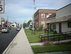
McSherrystown is a borough in Adams County, Pennsylvania, United States. The population was 3,038 as of the 2010 census.
McSherrystown, Pennsylvania | |
|---|---|
Borough | |
 McSherrystown, Pennsylvania | |
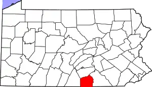
 Location in Adams County and the U.S. state of Pennsylvania. | |
 McSherrystown Location in Pennsylvania and the United States  McSherrystown McSherrystown (the United States) | |
| Coordinates: 39°48′15″N 77°01′09″W | |
| Country | United States |
| State | Pennsylvania |
| County | Adams |
| Settled | 1765 |
| Incorporated | 1882 |
| Government | |
| • Type | Borough Council |
| • Mayor | Office Vacant |
| Area | |
| • Total | 0.51 sq mi (1.33 km2) |
| • Land | 0.51 sq mi (1.33 km2) |
| • Water | 0.00 sq mi (0.00 km2) |
| Elevation | 587 ft (179 m) |
| Population (2010) | |
| • Total | 3,038 |
| • Estimate (2019)[2] | 3,090 |
| • Density | 6,035.16/sq mi (2,331.38/km2) |
| Time zone | UTC-5 (Eastern (EST)) |
| • Summer (DST) | UTC-4 (EDT) |
| Zip code | 17344 |
| Area code(s) | 717 |
| FIPS code | 42-46376 |
McSherrystown was home to the headquarters of Teddy Bear manufacturer Boyds Bears as well as the oldest operating family-run cigar manufacturer in the U.S. (since 1863), F.X. Smith & Sons. Boyds has since closed down, and in 2018, the cigar company was sold.
History
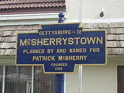
McSherrystown is the fourth oldest town in Adams County. Its founder, Patrick McSherry (1725–1795) having family origins stemming from Newry, Northern Ireland, procured a 300-acre (1.2 km2) tract from the Digges Family in 1763 and proceeded to lay out a number of 5-acre (20,000 m2) lots. The first known deed for one of these lots was dated June 27, 1765. Although McSherry may have intended his effort to be used primarily as outlots for Hanover residents, where they could keep their animals at times and obtain wood, it soon developed into a full-fledged town. McSherry, who lived in Mount Pleasant Township in 1765 and was later tavern-keeper in Littlestown, may never have lived in the town which bears his name.[3]
Geography
McSherrystown is located at 39°48′15″N 77°1′9″W (39.804202, -77.019301).[4]
According to the United States Census Bureau, the borough has a total area of 0.5 square miles (1.3 km2), all land.
Demographics
| Historical population | |||
|---|---|---|---|
| Census | Pop. | %± | |
| 1850 | 206 | — | |
| 1860 | 280 | 35.9% | |
| 1870 | 291 | 3.9% | |
| 1880 | 439 | 50.9% | |
| 1890 | 1,020 | 132.3% | |
| 1900 | 1,490 | 46.1% | |
| 1910 | 1,724 | 15.7% | |
| 1920 | 1,800 | 4.4% | |
| 1930 | 2,050 | 13.9% | |
| 1940 | 2,128 | 3.8% | |
| 1950 | 2,510 | 18.0% | |
| 1960 | 2,839 | 13.1% | |
| 1970 | 2,773 | −2.3% | |
| 1980 | 2,764 | −0.3% | |
| 1990 | 2,769 | 0.2% | |
| 2000 | 2,691 | −2.8% | |
| 2010 | 3,038 | 12.9% | |
| 2019 (est.) | 3,090 | [2] | 1.7% |
| Sources:[5][6][7] | |||
As of the census[6] of 2000, there were 2,691 people, 1,175 households, and 727 families residing in the borough. The population density was 5,138.7 people per square mile (1,998.1/km²). There were 1,231 housing units at an average density of 2,350.7 per square mile (914.0/km²). The racial makeup of the borough was 97.88% White, 0.52% African American, 0.22% Native American, 0.19% Asian, 0.04% Pacific Islander, 0.30% from other races, and 0.85% from two or more races. Hispanic or Latino of any race were 1.64% of the population.
There were 1,175 households, out of which 29.0% had children under the age of 18 living with them, 45.7% were married couples living together, 11.7% had a female householder with no husband present, and 38.1% were non-families. 32.0% of all households were made up of individuals, and 15.4% had someone living alone who was 65 years of age or older. The average household size was 2.27 and the average family size was 2.86.
In the borough the population was spread out, with 22.3% under the age of 18, 8.1% from 18 to 24, 31.0% from 25 to 44, 20.4% from 45 to 64, and 18.2% who were 65 years of age or older. The median age was 37 years. For every 100 females there were 86.6 males. For every 100 females age 18 and over, there were 82.4 males.
The median income for a household in the borough was $32,286, and the median income for a family was $40,089. Males had a median income of $33,378 versus $20,784 for females. The per capita income for the borough was $20,158. About 1.4% of families and 6.0% of the population were below the poverty line, including 3.2% of those under age 18 and 6.5% of those age 65 or over.
Government
The borough is governed by seven locally elected Council Members and an elected mayor. The borough also has an three(3)-member, locally selected Planning Committee. It is one of 13 boroughs in Adams County.[8] In December 2013, council raised residents' municipal property taxes by 16 percent to 3.6256 mills.[9] The borough's 2013 tax millage of 3.1256 included 2.7715 for the regular budget. Since 2009 the fire protection tax was 0.3541 mills.
- County level
Three, elected at large, Adams County Commissioners. In 2014, they are: Randy Phiel, Chairman; Jim Martin, Vice Chairman; and Marty Karsteter Qually.
- State level
- Dan Moul - State Representative, Pennsylvania House of Representatives, District 91
- Douglas Mastriano - State Senator, Pennsylvania Senate, District 33
- Federal level
- John Joyce, Republican, Pennsylvania's 13th congressional district
- Pat Toomey, US Senator
- Bob Casey, Jr., US Senator
Education

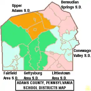
Residents of McSherrystown may attend the local, public schools operated by Conewago Valley School District which provides full day kindergarten through 12th grade. In 2013, the Conewago Valley School District's enrollment declined to 3,936 students in kindergarten through 12th grade.[10] In 2010, Conewago Valley School District enrollment was 4,024 pupils. Conewago Valley School District operates New Oxford High School (9th-12th), New Oxford Middle School (7th-8th), Conewago Valley Intermediate School (4th-6th), Conewago Township Elementary School (K-3rd) and New Oxford Elementary School (K-3rd). None of the District's schools are located in McSherrystown.
In 2013, the Pittsburgh Business Times ranked Conewago Valley School District 310th out of 498 public schools for academic achievement of its pupils.[11] In 2012, Conewago Valley School District declined to ‘’Warning’’ Adequate Yearly Progress (AYP) due to lagging student achievement in both reading and mathematics.[12]
High school aged students can attend the taxpayer funded Adams County Tech Prep[13] for training in the building trades, the culinary arts, Diesel Mechanics, allied health including Emergency medical technician (EMT) certification and other areas. The school is located on the Gettysburg Area High School campus at 1130 Old Harrisburg Road. Adams County Tech Prep is funded by a consortium of the school districts, which includes: Gettysburg Area School District, Littlestown Area School District, Fairfield Area School District, Conewago Valley School District and Bermudian Springs School District.
Delone Catholic High School is also located in McSherrystown.
McSherrystown residents may also choose between two local public charter schools: Vida Charter School and Gettysburg Montessori Charter School. In Pennsylvania, residents may attend public charter schools at no cost to the parents. The tuition is paid by their public school system. By Commonwealth law, if the public school district provides transportation for its own students, then the district must also provide transportation to any school that lies within 10 miles of its borders, as well as, all schools within its borders.[14] Tuition at Conewago Valley School District rates in 2012 were Elementary School - $8,102.21, High School - $8,514.19.[15]
McSherrystown residents may also apply to attend any of the Commonwealth's 14 public cyber charter schools (in 2013) at no additional cost to the parents. The resident’s public school district is required to pay the charter school and cyber charter school tuition for residents who attend these public schools.[16][17] By Commonwealth law, if the District provides transportation for its own students, then the District must provide transportation to any school that lies within 10 miles of its borders. Residents may also seek admission for their school aged child to any other public school district. When accepted for admission, the student's parents are responsible for paying an annual tuition fee set by the Pennsylvania Department of Education.
Lincoln Intermediate Unit #12 provides a wide variety of services to children living in its region which includes McSherrystown. Early screening, special educations services, speech and hearing therapy, autistic support, preschool classes and many other services like driver education are available. Services for children during the preschool years are provided without cost to their families when the child is determined to meet eligibility requirements. Intermediate units receive taxpayer funding: through subsidies paid by member school districts; through direct charges to users for some services; through the successful application for state and federal competitive grants and through private grants.
Community members have access to the Adams County Public Library which is located on 140 Baltimore Street in Gettysburg; the East Berlin Community Library which is located on 105 Locust Street, East Berlin; the Littlestown Library, located at 232 North Queen Street, Littlestown; the New Oxford Area Library located at 122 North Peter Street, in New Oxford; the Adams County Historical Society Library which is located on 111 Seminary Ridge, in Gettysburg; the Adams County Law Library located in the Court House, 117 Baltimore St Rm 305 in Gettysburg and to the statewide PA Power Library[18] which is an online library funded with tax dollars from the state's education budget.
At Harrisburg Area Community College Gettysburg Campus, McSherrystown borough residents have access to college courses at a discounted tuition rate for state residents. Conewago Valley School District is not a tax funding district of the College. McSherrystown residents contribute to the community college through state taxation and funding.
References
- "2019 U.S. Gazetteer Files". United States Census Bureau. Retrieved July 28, 2020.
- "Population and Housing Unit Estimates". United States Census Bureau. May 24, 2020. Retrieved May 27, 2020.
- http://www.gettysburg.com/adams200/tidbits/sept.htm
- "US Gazetteer files: 2010, 2000, and 1990". United States Census Bureau. 2011-02-12. Retrieved 2011-04-23.
- "Census of Population and Housing". U.S. Census Bureau. Retrieved 11 December 2013.
- "U.S. Census website". United States Census Bureau. Retrieved 2008-01-31.
- "Incorporated Places and Minor Civil Divisions Datasets: Subcounty Resident Population Estimates: April 1, 2010 to July 1, 2012". Population Estimates. U.S. Census Bureau. Archived from the original on 17 June 2013. Retrieved 11 December 2013.
- Adams County Administration (2014). "McSherrystown Borough".
- Melody Asper (December 13, 2013). "McSherrystown's final budget raises taxes by 16 percent". Evening Sun. Archived from the original on April 17, 2014.
- Pennsylvania Department of Education (October 4, 2013). "District Fast Facts - Conewago Valley School District".
- Pittsburgh Business Times (April 5, 2013). "Guide to Pennsylvania Schools Statewide ranking 2013".
- Pennsylvania Department of Education (September 21, 2012). "Conewago Valley School District AYP Overview 2012". Archived from the original on October 5, 2013.
- "Archived copy". Archived from the original on 2014-05-27. Retrieved 2014-02-17.CS1 maint: archived copy as title (link)
- Pennsylvania Department of Education (2013). "Pupil Transportation -Frequently Asked Questions".
- Pennsylvania Department of Education (May 2012). "Pennsylvania Public School District Tuition Rates".
- Pennsylvania Department of Education (2013). "Charter Schools".
- Pennsylvania Department of Education (2013). "What is a Charter School?".
- http://www.powerlibrary.org/
External links
- Southeast Adams Volunteer Emergency Services aka S.A.V.E.S. – McSherrystown VFD and other VFDs consolidated as of Jan. 1, 2005

