Menzelya
The Menzelya (Russian: Мензеля; Tatar: Cyrillic Минзәлә, Latin Minzälä) is a river in Tatarstan, Russian Federation, a former left-bank tributary of the river Ik, which flows into the Nizhnekamsk Reservoir. It is 159 kilometres (99 mi) long, and its drainage basin covers 2,120 square kilometres (820 sq mi).[1]
| Menzelya | |
|---|---|
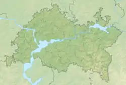 The river mouth on the map of Tatarstan | |
| Native name | Минзәлә (Tatar) |
| Location | |
| Country | Russia |
| Republic | Tatarstan |
| Physical characteristics | |
| Source | |
| • location | Novy Menzelyabash, Sarmanovsky District, Tatarstan |
| • coordinates | 55°02′13″N 52°42′39″E |
| Mouth | |
• location | Nizhnekamsk Reservoir (formerly Ik (river)) |
• coordinates | 55°41′55″N 53°05′24″E |
| Length | 159 km (99 mi) |
| Basin size | 2,120 km2 (820 sq mi) |
| Discharge | |
| • maximum | 215 m3/s (7,600 cu ft/s) (1979) |
| Basin features | |
| Progression | Nizhnekamsk Reservoir→ Kama→ Volga→ Caspian Sea |
The river's source is at the village Novy Menzelyabash, Sarmanovsky District, Tatarstan. Major tributaries are the Kholodnaya, Kamyshly, Iganya, Urguda rivers.

The maximal mineralization is 400-800 mg/l. The average sediment deposition at the river mouth per year reaches 100 millimetres (3.9 in). The maximal discharge is 215 cubic metres per second (7,600 cu ft/s). Drainage is regulated. Since 1978 it is protected as a natural monument of Tatarstan.[2]
The town of Menzelinsk is located near the river's mouth. The notable landmark of the river and the town is an abandoned railway bridge, where the railway was never installed.
References
- «Река МЕНЗЕЛЯ», Russian State Water Registry
- "Минзәлә". Tatar Encyclopaedia (in Tatar). Kazan: The Republic of Tatarstan Academy of Sciences. Institution of the Tatar Encyclopaedia. 2002.