Ik (river)
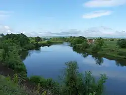
The Ik (Russian: Ик; Tatar: Ык; Bashkir: Ыҡ) is a river in Russia that flows north to the Kama. It flows through the Republics of Bashkortostan and Tatarstan and through Orenburg Oblast. The left tributaries are Mellya, Menzelya, Dymka, and the right tributary is Usen.[1] It is 571 kilometres (355 mi) long, and its drainage basin covers 18,100 square kilometres (7,000 sq mi).[2]
| Ik | |
|---|---|
 | |
| Location | |
| Country | Russia |
| Physical characteristics | |
| Source | |
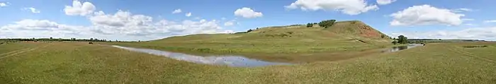
| • location | Bugulma-Belebey Hills |
| Mouth | Kama |
• location | Nizhnekamsk Reservoir |
• coordinates | 55°42′08″N 53°22′59″E |
| Length | 571 km (355 mi) |
| Basin size | 18,100 km2 (7,000 sq mi) |
| Discharge | |
| • average | 45.5 m3/s (1,610 cu ft/s) (near Nagaybakovo) |
| Basin features | |
| Progression | Kama→ Volga→ Caspian Sea |
The time difference between Bavly in Tatarstan and Oktyabrsky in Bashkortostan is two hours (Tatarstan uses Moscow Time and Bashkortostan uses Yekaterinburg Time). Therefore, the bridge through Ik (river-border) is jokingly called "the longest bridge in the world".[3]
Ik river
References
- Ик, Great Soviet Encyclopedia
- «Река Ик (Большой Ик)», Russian State Water Registry
- The longest bridge in the world.(in Russian)
The river Kama | ||
|---|---|---|
Left tributary of the Volga | ||
| Tributaries | 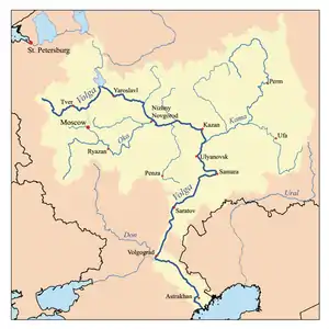 | |
| Reservoirs | ||
| Hydroelectric stations | ||
This article is issued from Wikipedia. The text is licensed under Creative Commons - Attribution - Sharealike. Additional terms may apply for the media files.
