Merrill Creek (Ontario)
Merrill Creek is a creek in the Moira River and Lake Ontario drainage basins in Hastings and Lennox and Addington Counties, Ontario, Canada.
| Merrill Creek | |
|---|---|
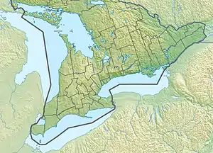 Location of the mouth of Merrill Creek in southern Ontario | |
| Location | |
| Country | Canada |
| Province | Ontario |
| Regions | |
| Counties | |
| Physical characteristics | |
| Source | Unnamed lake |
| • location | Addington Highlands, Lennox and Addington County |
| • coordinates | 44°56′56″N 77°23′45″W |
| • elevation | 368 m (1,207 ft) |
| Mouth | Partridge Creek |
• location | Tweed, Hastings County |
• coordinates | 44°53′21″N 77°25′44″W |
• elevation | 331 m (1,086 ft) |
| Basin features | |
| River system | Great Lakes Basin |
Course
Merrill Creek begins at an unnamed lake in Addington Highlands, Lennox and Addington County at an elevation of 368 metres (1,207 ft) and flows east and then south, through Todd Lakes, to reach Merrill Lake at an elevation of 338 metres (1,109 ft). It heads south into Little Merrill Lake, then southwest to Whitefish Lake. Leaving the lake, the creek passes into the Cashel portion of Tudor and Cashel, Hastings County, then Tweed, Hastings County, and flows southwest to reach its mouth at Partridge Creek at an elevation of 331 metres (1,086 ft). Partridge Creek flows via the Skootamatta River and Moira River to the Bay of Quinte on Lake Ontario at Belleville.
See also
References
- "Merrill Creek". Geographical Names Data Base. Natural Resources Canada. Retrieved 2010-03-04.
- "Toporama - Topographic Map Sheet 31C14". Atlas of Canada. Natural Resources Canada. Archived from the original on 2010-02-10. Retrieved 2010-03-04.
- "Quinte Conservation Watersheds" (PDF). Quinte Conservation. 2007. Archived from the original (PDF) on 2011-07-06. Retrieved 2010-03-04.
- "Moira River Watershed" (PDF). Quinte Conservation. Archived from the original (PDF) on 2011-07-06. Retrieved 2010-03-04.