Lennox and Addington County
Lennox and Addington County is a county and census division of the Canadian province of Ontario. The county seat is Greater Napanee. It is located in the subregion of Southern Ontario named Eastern Ontario.
Lennox and Addington County | |
|---|---|
| County of Lennox and Addington | |
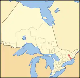 Location of Lennox and Addington County | |
| Coordinates: 44°40′N 77°10′W | |
| Country | |
| Province | |
| County seat | Greater Napanee |
| Municipalities | List
|
| Area | |
| • Land | 2,839.68 km2 (1,096.41 sq mi) |
| Population (2016)[1] | |
| • Total | 42,888 |
| • Density | 15.1/km2 (39/sq mi) |
| Time zone | UTC-5 (EST) |
| • Summer (DST) | UTC-4 (EDT) |
| Website | www.lennox-addington.on.ca/ |
Around the middle of the 19th century, the Addington Road was built by the province to encourage settlement in the northern sections of the county.
Historical evolution
The two original counties of Lennox and Addington, respectively named after Charles Lennox, 3rd Duke of Richmond and Henry Addington, 1st Viscount Sidmouth, were organized for electoral purposes in 1792,[2] and were situated within the Mecklenburg District. Mecklenburg was renamed as the "Midland District" in 1792.[3]
In 1798, the Parliament of Upper Canada passed legislation to provide, that, at the beginning of 1800:
... the townships of Ernest Town, Fredericksburg, Adolphustown, Richmond, Camden (distinguished by being called Camden East), Amherst Island and Sheffield, do constitute and form the incorporated counties of Lenox and Addington.[4]
In 1821, the newly surveyed township of Kaladar was added to the counties.[5]
In 1845, the counties regained their separate identities, but still remained united for electoral purposes.[6] The newly surveyed township of Anglesea was added to Addington at that time.
At the beginning of 1850, Midland District was abolished, and the United Counties of Frontenac, Lennox and Addington replaced it for municipal and judicial purposes.[7] In 1860, Lennox and Addington were formally amalgamated as the "County of Lennox and Addington", and declared to be the junior county in the United Counties.[8] The townships of Effingham, Abinger, Ashby and Denbigh were added to the County at the same time.[9]
Upon the dissolution of the United Counties at the beginning of 1865, the County became separate for all purposes.[10]
In the late 1990s, the County's municipalities were reorganized to form the town of Greater Napanee and the townships of Addington Highlands, Loyalist and Stone Mills.[11]
Demographics
| Year | Pop. | ±% |
|---|---|---|
| 1996 | 39,206 | — |
| 2001 | 39,461 | +0.7% |
| 2006 | 40,542 | +2.7% |
| 2011 | 41,824 | +3.2% |
| 2016 | 42,888 | +2.5% |
| [12][13][14][1] | ||
| Canada census – Lennox and Addington County community profile | |||
|---|---|---|---|
| 2016 | 2011 | 2006 | |
| Population: | 42,888 (+2.6% from 2011) | 41,824 (+3.2% from 2006) | 40,542 (+2.7% from 2001) |
| Land area: | 2,839.68 km2 (1,096.41 sq mi) | 2,841.10 km2 (1,096.95 sq mi) | 2,776.48 km2 (1,072.00 sq mi) |
| Population density: | 15.1/km2 (39/sq mi) | 14.7/km2 (38/sq mi) | 14.6/km2 (38/sq mi) |
| Median age: | 47.2 (M: 46.3, F: 48.3) | 43.3 (M: 42.8, F: 43.8) | |
| Total private dwellings: | 19,684 | 18,295 | 17,981 |
| Median household income: | $71,725 | ||
| References: 2016[15] 2011[14] 2006[16] earlier[13] | |||
Notable inhabitants
- Charles Jones, composer
- Terence Dickinson, awards-winning astronomy author and expert in astrophotography
See also
References
- "Census Profile, 2016 Census Lennox and Addington, County". Statistics Canada. Retrieved August 6, 2019.
- Proclamation of July 16, 1792
- An act for building a gaol and court house in every district within this province, and for altering the names of the said districts, S.U.C. 1792, c. 8, s. 3
- An act for the better division of this province, S.U.C. 1798, c. 5, s. 15
- An Act to repeal part of an Act passed in thirty-eighth year of His late Majesty's Reign, intituled, "An act for the better division of this province," and to make further provision for the division of the same into Counties and Districts, S.U.C. 1821, c. 3, s. 5
- An Act for better defining the limits of the Counties and Districts in Upper Canada, for erecting certain new Townships, for detaching Townships from some Counties and attaching them to others, and for other purposes relative to the division of Upper Canada into Townships, Counties and Districts, S.Prov.C. 1845, c. 7, Sch. B
- An Act for abolishing the Territorial Division of Upper-Canada into Districts, and for providing temporary Unions of Counties for Judicial and other purposes, and for the future dissolutions of such Unions, as the increase of wealth and population may require, S.Prov.C. 1849, c. 78, Sch. A, B
- An Act to amend "An Act respecting the Territorial Division of Upper Canada", S.Prov.C. 1860, c. 39, s. 1
- 1860 Act, s. 3
- "Proclamation". Canada Gazette. 40 (23): 2846–2847. October 1, 1864.
- Restructured municipalities - Ontario map #5 (Map). Restructuring Maps of Ontario. Ontario Ministry of Municipal Affairs and Housing. 2006.
- Statistics Canada: 1996, 2001, 2006, 2011
- "2001 Community Profiles". 2001 Canadian Census. Statistics Canada. February 17, 2012.
- "2011 Community Profiles". 2011 Canadian Census. Statistics Canada. July 5, 2013. Retrieved 2012-03-15.
- "2016 Community Profiles". 2016 Canadian Census. Statistics Canada. February 21, 2017. Retrieved 2019-08-06.
- "2006 Community Profiles". 2006 Canadian Census. Statistics Canada. March 30, 2011. Retrieved 2012-03-15.
External links
| Wikimedia Commons has media related to Lennox and Addington County. |
Places adjacent to Lennox and Addington County | ||||||||||
|---|---|---|---|---|---|---|---|---|---|---|
| ||||||||||
| Regions | |
|---|---|
| Counties | |
| Districts | |
| Regional municipalities | |
| Single-tier municipalities | |
| Separated municipalities | |
| |