Merweville
Merweville is a town located in Beaufort West Municipality, Western Cape.
Merweville | |
|---|---|
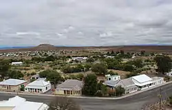
 View of Merweville | |
 Merweville  Merweville | |
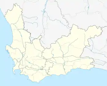
| Coordinates: 32°40′S 21°31′E | |
| Country | South Africa |
| Province | Western Cape |
| District | Central Karoo |
| Municipality | Beaufort West |
| Area | |
| • Total | 32.59 km2 (12.58 sq mi) |
| Population (2011)[1] | |
| • Total | 1,592 |
| • Density | 49/km2 (130/sq mi) |
| Racial makeup (2011) | |
| • Black African | 9.3% |
| • Coloured | 78.1% |
| • Indian/Asian | 2.6% |
| • White | 8.9% |
| • Other | 1.1% |
| First languages (2011) | |
| • Afrikaans | 95.0% |
| • Zulu | 1.4% |
| • Other | 3.6% |
| Time zone | UTC+2 (SAST) |
| PO box | 6940 |
| Area code | 023 |
Village 45 km north-west of Prince Albert Road and 130 km south-east of Beaufort West. It was established on the farm Vanderbylskraal in 1904 and administered by a village management board from 1921. Named after the Reverend P van der Merwe (1860-1940), minister at Beaufort West of the Dutch Reformed Church, and chairman of the church council which established the town.[2]
The town is an isolated community that maintains an old-world charm, about 150 km from Beaufort West. The surrounding region has been likened to that of Nevada or Arizona. It was one of the few towns or villages in the province not to be serviced by a sealed highway until the 40 km stretch of gravel road from the N1 was tarred in 2015.
One of the few remaining towns that still retains the old type laid back livestyle of days gone by - see Merweville for more information.
References
- "Main Place Merweville". Census 2011.
- "Dictionary of Southern African Place Names (Public Domain)". Human Science Research Council. p. 306.
External links
![]() Media related to Merweville at Wikimedia Commons
Media related to Merweville at Wikimedia Commons
Merweville Town Website www.merweville.co.za
.svg.png.webp)
