Meteosat 8
Meteosat 8 is a weather satellite, also known as MSG 1. The Meteosat series are operated by EUMETSAT under the Meteosat Transition Programme (MTP) and the Meteosat Second Generation (MSG) program. Notable for imaging the first meteor to be predicted to strike the earth, 2008 TC3.[1] Launched 28 Aug 2002 by an Ariane V155, this European Meteorology satellite is in a Geostationary orbit.
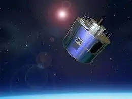 Artist's view of a Second Generation Meteosat (MSG) | |
| Mission type | Weather satellite |
|---|---|
| Operator | EUMETSAT/ESA |
| COSPAR ID | 2002-040B |
| SATCAT no. | 27509 |
| Mission duration | ≥ 14 years |
| Spacecraft properties | |
| Spacecraft type | MSG |
| Manufacturer | Alcatel Space |
| Launch mass | 2,040 kilograms (4,500 lb) |
| Power | 600 watts |
| Start of mission | |
| Launch date | 28 August 2002, 22:45:00 UTC |
| Rocket | Ariane 5G V155 |
| Launch site | Kourou ELA-3 |
| Orbital parameters | |
| Reference system | Geocentric |
| Regime | Geostationary |
| Longitude | 3.4° West (2004-2008) 9.5° East (2008-2013) 3.5° East (2013-2016) 41.5° East (2016-) |
| Period | 24 hours |
| Instruments | |
| DCS (Data Collection Service) GEOS&R (Geostationary Search and Rescue) GERB (Geostationary Earth Radiation Budget) SEVIRI (Spinning Enhanced Visible Infra-Red Imager) | |
While Meteosat 8 meteorological instruments are working OK, its solid state power amplifier SSPA-C failed in October 2002.
On 22 May 2007, the satellite experienced an unexpected orbit change. This was initially inappropriately assessed as being hit by an unknown object, but that was later assessed as not credible.[2] The thermal protection was damaged at the same time as the orbit change. Subsequent investigation assessed the Meteosat-8 spinning spacecraft's orbit change due to the mass release of thermal covering whose attachment failed. Meteosat-8 is still operating, and as of April 2013 is providing a backup capability to the Meteosat-10 primary 0-degree Full Earth Scan Service and also a backup to the Meteosat-9 Rapid Scan Service over Europe.
In May 2012 Meteosat-8 switched to operating in an Earth Sensor Mode due to a problem with the sun sensor data on board. After modifying the ground image processing system the Rapid Scan Service image quality was restored back to nominal.[3]
On 29 June 2016, EUMETSAT approved the proposal of relocating Meteosat-8 to 41.5°E, for the continuation of the Indian Ocean Data Coverage (IODC), replacing Meteosat-7.[4] Meteosat-8 arrived at 41.5°E on 21 September. The distribution of IODC Meteosat-8 data, in parallel to Meteosat-7 data, started on 20 October.[5] On 1 February 2017, Meteosat-8 replaced Meteosat-7 as the official EUMETSAT geostationary satellite for the Indian Ocean.[6][7][8]
Meteosat-8 is expected to run out of fuel sometime in 2020[9] and it's availability lifetime will end in 2022.[10]
References
- "ASTEROID IMPACT". SpaceWeather.com. 2008-10-08. Retrieved 2008-10-08.
- "Meteosat-8 [MSG-1]". EUMETSAT. 9 July 2007. Retrieved 2008-10-08.
- "Sun Sensor Anomaly". EUMETSAT. 24 May 2012. Retrieved 2012-05-24.
- "EUMETSAT Approves New Strategy and Move of Meteosat-8 Over the Indian Ocean". EUMETSAT. 29 June 2016. Retrieved 30 June 2016.
- https://www.ecmwf.int/sites/default/files/elibrary/2018/17915-indian-ocean-amvs-moving-meteosat-8-and-assessing-alternative-options.pdf
- "Following a decision of the EUMETSAT Council in June 2016, Meteosat-8 replaced Meteosat-7 as the EUMETSAT geostationary satellite observing the Indian Ocean today". EUMETSAT. 2017-02-01. Retrieved 2020-03-03.
- "The distribution of IODC Meteosat-8 data, in parallel to Meteosat-7 data, is planned to start in October". EUMETSAT. 7 July 2016. Retrieved 11 July 2016.
- https://phys.org/news/2017-04-satellites-die.html
- https://spacenews.com/noaa-weather-satellite-transferred-to-u-s-air-force/
- "Meteosat Second Generation (MSG) provides images of the full Earth disc, and data for weather forecasts". Archived from the original on 30 August 2020. Retrieved 19 October 2020.
