Meygal
The Meygal (in occitan Maigal) is a French mountain region, in the Massif Central, Haute-Loire (Auvergne-Rhône-Alpes).
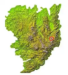
Location of the Meygal mountain on the Massif Central map
Description
It forms the core of the Velay. The highest point is the Testavoyre (1436 m, 4590 feet).[1][2] The Maygal is a series of jagged peaks covered by lava flow almost 500 feet thick and 37 miles long. The Loire River traverses the region, and its flow has created gorges more than 1600 feet deep.[3]
References
- "Le Testavoyre (1436m), massif du Meygal". altituderando.com. Retrieved 17 January 2017.
- Auvergne, Atlas des Paysages d’Auvergne - DREAL (23 June 2013). "1.11 Meygal". auvergne.gouv.fr. Retrieved 17 January 2017.
- Baynes, Thomas Spencer, ed. Loire, Haute, in The Encyclopaedia Britannica: a dictionary of arts, sciences, and general literature. Vol. 14. JM Stoddart, 1878. p817
This article is issued from Wikipedia. The text is licensed under Creative Commons - Attribution - Sharealike. Additional terms may apply for the media files.
