Middleburg Heights, Ohio
Middleburg Heights is a city and a suburb of Cleveland in Cuyahoga County, Ohio, United States. The population held steady at approximately sixteen thousand throughout the first two decades of the twenty-first century.
Middleburg Heights | |
|---|---|
 | |
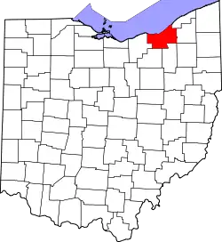
 Location in Cuyahoga County and the state of Ohio. | |
.svg.png.webp) Location of Ohio in the United States | |
| Coordinates: 41°22′0″N 81°48′32″W | |
| Country | United States |
| State | Ohio |
| County | Cuyahoga |
| Village | 1928 |
| City | 1961 |
| Government | |
| • Type | Mayor & Council |
| • Mayor | Matthew Castelli |
| Area | |
| • Total | 8.07 sq mi (20.91 km2) |
| • Land | 8.06 sq mi (20.88 km2) |
| • Water | 0.01 sq mi (0.03 km2) |
| Elevation | 850 ft (259 m) |
| Population | |
| • Total | 15,946 |
| • Estimate (2019)[4] | 15,432 |
| • Density | 1,913.93/sq mi (738.98/km2) |
| Time zone | UTC-5 (Eastern (EST)) |
| • Summer (DST) | UTC-4 (EDT) |
| ZIP code | 44130 |
| Area code(s) | 440 216 |
| FIPS code | 39-49644 |
| GNIS feature ID | 1048974[2] |
| Website | http://www.middleburgheights.com |
Government
Middleburg Heights has a mayor and council form of government.[5] The mayor is a non-voting member of the city council.[6]
Matthew Castelli became mayor on 8 January 2019[7] filling the vacancy created when Gary Starr resigned. Starr announced his resignation on 27 November 2018 after having served in that position for 37 years.[8]
History
Middleburg Heights is part of the historic Connecticut Western Reserve, which the State of Connecticut "Reserved" for their own purposes when in 1786 Connecticut relinquished claim to some of its western lands and ceded them to the new Federal Government. The first European settlers to the area that became Middleburg Township were Jared Hickcox and his family.[9] They were originally from Waterbury, Connecticut.[10]
The Village of Middleburg Heights was established in 1928.[11]
According to the United States Census Bureau, the city has a total area of 8.08 square miles (20.93 km2), of which 8.07 square miles (20.90 km2) is land and 0.01 square miles (0.03 km2) is water.[12]
Geography
Middleburg Heights is located in the southwesterly portion of the Cleveland metropolitan area along US Route 42 approximately 11 miles (18 km) southwest of downtown Cleveland at 41°22′0″N 81°48′32″W (41.366725, -81.808893).[13]
Places adjacent to Middleburg Heights, Ohio | ||||||||||
|---|---|---|---|---|---|---|---|---|---|---|
| ||||||||||
Demographics
| Historical population | |||
|---|---|---|---|
| Census | Pop. | %± | |
| 1930 | 874 | — | |
| 1940 | 1,225 | 40.2% | |
| 1950 | 3,299 | 169.3% | |
| 1960 | 7,282 | 120.7% | |
| 1970 | 12,367 | 69.8% | |
| 1980 | 16,228 | 31.2% | |
| 1990 | 14,702 | −9.4% | |
| 2000 | 15,542 | 5.7% | |
| 2010 | 15,946 | 2.6% | |
| 2019 (est.) | 15,432 | [4] | −3.2% |
| Sources:[14][15][16][17] | |||
2010 census
At the 2010 census,[3] there were 15,946 people, 7,114 households and 4,234 families living in the city. The population density was 1,976.0 inhabitants per square mile (762.9/km2). There were 7,586 housing units at an average density of 940.0 per square mile (362.9/km2). The racial makeup of the city was 91.1% White, 1.6% African American, 0.2% Native American, 5.6% Asian, 0.6% from other races, and 0.9% from two or more races. Hispanic or Latino of any race were 2.2% of the population.
There were 7,114 households, of which 22.8% had children under the age of 18 living with them, 46.6% were married couples living together, 9.4% had a female householder with no husband present, 3.5% had a male householder with no wife present, and 40.5% were non-families. 35.3% of all households were made up of individuals, and 13.9% had someone living alone who was 65 years of age or older. The average household size was 2.18 and the average family size was 2.84.
The median age was 46.6 years. 17.5% of residents were under the age of 18; 6.7% were between the ages of 18 and 24; 23.5% were from 25 to 44; 29.2% were from 45 to 64; and 23.1% were 65 years of age or older. The gender makeup of the city was 47.3% male and 52.7% female.
2000 census
At the 2000 census, there were 15,542 people, 6,705 households and 4,257 families living in the city. The population density was 1,924.8 per square mile (743.6/km2). There were 7,094 housing units at an average density of 878.6 per square mile (339.4/km2). The racial makeup of the city was 94.63% White, 1.33% African American, 0.15% Native American, 2.26% Asian, 0.07% Pacific Islander, 0.28% from other races, and 1.28% from two or more races. Hispanic or Latino of any race were 1.27% of the population.
There were 6,705 households, of which 21.4% had children under the age of 18 living with them, 52.0% were married couples living together, 8.2% had a female householder with no husband present, and 36.5% were non-families. 31.8% of all households were made up of individuals, and 11.8% had someone living alone who was 65 years of age or older. The average household size was 2.25 and the average family size was 2.84.
17.7% of the population were under the age of 18, 7.3% from 18 to 24, 27.7% from 25 to 44, 25.7% from 45 to 64, and 21.7% who were 65 years of age or older. The median age was 43 years. For every 100 females, there were 90.1 males. For every 100 females age 18 and over, there were 87.9 males.
The median household income was $47,893 and the median family income was $60,015. Males had a median income of $44,707 compared with $28,608 for females. The per capita income was $25,201. About 2.0% of families and 3.0% of the population were below the poverty line, including 2.2% of those under age 18 and 2.6% of those age 65 or over.

References
- "2019 U.S. Gazetteer Files". United States Census Bureau. Retrieved July 28, 2020.
- "US Board on Geographic Names". United States Geological Survey. 2007-10-25. Retrieved 2008-01-31.
- "U.S. Census website". United States Census Bureau. Retrieved 2013-01-06.
- "Population and Housing Unit Estimates". Retrieved May 21, 2020.
- "Middleburg Heights Government". Middleburg Heights, Ohio. Retrieved 26 February 2019.
- "Middleburg Heights Mayor". Middleburg Heights, Ohio. Retrieved 26 February 2019.
- "Mayor Castelli Oath of Office". Advance Local Media LLC. Retrieved 26 February 2019.
- "Middleburg Heights Mayor Resigns". Advance Local Media LLC. Retrieved 26 February 2019.
- "The Pioneers Hickcox Family". Middleburg Heights, Ohio. Retrieved 26 February 2019.
- "The Pioneers - Hickcox of Waterbury, Connecticut". Middleburg Heights, Ohio. Retrieved 26 February 2019.
- "History of Middleburg Heights". Middleburg Heights, Ohio. Retrieved 26 February 2019.
- "US Gazetteer files 2010". United States Census Bureau. Archived from the original on 2012-01-25. Retrieved 2013-01-06.
- "US Gazetteer files: 2010, 2000, and 1990". United States Census Bureau. 2011-02-12. Retrieved 2011-04-23.
- "Population: Ohio" (PDF). 1930 US Census. U.S. Census Bureau. Retrieved 28 November 2013.
- "Number of Inhabitants: Ohio" (PDF). 18th Census of the United States. U.S. Census Bureau. 1960. Retrieved 17 May 2020.
- "Ohio: Population and Housing Unit Counts" (PDF). U.S. Census Bureau. Retrieved 22 November 2013.
- "U.S. Census website". United States Census Bureau. Retrieved 2008-01-31.
External links
| Wikimedia Commons has media related to Middleburg Heights, Ohio. |
- Official website
- Middleburg Heights and Middleburg Township from The Encyclopedia of Cleveland History
Municipalities and communities of Cuyahoga County, Ohio, United States | ||
|---|---|---|
| Cities |
|  Map of Ohio highlighting Cuyahoga County |
| Villages | ||
| Townships | ||
| Footnotes | ‡This populated place also has portions in an adjacent county or counties | |
| ||
| Authority control |
|---|