Milford, Kansas
Milford is a city in Geary County, Kansas, United States. As of the 2010 census, the city population was 530.[5]
Milford, Kansas | |
|---|---|
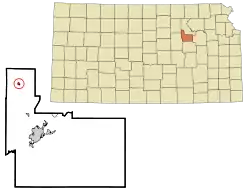 Location within Geary County and Kansas | |
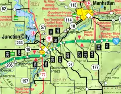 KDOT map of Geary County (legend) | |
| Coordinates: 39°10′24″N 96°54′42″W | |
| Country | United States |
| State | Kansas |
| County | Geary |
| Area | |
| • Total | 0.57 sq mi (1.48 km2) |
| • Land | 0.57 sq mi (1.48 km2) |
| • Water | 0.00 sq mi (0.00 km2) |
| Elevation | 1,158 ft (353 m) |
| Population | |
| • Total | 530 |
| • Estimate (2019)[3] | 511 |
| • Density | 893.36/sq mi (345.10/km2) |
| Time zone | UTC-6 (CST) |
| • Summer (DST) | UTC-5 (CDT) |
| ZIP code | 66514 |
| Area code | 785 |
| FIPS code | 20-46525 |
| GNIS ID | 0476335 [4] |
History
Milford was originally called Bachelder, and under the latter name was laid out in 1855.[6] Milford contained a lumber mill in its early days.[7]
Geography
Milford is located at 39°10′24″N 96°54′42″W (39.173454, -96.911650).[8] According to the United States Census Bureau, the city has a total area of 0.59 square miles (1.53 km2), all of it land.[9]
Climate
The climate in this area is characterized by hot, humid summers and generally mild to cool winters. According to the Köppen Climate Classification system, Milford has a humid subtropical climate, abbreviated "Cfa" on climate maps.[10]
Demographics
| Historical population | |||
|---|---|---|---|
| Census | Pop. | %± | |
| 1930 | 300 | — | |
| 1940 | 271 | −9.7% | |
| 1950 | 284 | 4.8% | |
| 1960 | 318 | 12.0% | |
| 1970 | 296 | −6.9% | |
| 1980 | 465 | 57.1% | |
| 1990 | 384 | −17.4% | |
| 2000 | 502 | 30.7% | |
| 2010 | 530 | 5.6% | |
| 2019 (est.) | 511 | [3] | −3.6% |
| U.S. Decennial Census[11] 2018 Estimate[12] | |||
Milford is part of the Manhattan, Kansas Metropolitan Statistical Area.
2010 census
As of the census[2] of 2010, there were 530 people, 203 households, and 133 families residing in the city. The population density was 898.3 inhabitants per square mile (346.8/km2). There were 272 housing units at an average density of 461.0 per square mile (178.0/km2). The racial makeup of the city was 83.4% White, 5.7% African American, 0.4% Native American, 0.9% Asian, 0.2% Pacific Islander, 1.3% from other races, and 8.1% from two or more races. Hispanic or Latino of any race were 5.7% of the population.
There were 203 households, of which 36.0% had children under the age of 18 living with them, 54.7% were married couples living together, 8.9% had a female householder with no husband present, 2.0% had a male householder with no wife present, and 34.5% were non-families. 25.1% of all households were made up of individuals, and 4% had someone living alone who was 65 years of age or older. The average household size was 2.61 and the average family size was 3.18.
The median age in the city was 32.8 years. 25.8% of residents were under the age of 18; 11.9% were between the ages of 18 and 24; 30.4% were from 25 to 44; 22.7% were from 45 to 64; and 9.2% were 65 years of age or older. The gender makeup of the city was 54.2% male and 45.8% female.
2000 census
As of the census of 2000, there were 502 people, 183 households, and 133 families residing in the city. The population density was 3,217.2 people per square mile (1,211.4/km2). There were 245 housing units at an average density of 1,570.1 per square mile (591.2/km2). The racial makeup of the city was 84.66% White, 3.19% African American, 0.40% Native American, 0.80% Asian, 1.00% Pacific Islander, 3.59% from other races, and 6.37% from two or more races. Hispanic or Latino of any race were 6.37% of the population.
There were 183 households, out of which 41.5% had children under the age of 18 living with them, 63.4% were married couples living together, 6.6% had a female householder with no husband present, and 26.8% were non-families. 22.4% of all households were made up of individuals, and 6.0% had someone living alone who was 65 years of age or older. The average household size was 2.74 and the average family size was 3.27.
In the city, the population was spread out, with 34.1% under the age of 18, 11.6% from 18 to 24, 32.7% from 25 to 44, 15.9% from 45 to 64, and 5.8% who were 65 years of age or older. The median age was 28 years. For every 100 females, there were 110.0 males. For every 100 females age 18 and over, there were 110.8 males.
The median income for a household in the city was $33,750, and the median income for a family was $40,000. Males had a median income of $29,583 versus $16,250 for females. The per capita income for the city was $14,246. About 10.3% of families and 8.1% of the population were below the poverty line, including 7.7% of those under age 18 and 8.8% of those age 65 or over.
Education
The community is served by Geary County USD 475 public school district.[13]
Milford High School was closed through school unification. The Milford High School mascot was the Panthers.[14]
Parks and recreation
Notable people
- John R. Brinkley, controversial medical doctor, advertising and radio pioneer
- Henry D. Linscott, veteran of both World Wars, later lieutenant general in the Marine Corps
References
- "2019 U.S. Gazetteer Files". United States Census Bureau. Retrieved July 24, 2020.
- "U.S. Census website". United States Census Bureau. Retrieved 2012-07-06.
- "Population and Housing Unit Estimates". United States Census Bureau. May 24, 2020. Retrieved May 27, 2020.
- "US Board on Geographic Names". United States Geological Survey. 2007-10-25. Retrieved 2008-01-31.
- "2010 City Population and Housing Occupancy Status". U.S. Census Bureau. Retrieved November 8, 2011.
- Blackmar, Frank Wilson (1912). Kansas: A Cyclopedia of State History, Volume 2. Standard Publishing Company. p. 280.
- Capace, Nancy (2000). Encyclopedia of Kansas. Somerset Publishers. p. 236.
- "US Gazetteer files: 2010, 2000, and 1990". United States Census Bureau. 2011-02-12. Retrieved 2011-04-23.
- "US Gazetteer files 2010". United States Census Bureau. Archived from the original on 2012-07-02. Retrieved 2012-07-06.
- Climate Summary for Milford, Kansas
- United States Census Bureau. "Census of Population and Housing". Retrieved January 2, 2014.
- "Population Estimates". United States Census Bureau. Retrieved June 8, 2018.
- "USD 475 Geary County Schools". USD 475. Archived from the original on 24 August 2017. Retrieved 10 January 2017.
- "Milford Rural High School". E-YEARBOOK.COM. Retrieved 10 January 2017.
Further reading
External links
Municipalities and communities of Geary County, Kansas, United States | ||
|---|---|---|
| Cities | 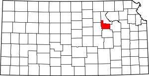 Map of Kansas highlighting Geary County | |
| Unincorporated communities | ||
| Ghost towns | ||
| Townships | ||
| Footnotes | †This populated place is designated a Census-Designated Place (CDP) by the United States Census Bureau, ‡This populated place also has portions in an adjacent county or counties. | |
| ||