Minnesota State Highway 102
Minnesota State Highway 102 (MN 102) is a 19.297-mile-long (31.056 km) highway in northwest Minnesota, which runs from its intersection with State Highway 32 outside Fertile and continues northwest to its northern terminus at its intersection with State Highway 9 (one mile south of U.S. Highway 2) near the city of Crookston.
| ||||
|---|---|---|---|---|
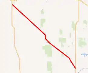
MN 102 highlighted in red | ||||
| Route information | ||||
| Defined by MS § 161.115(109) | ||||
| Maintained by MnDOT | ||||
| Length | 19.297 mi[1] (31.056 km) | |||
| Existed | April 22, 1933[2]–present | |||
| Major junctions | ||||
| South end | ||||
| North end | ||||
| Location | ||||
| Counties | Polk | |||
| Highway system | ||||
| ||||

Highway 102 passes through the communities of Garfield Township, Onstad Township, Kertsonville Township, and Fairfax Township.
Route description
State Highway 102 serves as a northwest–southeast route in northwest Minnesota between the cities of Fertile and Crookston.
Highway 102 is located in the Red River Valley region of Minnesota.
The route is legally defined as Route 178 in the Minnesota Statutes.[3] It is not marked with this number.
Major intersections
The entire route is in Polk County.
| Location | mi[1] | km | Destinations | Notes | |
|---|---|---|---|---|---|
| Garfield Township | 0.000 | 0.000 | Southern terminus | ||
| Onstad Township | 6.395 | 10.292 | Eastern end of CSAH 41 concurrency | ||
| 7.217 | 11.615 | Western end of CSAH 41 concurrency | |||
| Kertsonville Township | 12.562 | 20.217 | |||
| Fairfax Township | 14.925 | 24.019 | |||
| 19.320 | 31.093 | Northern terminus; roadway continues as MN 9 north | |||
| 1.000 mi = 1.609 km; 1.000 km = 0.621 mi | |||||
References
- "Trunk Highway Log Point Listing - Construction District 2" (PDF). Minnesota Department of Transportation. August 23, 2010. Archived from the original (PDF) on December 4, 2008. Retrieved November 16, 2010.
- "Chapter 440-H.F. No. 2000", Session Laws of Minnesota for 1933, Mike Holm, Secretary of State, pp. 881–897
- "161.115, Additional Trunk Highways". Minnesota Statutes. Office of the Revisor of Statutes, State of Minnesota. 2010. Retrieved November 16, 2010.
- Official Road Map of Minnesota (Map). Minnesota Department of Highways. January 1, 1949. § B7-C7. Archived from the original on July 21, 2011. Retrieved November 16, 2010.
- Minnesota 1950 Official Highway Map (Map). Minnesota Department of Highways. January 1, 1950. § B7-C7. Archived from the original on July 21, 2011. Retrieved November 16, 2010.
