Minnesota State Highway 226
Minnesota State Highway 226 (MN 226) is a short 1.494-mile-long (2.404 km) highway in north-central Minnesota, which runs from its intersection with State Highway 34 in Henrietta Township (east of Park Rapids) and continues north to its northern terminus at Dorset. The route becomes Hubbard County Road 7 at Dorset.
| ||||
|---|---|---|---|---|
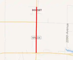
MN 226 highlighted in red | ||||
| Route information | ||||
| Defined by MS § 161.115(157) | ||||
| Maintained by MnDOT | ||||
| Length | 1.494 mi[1] (2.404 km) | |||
| Existed | July 1, 1949[2]–present | |||
| Major junctions | ||||
| South end | ||||
| North end | ||||
| Location | ||||
| Counties | Hubbard | |||
| Highway system | ||||
| ||||

Route description
Highway 226 serves as a short north–south connector route between State Highway 34 and the community of Dorset in north-central Minnesota.
The southern terminus of Highway 226 intersects State Highway 34, which is briefly four lanes to facilitate turns and two through lanes. The northern terminus of Highway 226 is approximately one-tenth of a mile north of the Heartland Trail intersection in Dorset, where the route becomes Hubbard County State-Aid Highway 7.
The route is legally defined as Route 226 in the Minnesota Statutes.[3]
History
Highway 226 was authorized on July 1, 1949.[2]
The route was paved at the time it was marked.[4]
Major intersections
The entire route is in Hubbard County.
| Location | mi[1] | km | Destinations | Notes | |
|---|---|---|---|---|---|
| Henrietta Township | 0.000 | 0.000 | |||
| 0.998 | 1.606 | ||||
| Dorset | 1.494 | 2.404 | |||
| 1.000 mi = 1.609 km; 1.000 km = 0.621 mi | |||||
References
- "Trunk Highway Log Point Listing - Construction District 2" (PDF). Minnesota Department of Transportation. August 23, 2010. Archived from the original (PDF) on December 4, 2008. Retrieved December 15, 2010.
- "Chapter 663-H.F. No. 1792", Session Laws of Minnesota for 1949, Earl L. Berg, Commissioner of Administration, pp. 1177–1185
- "161.115, Additional Trunk Highways". Minnesota Statutes. Office of the Revisor of Statutes, State of Minnesota. 2010. Retrieved December 15, 2010.
- Minnesota 1950 Official Highway Map (Map). Minnesota Department of Highways. January 1, 1950. § G10. Archived from the original on July 21, 2011. Retrieved December 12, 2010.