Missouri Route 79
Route 79 is a highway in eastern Missouri. Its northern terminus is at Interstate 72/U.S. Route 36 in downtown Hannibal; its southern terminus is at Interstate 70 in St. Peters. The route closely parallels the Mississippi River.
| ||||
|---|---|---|---|---|
| Route information | ||||
| Maintained by MoDOT | ||||
| Length | 86 mi (138 km) | |||
| Tourist routes | ||||
| Major junctions | ||||
| South end | ||||
| North end | ||||
| Highway system | ||||
| ||||

History
When Route 79 was created in about 1930, it replaced the north–south section of Route 56, which had been created in 1922 between Troy and O'Fallon. The part of Route 56 west of Winfield became an extension of Route 47.
Route 79 had major closures as a result of the Mississippi River floods of 2019 and other recent floods. Its buckling pavement in summer 2019 was attributed to hotter and more erratic climate conditions.[1]
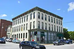
Along the route in downtown Hannibal
Major intersections
All exits are unnumbered.
| County | Location | mi[2] | km | Destinations | Notes | |||
|---|---|---|---|---|---|---|---|---|
| St. Charles | O'Fallon–St. Peters line | 0.000 | 0.000 | |||||
| 0.408 | 0.657 | Outer Road north | Interchange | |||||
| 1.125 | 1.811 | Pearl Drive, Salt River Road | Interchange | |||||
| Lincoln | Old Monroe | 11.393 | 18.335 | Interchange | ||||
| Winfield | 15.492 | 24.932 | ||||||
| Pike | Louisiana | 54.567 | 87.817 | Eastern end of US 54 overlap | ||||
| 54.817 | 88.219 | Western end of US 54 overlap | ||||||
| Ralls |
No major junctions | |||||||
| Marion | Hannibal | 87.952 | 141.545 | |||||
1.000 mi = 1.609 km; 1.000 km = 0.621 mi
| ||||||||
References
- Gray, Bryce. "Rising heat and climate extremes mean questions, challenges for roads, the power grid, and other infrastructure". St. Louis Post Dispatch. Retrieved November 13, 2019.
- Missouri Department of Transportation (December 29, 2020). MoDOT HPMAPS (Map). Missouri Department of Transportation. Retrieved December 29, 2020.
This article is issued from Wikipedia. The text is licensed under Creative Commons - Attribution - Sharealike. Additional terms may apply for the media files.