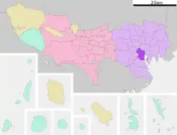
Mita, Minato, Tokyo
Mita (三田) is a district of Minato, Tokyo, Japan, located near Akabanebashi Station on the Toei Ōedo Line, Tamachi Station on the Yamanote Line, and Mita Station on the Toei Mita Line.
Mita
三田 | |
|---|---|
District | |
 | |
| Coordinates: 35°38′51″N 139°44′26″E | |
| Country | Japan |
| City | Tokyo |
| Ward | Minato |
| Area | Shiba Area (1, 2, 3-chōme) Takanawa Area (4, 5-chōme) |
| Population (January 1, 2016) | |
| • Total | 18,760 |
| Time zone | UTC+9 (JST) |
| Area code(s) | 03 |
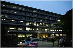
Mita is home to Keio University, Mita Hachiman Jinja, and the diplomatic missions of Kuwait, Italy, Hungary, Papua New Guinea and Australia.
Economy
The NEC Corporation well-known Japanese electronics company has been headquartered in Mita since 1899.[1] The Yazaki Group is headquartered in the Mita-Kokusai Building (三田国際ビル Mita Kokusai Biru) in Mita.[2]
Notable places in Mita
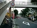
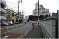
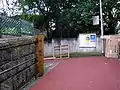
Slopes
Many roads up to the Mita plateau have named slopes of historical significance. Each is marked by a wooden post which explains the name.
Hijiri zaka 「聖坂」corresponds to the ancient Tōkaidō 「東海道」 road. As for the slope, the name changes from the top of Isarago zaka 「伊皿子坂」to the Nihon enoki dori 「二本榎通り」.
Gyoranzaka (魚藍坂) is a hill road in Mita 4-chōme. It reaches the promontory from Gyoranzaka Crossing which results from the summit in Isaragozaka.
Katsurazaka (桂坂) is a hill road which lies between Takanawa 2-chōme and 3-chōme. A long time ago, ivy and vines covered the surface of this hill, though an alternate etymology says that a Buddhist priest who wore a wig (鬘, katsura) died along this slope suddenly on a return trip from Shinagawa.
Zakurozaka (石榴坂) is a hill road which crosses between Takanawa 3-chōme and 4-chōme. The area has many hotels. The street was probably named because there was a pomegranate tree (石榴, zakuro) in the middle of a slope a long time ago.
Hebizaka (蛇坂) is a slope which is in district four of Mita. Hebi means snake.
Anzenjizaka (安全寺坂) is a hill road crossing between Mita 3-chōme and 4-chōme. The temple of Anzenji was built here in the Edo era.
Horazaka (洞坂) is a hill road in Takanawa 3-chōme. The name means "cavernous slope," in Japanese. It is alternatively called Horazaka (法螺坂) or "conch shell slope" and Borazaka (鯔坂) or "herring slope."
Hiyoshizaka (日吉坂) is a hill road which forms the border of Shirokane 2-chōme and 4-chōme. It goes from Meguro-dori in the southwest to Sakurada-dori in the northeast, and goes past the Kuwaharazaka (桑原坂) to the south. The name originates from the Noh actor Hiyoshi Kahei who lived nearby.
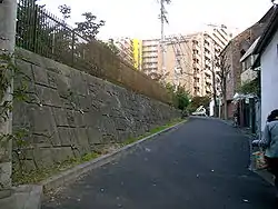
 top of Hora zaka
 Katsura zaka
 Bottom of Hiyosi zaka
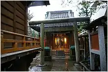
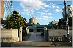
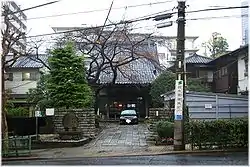
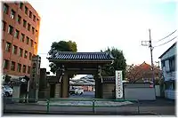
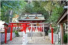
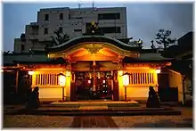
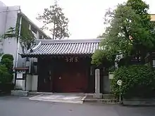
Shinto shrines and Temples
In the early stages of the Edo period, the Shōgun decided to extend Edo-Castle (江戸城) and ordered temples around there to move into here. From this reason, there were many temples on the hill, especially in the Mita (三田) named Tera machi (寺町), there were many temples. As for shrines, there are its ancestor can go back to the Asuka (飛鳥時代) or Heian (平安時代) period.
Tokyo is the city which the aspect changes to rapidly, but the scenery of here didn't change.
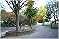
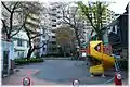
Parks
In the Edo period, the daimyō’s (大名) mansion ( most are non-Tokugawa daimyō (外様大名)) ranged on the whole hill. The mansion was sold as the mansion of the high-ranking official in the government (顕官), Kazoku (=華族nobleman), in Meiji era. At present, the vacant lot is opened to the citizen as the park. By such historic process, the Parks locate in wide area and have a fine scene.
- Mitadai Kouen 「三田台公園」
- Toyouka cho Jidou Yuuen「豊岡町児童遊園」. Its former name is Toyooka Kouen「豊岡公園」
- children's park which exists in Mita 5-11-6 Minato, Tokyo, Japan. Its former name is Toyooka kōen 「豊岡公園」.
- Area:191㎡
- Nearby station: Shirokane-takanawa 「白金高輪」 Subway station
- Although a swing, sandbox, launching platform, box type swing, and drinking fountain place existed before, but it is removed now except drinking fountain place.
Tertiary
Primary and secondary schools
- Mita Junior High School 「三田中学校」
- Mita Elementary School 「御田小学校」
- Takamatsu Junior High School 「高松中学」
- Friends School 「普連土学園」, Friends School
- Tokai University Takanawadai Junior & Senior High School
- Takanawa Junior / Senior High School
- Kindergarten Teacher Training College, Seitoku University<ref>Seitoku tanki daigaku「聖徳大学幼児教育専門学校」
聖徳大学幼児教育専門学校 Kindergarten Teacher Training College, Seitoku University
 「松坂児童公園」
Mita Matsuzaka Children's Park (Matsuzaka Jido Kōen)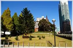
See also
- Edo Meisho Zukai「江戸名所図解」
- Hasegawa Settan「長谷川雪旦」
References
- NEC - Corporate Profile
- "Japan." Yazaki. Retrieved on June 18, 2015. "Headquarters 17th Floor, Mita-Kokusai Bldg., 4-28 Mita 1-chōme, Minato-ku, Tokyo, 108-8333 Japan" - Japanese address: "本 社 〒108-8333 東京都港区三田1-4-28 三田国際ビル17F"