Mitchell Lake (Ontario)
Mitchell Lake is a small, man-made lake in the Great Lakes Basin and located in the city of Kawartha Lakes in Central Ontario, Canada.[1][2][3][4] The lake was formed sometime in the first decade of the twentieth century alongside the construction of the Kirkfield Lift Lock, which was completed and operational by the end of 1907.[5] It is part of the summit of the Trent–Severn Waterway, the middle of a connection via canals of Balsam Lake on the Gull River system, which flows eventually to Lake Ontario, and the Kirkfield Lift Lock and Canal Lake on the Talbot River system, which flows to Lake Simcoe and eventually to Lake Huron.
| Mitchell Lake | |
|---|---|
.jpg.webp) Photo showing the two areas of the lake, separated by the Hartley Road causeway | |
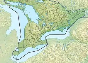 Mitchell Lake Location in Southern Ontario | |
| Location | Kawartha Lakes, Ontario |
| Coordinates | 44°34′26″N 78°57′01″W[1] |
| Type | Lake |
| Part of | Great Lakes Basin |
| Primary inflows | Trent–Severn Waterway, Grass Creek |
| Primary outflows | Trent–Severn Waterway, Grass Creek |
| Basin countries | Canada |
| Max. length | 3.3 kilometres (2.1 mi) |
| Max. width | 2.2 kilometres (1.4 mi) |
| Surface elevation | 256 metres (840 ft) |
History
Prior to flooding, the Grass River (now Grass Creek) flowed through the centre of marshland above which the current lake sits in Eldon Township, Victoria County. It entered from the south-west, reaching Fennel Road (Kawartha Lakes Road 35) where it now crosses the Trent Canal. From here it turned west and followed the same course as the modern canal to Portage Road (formerly Ontario Highway 48, today Kawartha Lakes Road 48). Passing under the road, it resumed a north-easterly course towards the village of Victoria Road, where it flowed as it continues to today, now controlled by a dam, westward into the Talbot River.[6]
Modern Mitchell Lake
Like many of the lakes of the Kawarthas, Mitchell Lake enjoys use by recreational cottagers. However, most of the lake is relatively shallow (Between 3 and 6 feet deep), swampy, and filled with partially or wholly submerged tree stumps remaining from before the flooding. As such, cottages are sparse outside of the canal zone and south eastern section of the lake. The shallow south-western section of the lake is isolated from the rest by Hartley Road, which crosses the lake by causeway, and is only navigable by canoe.
The former path of the Grass River north of Kawartha Lakes 48 is still visible beneath the shallow and undisturbed waters of the lake.[7]
See also
- List of lakes in Ontario
References
- "Mitchell Lake". Geographical Names Data Base. Natural Resources Canada. Retrieved 2012-06-01.
- "CLAIMaps IV". Ontario Ministry of Northern Development and Mines. 2016. Retrieved 2018-07-06.
- Map 5 (PDF) (Map). 1 : 700,000. Official road map of Ontario. Ministry of Transportation of Ontario. 2010-01-01. Retrieved 2018-07-06.
- Restructured municipalities - Ontario map #5 (Map). Restructuring Maps of Ontario. Ontario Ministry of Municipal Affairs and Housing. 2006. Retrieved 2018-07-06.
- "Canada's New Government celebrates the Kirkfield Lift Lock Centennial". newswire.ca. 2007-07-21. Retrieved 2008-08-26.
- "The Canadian County Atlas Digital Project". Retrieved 2009-07-27.
- Use coordinate links to view satellite photos.
External links
City of Kawartha Lakes | |||||||
|---|---|---|---|---|---|---|---|
| Towns |  | ||||||
| Villages and unincorporated communities |
| ||||||
| Former townships | |||||||
| Major lakes |
| ||||||
| Topics | |||||||
1) This area lies on the border of an adjacent region, but is part of the Kawartha Lakes census. | |||||||