Mityana
Mityana, is a town in the Central Region of Uganda. It is the main municipal, administrative, and commercial center of Mityana District, and the district headquarters are located there.[2]
Mityana
Mitiyana | |
|---|---|
 | |
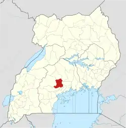
 Mityana Location in Uganda | |
| Coordinates: 00°24′02″N 32°02′32″E | |
| Country | |
| Region | Central Uganda |
| District | Mityana District |
| Area | |
| • Urban | 102 sq mi (263 km2) |
| Elevation | 3,967 ft (1,209 m) |
| Population (2020 Estimate) | |
| • City | 105,200[1] |
| • Urban density | 1,037/sq mi (400.5/km2) |
| Time zone | UTC+3 (EAST) |
Location
Mityana is approximately 70 kilometres (43 mi), by road, west of Kampala, Uganda's capital and largest city.[3] This is approximately 80.5 kilometres (50 mi), by road, east of Mubende, along the Kampala–Mityana–Mubende–Fort Portal Road. Mityana is about halfway between Kampala and Mubende, along an all-weather tarmac highway that links Uganda's capital with the city of Fort Portal in the Western Region.[4] The geographical coordinates of Mityana are 0°23'58.0"N, 32°02'36.0"E (Latitude:0.399444, Longitude:32.043333).[5] The average elevation of the town is 1,209 metres (3,967 ft) above mean sea level.[6]
Overview
As of January 2020, Mityana town covers an area of 263 square kilometres (102 sq mi).[1] The topography consists of gentle slopes with open, U-shaped valleys. The plateau landscape is advantageous to real estate developers because they do not incur many expenses for clearance of building sites. In July 2013, the town was added to the list of urban centers serviced by the National Water and Sewerage Corporation. Since then, NWSC has expanded service to other areas of Mityana District.[7]
Population
In 2002, the national census estimated the population of Mityana town to be 34,100. In 2010, the Uganda Bureau of Statistics (UBOS) estimated the population at 38,700. In 2011, UBOS estimated the mid-year population at 39,300.[8]
In August 2014, the national population census put the population of Mityana, as presently (February 2021), 95,428 people. In 2020, UBOS estimated the mid-year population of he town at 105,200. The population agency calculated the annual population growth rate of Mityana to average 1.68 percent, between 2014 and 2020.[1]
Points of interest
The following points of interest are located near or within the town limits:[5]
1. The offices of Mityana Town Council
2. Mityana Central Market
3. The headquarters of the Roman Catholic Diocese of Kiyinda–Mityana
4. Mityana General Hospital, a 120-bed public hospital administered by the Uganda Ministry of Health[9]
5. The headquarters of Kolping Mityana Women's Project, a Tier IV financial institution[10]
6. Lake Wamala, with the northern shores located approximately 4 kilometres (2 mi) southwest of downtown Mityana
7. Kampala−Mubende highway, passing through the center of town in a northwest/southeast direction
8. Mityana Secondary School, a public residential secondary school with 26 dormitories
9. William Mukasa Primary School, a mixed day and boarding primary school close to the district headquarters
10. LivingHope-Children Junior Academy, serving poor children in Buwalula, Kamuli, and Jezza
11. Mityana Modern Secondary School, a private secondary school, founded in 1994.
References
- Uganda Bureau of Statistics (14 June 2020). "The population of all Ugandan cities and towns with more than 15,000 inhabitants according to census results and latest official projections" (Cityppulation.de Quoting Uganda Bureau of Statistics). Citypopultion.de. Retrieved 1 February 2021.
- Mityana Charity Organisation (1 February 2021). "About Mityana District: The District Headquarters Are In Mityana". Mityana Charity Organisation. Retrieved 1 February 2021.
- Google (1 February 2021). "Distance between Kampala and Mityana With Map" (Map). Google Maps. Google. Retrieved 1 February 2021.
- Google (1 February 2021). "Travel Distance Between Mityana, Uganda And Mubende, Uganda" (Map). Google Maps. Google. Retrieved 1 February 2021.
- Google (1 February 2021). "Location of Mityana, Central Region, Uganda" (Map). Google Maps. Google. Retrieved 1 February 2021.
- Floodmap (1 February 2021). "Elevation of Mityana, Uganda". Floodmap.net. Retrieved 1 February 2021.
- Muhamadi Matovu (20 August 2020). "NWSC to increase water supply to over 100 villages in Nakaseke, Kiboga and Mityana". Kampala: Nile Post Uganda. Retrieved 1 February 2021.
- Uganda Bureau of Statistics (2012). "Estimated Population of Mityana In 2002, 2010 & 2011" (Archived from the original on 7 July 2014). Kampala: Uganda Bureau of Statistics. Retrieved 1 February 2021.
- C.B.R. Ibingira (May 2003). "Chronic Osteomyelitis In A Ugandan Rural Setting". East African Medical Journal: ; Vol:80, No:5. doi:10.4314/eamj.v80i5.8694. Retrieved 1 February 2021.
- Kolping Guest Houses (1 February 2021). "Kolping Guesthouse Mityana". Kolping Guesthouses Africa. Retrieved 1 February 2021.
External links
- Brief Town Profile As of 2013.
Capital: Mityana | ||
| Counties and sub-counties |
|  |
| Towns and villages |
| |
| Economy | ||
| Transport | ||
| Notable landmarks | ||
| Health | ||
| Notable people | ||
