Moei Wadi District
Moei Wadi (Thai: เมยวดี, pronounced [mɤ̄ːj wā.dīː]) is a district (amphoe) in the northern part of Roi Et Province, northeastern Thailand.
Moei Wadi
เมยวดี | |
|---|---|
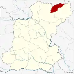 District location in Roi Et Province | |
| Coordinates: 16°23′21″N 104°9′27″E | |
| Country | Thailand |
| Province | Roi Et |
| Area | |
| • Total | 180.59 km2 (69.73 sq mi) |
| Population (2005) | |
| • Total | 22,463 |
| • Density | 124.4/km2 (322/sq mi) |
| Time zone | UTC+7 (ICT) |
| Postal code | 45250 |
| Geocode | 4515 |
Geography
Neighboring districts are (from the east clockwise): Nong Phok and Phon Thong of Roi Et Province; Kuchinarai of Kalasin Province; and Nong Sung of Mukdahan Province.
History
The minor district (king amphoe) Moei Wadi was established on 1 April 1978, when the two tambons, Moei Wadi and Chumphon, were split off from Phon Thong District.[1] It was upgraded to a full district on 3 November 1993.[2]
Administration
The district is divided into four sub-districts (tambons), which are further subdivided into 43 villages (mubans). There are no municipal (thesabans); there are four tambon administrative organizations (TAO).
| No. | Name | Thai name | Villages | Pop. | |
|---|---|---|---|---|---|
| 1. | Moei Wadi | เมยวดี | 11 | 5,609 | |
| 2. | Chumphon | ชุมพร | 14 | 7,823 | |
| 3. | Bung Loet | บุ่งเลิศ | 9 | 4,852 | |
| 4. | Chom Sa-at | ชมสะอาด | 9 | 4,179 |
References
- ประกาศกระทรวงมหาดไทย เรื่อง แบ่งท้องที่อำเภอโพนทอง จังหวัดร้อยเอ็ด ตั้งเป็นกิ่งอำเภอเมยวดี (PDF). Royal Gazette (in Thai). 95 (42 ง): 1124. April 18, 1978.
- พระราชกฤษฎีกาตั้งอำเภอลำทับ อำเภอร่องคำ อำเภอเวียงแหง อำเภอนาโยง อำเภอแก้งสนามนาง อำเภอโนนแดง อำเภอบ้านหลวง อำเภอกะพ้อ อำเภอศรีบรรพต อำเภอแก่งกระจาน อำเภอหนองสูง อำเภอสบเมย อำเภอเมยวดี อำเภอโคกเจริญ อำเภอทุ่งหัวช้าง อำเภอผาขาว อำเภอวังหิน อำเภอดอนพุด อำเภอบึงโขงหลง และอำเภอห้วยคต พ.ศ. ๒๕๓๖ (PDF). Royal Gazette (in Thai). 110 (179 ก special): 1–3. November 3, 1993.
This article is issued from Wikipedia. The text is licensed under Creative Commons - Attribution - Sharealike. Additional terms may apply for the media files.
