Moerewa
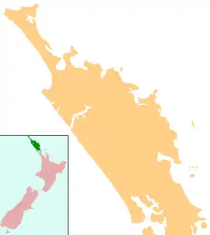
Moerewa is a small town in the Northland Region of the North Island of New Zealand. It is located close to the Bay of Islands five kilometres to the west of Kawakawa.
Moerewa | |
|---|---|
 Moerewa | |
| Coordinates: 35°23′9″S 174°1′11″E | |
| Country | New Zealand |
| Region | Northland Region |
| District | Far North District |
| Population (June 2020)[1] | |
| • Total | 1,850 |
| Postcode(s) | 0211 |
Moerewa is a service town for the surrounding farming industry. Its main industry is the freezing works. During the economic slump of the 1980s, many of the town's industries were badly affected, and unemployment soared. For this reason, the town's population has dwindled in recent years, although there are signs of an economic revival in the district.
Demographics
| Year | Pop. | ±% p.a. |
|---|---|---|
| 2006 | 1,410 | — |
| 2013 | 1,344 | −0.68% |
| 2018 | 1,632 | +3.96% |
| Source: [2] | ||
Moerewa had a population of 1,632 at the 2018 New Zealand census, an increase of 288 people (21.4%) since the 2013 census, and an increase of 222 people (15.7%) since the 2006 census. There were 432 households. There were 810 males and 822 females, giving a sex ratio of 0.99 males per female. Of the total population, 480 people (29.4%) were aged up to 15 years, 351 (21.5%) were 15 to 29, 645 (39.5%) were 30 to 64, and 159 (9.7%) were 65 or older. Figures may not add up to the total due to rounding.
Ethnicities were 22.8% European/Pākehā, 90.4% Māori, 6.6% Pacific peoples, 1.1% Asian, and 0.2% other ethnicities. People may identify with more than one ethnicity.
The percentage of people born overseas was 4.6, compared with 27.1% nationally.
Although some people objected to giving their religion, 32.0% had no religion, 42.8% were Christian, and 15.8% had other religions.
Of those at least 15 years old, 69 (6.0%) people had a bachelor or higher degree, and 366 (31.8%) people had no formal qualifications. The median income was $19,400. The employment status of those at least 15 was that 438 (38.0%) people were employed full-time, 120 (10.4%) were part-time, and 138 (12.0%) were unemployed.[2]
Marae

Moerewa has three Ngāpuhi marae:
- Horomanga Marae and meeting house are affiliated with Ngāti Hine.
- Ōtiria Marae and Tūmatauenga are affiliated with the hapū of Ngāti Hine, Ngāti Kōpaki and Ngāti Te Ara.
- Tereawatea Marae and meeting house are affiliated with Ngāti Hine.
- Te Rito Marae and meeting house are affiliated with Ngāti Hine.[3][4]
In October 2020, the Government committed $362,468 from the Provincial Growth Fund to upgrade Te Rito Marae, creating 10 jobs.[5]
Education
Moerewa School is a coeducational full primary (years 1-8) school with a roll of 135 students as of March 2020.[6][7] Moerewa School opened in 1913,[8] and merged with Otiria School at the beginning of 2005.[9]
Te Kura Kaupapa Māori o Taumarere is a coeducational composite (years 1-13) school with a roll of 165 students as of March 2020.[6][10] It is a Kura Kaupapa Māori school which teaches fully in the Māori language. The school was largely destroyed in an arson attack on 23 March 2008.[11] Prefab buildings were used to keep the school running and a new block was built in 2010. A substantial redevelopment began in 2016.[12]
Transport
Moerewa is on State Highway 1.
Moerewa was formerly served by the Opua Branch of the North Auckland Line railway. The line was originally built to link the Bay of Islands with Whangarei, and the complete route opened on 13 April 1911.[13] From December 1925 until November 1956, the Northland Express train ran through Moerewa, providing a direct service to Auckland.[14] After it ceased to run, passengers were served by mixed trains between Opua and Whangarei until 18 July 1976. In 1985, freight services ceased and the line from Moerewa to Kawakawa was dismantled.[15] The line from Otiria, the present northern terminus, to Moerewa remains in place but is disused.
References
- "Population estimate tables - NZ.Stat". Statistics New Zealand. Retrieved 22 October 2020.
- "Statistical area 1 dataset for 2018 Census". Statistics New Zealand. March 2020. Moerewa (104500). 2018 Census place summary: Moerewa
- "Te Kāhui Māngai directory". tkm.govt.nz. Te Puni Kōkiri.
- "Māori Maps". maorimaps.com. Te Potiki National Trust.
- "Marae Announcements" (Excel). growregions.govt.nz. Provincial Growth Fund. 9 October 2020.
- "New Zealand Schools Directory". New Zealand Ministry of Education. Retrieved 26 April 2020.
- Education Counts: Moerewa School
- "Moerewa School Closure/Merger". Education Gazette New Zealand. 15 November 2004.
- "Moerewa School Reunion". Education Gazette New Zealand. 2 August 2004.
- Education Counts: Te Kura Kaupapa Māori o Taumarere
- "School fire deliberately lit". The New Zealand Herald. 23 March 2008.
- Collins, Michaela (16 August 2016). "$6.9m to replace burned-out kura". Northern Advocate.
- H. J. Hansen and F. J. Neil, Tracks in the North (Auckland: H. J. Hansen, 1992), 86-88.
- J. D. Mahoney, Kings of the Iron Road: Steam Passenger Trains of New Zealand (Palmerston North: Dunmore Press, 1982), 13.
- Churchman & Hurst 2001, p. 96.
Further reading
- Churchman, Geoffrey B; Hurst, Tony (2001) [1990, 1991]. The Railways of New Zealand: A Journey through History (Second ed.). Transpress New Zealand. ISBN 0-908876-20-3.