Monfort Heights, Ohio
Monfort Heights is a census-designated place (CDP) in Green Township, Hamilton County, Ohio, United States, part of the Cincinnati–Northern Kentucky metropolitan area. The population of Monfort Heights was 11,948 at the 2010 census.[3] In previous censuses, the area was listed as two separate CDPs, Monfort Heights East and Monfort Heights South.
Monfort Heights, Ohio | |
|---|---|
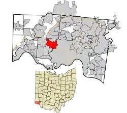 Location in Hamilton County and the state of Ohio | |
| Coordinates: 39°11′17″N 84°36′7″W | |
| Country | United States |
| State | Ohio |
| County | Hamilton |
| Area | |
| • Total | 5.9 sq mi (15.3 km2) |
| • Land | 5.9 sq mi (15.3 km2) |
| • Water | 0 sq mi (0 km2) |
| Elevation | 930 ft (280 m) |
| Population (2010) | |
| • Total | 11,948 |
| • Density | 2,000/sq mi (780/km2) |
| Time zone | UTC-5 (Eastern (EST)) |
| • Summer (DST) | UTC-4 (EDT) |
| FIPS code | 39-51212[2] |
| GNIS feature ID | 1065476[1] |
History
The community was earlier known as "Wisenburg" or "Wisenburgh"[4][5] A post office named "Monfort" was established on March 17, 1900, with Frank Lumler as its first postmaster. The office was named in honor of Civil War Captain E.R. Monfort, who was then the postmaster of Cincinnati. The office was discontinued on September 14, 1905.[6] The name almost disappeared until the late 1920s when a name was needed for a new school district after the consolidation of three area districts and the name "Monfort Heights" was selected.[4][7][8]
A 1944 study cited a population of 250 for Monfort Heights in 1920.[9]
The first Cincinnati area McDonald's was opened by Lou Groen in Monfort Heights in 1959. It is was at this restaurant that he created the iconic Filet-O-Fish sandwich to lure his Catholic customers during lent and on Fridays.[10]
Geography
Monfort Heights is located at 39°11′17″N 84°36′7″W,[11] 9 miles (14 km) northwest of downtown Cincinnati. The community "runs along North Bend Road with its heart at the intersection of West Fork and North Bend Roads."[4] Just south of this intersection is Exit 14 of Interstate 74 which runs east–west through the CDP.
According to the United States Census Bureau, the CDP has a total area of 5.9 square miles (15.3 km2), all land.[3]
Notable person
- Bonnie Lou, music and TV star
References
- "US Board on Geographic Names". United States Geological Survey. 2007-10-25. Retrieved 2008-01-31.
- "U.S. Census website". United States Census Bureau. Retrieved 2008-01-31.
- "Geographic Identifiers: 2010 Demographic Profile Data (G001): Monfort Heights CDP, Ohio". U.S. Census Bureau, American Factfinder. Archived from the original on February 12, 2020. Retrieved November 14, 2012.
- Lueders, pg. 122
- Lueders, pg. 107
- "Monfort Post Office (historical)". Geographic Names Information System. United States Geological Survey.
- Lueders, pg. 78
- "History of Green Township". Green Township. Archived from the original on 28 October 2010. Retrieved 30 October 2010.
- Miller, Zane L. (2000) [first published 1968]. Boss Cox's Cincinnati: Urban Politics in the Progressive Era (revised ed.). Ohio State University Press. p. 27. ISBN 0-8142-0861-4. Retrieved 30 October 2010.
- |url=https://www.cincinnati.com/story/news/2020/02/26/ash-wednesday-2020-wearing-ashes-marks-beginning-lent/4878518002/|
- "US Gazetteer files: 2010, 2000, and 1990". United States Census Bureau. 2011-02-12. Retrieved 2011-04-23.
Further reading
- Lueders, Jeffrey R. (October 9, 2006). Hamilton County's Green Township. Images of America. Charleston, South Carolina: Arcadia Publishing. ISBN 0-7385-4117-6. OCLC 75274706. Retrieved 30 October 2010.
Municipalities and communities of Hamilton County, Ohio, United States | ||
|---|---|---|
| Cities | 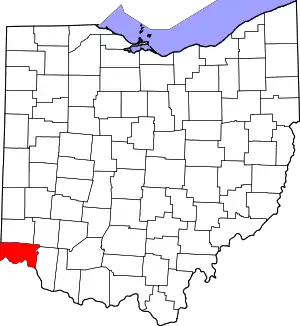 Map of Ohio highlighting Hamilton County | |
| Villages | ||
| Townships | ||
| CDPs |
| |
| Other unincorporated communities | ||
| Footnotes | ‡This populated place also has portions in an adjacent county or counties | |
| ||
| Authority control |
|
|---|