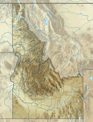
Monida Pass
Monida Pass is a high mountain pass in the Rocky Mountains of the northwestern United States, at an elevation of 6820 ft (2079 m) above sea level on the Union Pacific Railroad and 6870 ft (2094 m) on adjacent Interstate 15.
| Monida Pass | |
|---|---|
 Beaver Canyon | |
| Elevation | 6,870 ft (2,094 m) |
| Traversed by | |
| Location | Clark County, Idaho / Beaverhead County, Montana, United States |
| Range | Bitterroot Range, Rocky Mountains |
| Coordinates | 44°33′31″N 112°18′20″W |
 Monida Pass Location in Idaho, on the border with Montana | |
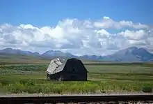
On the Continental Divide in the Bitterroot Range, it marks the transition between the Beaverhead Mountains and the Centennial Mountains. Its name is derived from the states that it separates, "Mon" from Montana and "-ida" from Idaho.[1]
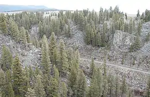
The pass forms part of the border between eastern Idaho and southwestern Montana, and is between the towns of Spencer in Clark County and Lima in Beaverhead County. On the Idaho side is Beaver Creek running through Beaver Canyon, Idaho, which was the route of the Utah and Northern Railway in 1880 and is still used by Union Pacific.[2]
on Monida Pass
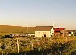
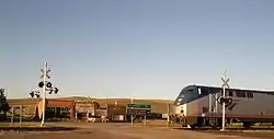
Union Pacific once had an icemaking plant at Humphrey, Idaho, which is now a ghost town; Monida, Montana, which is near the top of the pass, is also almost a ghost town, as only seven people now live there. Its elevation is 6780 ft (2067 m), 90 ft (27 m) below the pass on I-15.
In the late 19th century, stagecoaches ferried tourists from the railroad at Monida Pass to Yellowstone National Park, until UP built a branch line to the park over Reas Pass. Interstate 15, the "Veterans Memorial Highway," runs through the pass and north to the international boundary with Canada at Sweetgrass.[3]
See also
- Mountain passes in Montana
References
- UltimateMontana.com Archived 2008-05-16 at the Wayback Machine. retrieved 2008-04-24.
- Idaho Museum of Natural History - Digital Atlas of Idaho - Rocks, Rails & Trails - Part 3, History of Eastern Idaho - "The Gold Road & the Coming of the Railroads," Page 54. Retrieved 4 March 2007.
- Montana Code Annotated 2005 Archived 2007-02-16 at the Wayback Machine - 60 Archived 2007-04-09 at the Wayback Machine-1 Archived 2007-04-10 at the Wayback Machine-203. Veterans memorial highway Archived 2007-11-09 at the Wayback Machine. Retrieved 4 March 2007.
- Ferrel, Hauck, Myers (1981). Colorado Rail Annual No. 15. the Colorado Railroad Museum. US 0-918654-15-7.CS1 maint: multiple names: authors list (link)
- Idaho: A Climbing Guide - 76. Retrieved 4 March 2007.
- USDA Forest Service - Beaverhead-Deerlodge National Forest - Cultural Resources at the Wayback Machine (archived January 14, 2009) - Historic Period at the Wayback Machine (archived January 18, 2009). Retrieved 4 March 2007.
- Idaho Museum of Natural History - Digital Atlas of Idaho - "A Brief Introduction to Idaho." Retrieved 4 March 2007.
External links
- Montana Dept. of Transportation - webcam - Monida Pass
Municipalities and communities of Beaverhead County, Montana, United States | ||
|---|---|---|
| City | 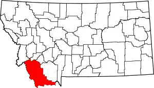 Beaverhead County map | |
| Town | ||
| CDP | ||
| Ghost towns | ||
| Unincorporated communities | ||
| ||