Montacuto
Montacuto is a comune (municipality) in the Province of Alessandria in the Italian region Piedmont, located about 120 kilometres (75 mi) southeast of Turin and about 40 kilometres (25 mi) southeast of Alessandria.
Montacuto | |
|---|---|
| Comune di Montacuto | |
Location of Montacuto 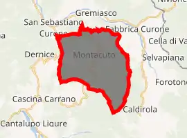
| |
 Montacuto Location of Montacuto in Italy 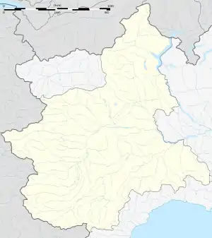 Montacuto Montacuto (Piedmont) | |
| Coordinates: 44°46′N 9°6′E | |
| Country | Italy |
| Region | Piedmont |
| Province | Alessandria (AL) |
| Government | |
| • Mayor | Giovanni Carlo Ferrari |
| Area | |
| • Total | 23.7 km2 (9.2 sq mi) |
| Elevation | 525 m (1,722 ft) |
| Population (31 October 2017)[2] | |
| • Total | 263 |
| • Density | 11/km2 (29/sq mi) |
| Demonym(s) | Monteacutesi |
| Time zone | UTC+1 (CET) |
| • Summer (DST) | UTC+2 (CEST) |
| Postal code | 15050 |
| Dialing code | 0131 |
Montacuto borders the following municipalities: Albera Ligure, Cantalupo Ligure, Dernice, Fabbrica Curone, Gremiasco, and San Sebastiano Curone.
References
- "Superficie di Comuni Province e Regioni italiane al 9 ottobre 2011". Istat. Retrieved 16 March 2019.
- All demographics and other statistics: Italian statistical institute Istat.
| Authority control |
|
|---|
This article is issued from Wikipedia. The text is licensed under Creative Commons - Attribution - Sharealike. Additional terms may apply for the media files.