Montaure
Montaure is a former commune in the Eure department in Normandy in northern France. On 1 January 2017, it was merged into the new commune Terres de Bord.[2]
Montaure | |
|---|---|
Part of Terres de Bord | |
Location of Montaure 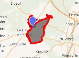
| |
 Montaure  Montaure | |
| Coordinates: 49°14′10″N 1°05′16″E | |
| Country | France |
| Region | Normandy |
| Department | Eure |
| Arrondissement | Les Andelys |
| Canton | Pont-de-l'Arche |
| Commune | Terres de Bord |
| Area 1 | 10.16 km2 (3.92 sq mi) |
| Population (2017)[1] | 1,042 |
| • Density | 100/km2 (270/sq mi) |
| Time zone | UTC+01:00 (CET) |
| • Summer (DST) | UTC+02:00 (CEST) |
| Postal code | 27400 |
| Elevation | 65–159 m (213–522 ft) (avg. 141 m or 463 ft) |
| 1 French Land Register data, which excludes lakes, ponds, glaciers > 1 km2 (0.386 sq mi or 247 acres) and river estuaries. | |
Population
| Year | Pop. | ±% |
|---|---|---|
| 1793 | 1,018 | — |
| 1800 | 1,035 | +1.7% |
| 1806 | 1,105 | +6.8% |
| 1821 | 1,275 | +15.4% |
| 1831 | 1,098 | −13.9% |
| 1836 | 1,081 | −1.5% |
| 1841 | 1,097 | +1.5% |
| 1846 | 1,120 | +2.1% |
| 1851 | 1,154 | +3.0% |
| 1856 | 1,160 | +0.5% |
| 1861 | 1,164 | +0.3% |
| 1866 | 1,203 | +3.4% |
| 1872 | 1,218 | +1.2% |
| 1876 | 1,230 | +1.0% |
| 1881 | 1,136 | −7.6% |
| 1886 | 1,137 | +0.1% |
| 1891 | 963 | −15.3% |
| 1896 | 812 | −15.7% |
| 1901 | 737 | −9.2% |
| 1906 | 642 | −12.9% |
| 1911 | 589 | −8.3% |
| 1921 | 617 | +4.8% |
| 1926 | 665 | +7.8% |
| 1931 | 628 | −5.6% |
| 1936 | 586 | −6.7% |
| 1946 | 648 | +10.6% |
| 1954 | 717 | +10.6% |
| 1962 | 698 | −2.6% |
| 1968 | 677 | −3.0% |
| 1975 | 656 | −3.1% |
| 1982 | 777 | +18.4% |
| 1990 | 990 | +27.4% |
| 1999 | 1,073 | +8.4% |
| 2008 | 996 | −7.2% |
See also
References
- Téléchargement du fichier d'ensemble des populations légales en 2017, INSEE
- Arrêté préfectoral 16 December 2016 (in French)
| Wikimedia Commons has media related to Montaure. |
| Authority control |
|
|---|
This article is issued from Wikipedia. The text is licensed under Creative Commons - Attribution - Sharealike. Additional terms may apply for the media files.