Eure
Eure (French pronunciation: [œʁ]) is a department in the north of France named after the river Eure.
Eure | |
|---|---|
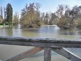 The river Eure in Neuilly | |
 Flag  Coat of arms | |
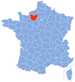 Location of Eure in France | |
| Coordinates: 49°5′N 1°0′E | |
| Country | France |
| Region | Normandy |
| Prefecture | Évreux |
| Subprefectures | Les Andelys Bernay |
| Government | |
| • President of the General Council | Jean-Louis Destans (PS) |
| Area | |
| • Total | 6,040 km2 (2,330 sq mi) |
| Population (2016) | |
| • Total | 602,825 |
| • Rank | 43rd |
| • Density | 100/km2 (260/sq mi) |
| Time zone | UTC+1 (CET) |
| • Summer (DST) | UTC+2 (CEST) |
| Department number | 27 |
| Arrondissements | 3 |
| Cantons | 23 |
| Communes | 585 |
| ^1 French Land Register data, which exclude estuaries, and lakes, ponds, and glaciers larger than 1 km2 | |
History
| Year | Pop. | ±% p.a. |
|---|---|---|
| 1791 | 385,206 | — |
| 1801 | 402,796 | +0.45% |
| 1806 | 421,344 | +0.90% |
| 1821 | 416,178 | −0.08% |
| 1831 | 424,248 | +0.19% |
| 1841 | 425,780 | +0.04% |
| 1851 | 415,777 | −0.24% |
| 1861 | 398,661 | −0.42% |
| 1872 | 377,874 | −0.49% |
| 1881 | 364,291 | −0.41% |
| 1891 | 349,471 | −0.41% |
| 1901 | 334,781 | −0.43% |
| 1911 | 323,651 | −0.34% |
| 1921 | 303,159 | −0.65% |
| 1931 | 305,788 | +0.09% |
| 1936 | 303,829 | −0.13% |
| 1946 | 315,902 | +0.39% |
| 1954 | 332,514 | +0.64% |
| 1962 | 361,943 | +1.07% |
| 1968 | 383,385 | +0.96% |
| 1975 | 422,952 | +1.41% |
| 1982 | 462,323 | +1.28% |
| 1990 | 513,818 | +1.33% |
| 1999 | 541,054 | +0.58% |
| 2006 | 567,223 | +0.68% |
| 2011 | 588,111 | +0.73% |
| 2016 | 602,825 | +0.50% |
| source:[1] | ||
Eure is one of the original 83 departments created during the French Revolution on 4 March 1790. It was created from part of the former province of Normandy. The name in fact is taken from the Eure river flowing mainly in this department.
After the allied victory at Waterloo, Eure was occupied by Prussian troops between June 1815 and November 1818.
In the wake of Louis-Napoléons December coup of 1851, Eure was one of the departments placed under a state of emergency in order to avert resistance to the post-republican régime. In the event fewer than 100 government opponents in Eure were arrested.[2]
Geography
Eure is part of the current region of Normandy and is surrounded by the departments of Seine-Maritime, Oise, Val-d'Oise, Yvelines, Eure-et-Loir, Orne, and Calvados.
The department is a largely wooded plateau intersected by the valleys of the Seine River and its tributaries.
The altitude varies from sea level in the north to 248 metres above it in the south.
Politics
The President of the General Council is Jean-Louis Destans of the Socialist Party.
| Party | seats | |
|---|---|---|
| • | Socialist Party | 12 |
| Union for a Popular Movement | 11 | |
| • | Miscellaneous Left | 7 |
| • | French Communist Party | 4 |
| Miscellaneous Right | 4 | |
| New Centre | 3 | |
| • | Left Radical Party | 2 |
Current National Assembly Representatives
Tourism
The main tourist attraction is Giverny (4 km (2.49 mi) from Vernon) where Claude Monet's house and garden can be seen, as well as other places of interest (see external links, below).
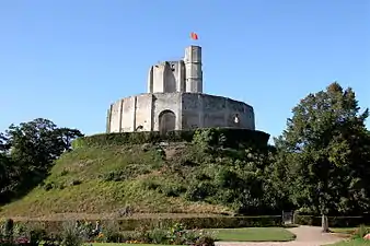
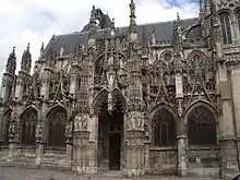
The Abbey of Bec and the Château-Gaillard near Les Andelys are other important tourist attractions.
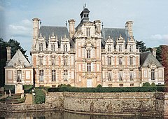
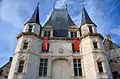
The Château of Buisson de May was built by the royal architect Jacques Denis Antoine from 1781 to 1783.

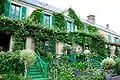
Giverny: Claude Monet's house 
See also
External links
- (in French) General Council website
- (in French) Prefecture website
- (in French) Village Arnières sur Iton website
- (in English) Giverny Vernon : In the Heart of Impressionism
- (in English) Château du Buisson de May
Sources
- Site sur la Population et les Limites Administratives de la France
- Jacques Olivier Boudon, Les Bonaparte : regards sur la France impériale. La Documentation photographique, dossier 8073, janvier-février 2010, p. 11 (carte de Gilles Pécout)
- http://www.assemblee-nationale.fr/
| Authority control |
|---|