Montier, Missouri
Montier is a census-designated place in southwestern Shannon County, Missouri, United States.[3]
Montier, Missouri | |
|---|---|
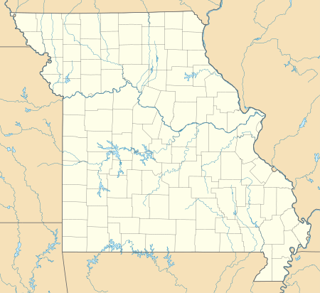 Montier Location within the state of Missouri | |
| Coordinates: 36°59′13″N 91°34′32″W | |
| Country | United States |
| State | Missouri |
| County | Shannon |
| Township | Montier |
| Elevation | 1,076 ft (328 m) |
| Population (2010) | |
| • Total | 98 |
| • Density | 66/sq mi (106.2/km2) |
| Time zone | UTC-6 (Central (CST)) |
| • Summer (DST) | UTC-5 (CDT) |
| ZIP code | 65546 |
| Area code(s) | 573 |
| FIPS code | 29-49610[2] |
| GNIS feature ID | 722548[1] |
History
A variant name was "Monteer".[1] A post office called Monteer was established in 1889, and the spelling was changed to Montier in 1924.[4] The community has the name of A. N. Montier, a railroad official.[5]
Geography
Montier is located approximately seven miles east of Mountain View and four miles west of Birch Tree on the south side of U.S. Route 60.[6] The town was located on the old St. Louis–San Francisco Railway line.[7]
References
- U.S. Geological Survey Geographic Names Information System: Montier, Missouri
- "U.S. Census website". United States Census Bureau. Retrieved 2008-01-31.
- U.S. Geological Survey Geographic Names Information System: Montier Census Designated Place
- "Post Offices". Jim Forte Postal History. Retrieved 25 December 2016.
- "Shannon County Place Names, 1928–1945". The State Historical Society of Missouri. Archived from the original on June 24, 2016. Retrieved December 25, 2016.
- Montier, MO, 7.5 Minute Topographic Quadrangle, USGS, 1986
- Montier, MO, 15 Minute Topographic Quadrangle, USGS, 1948
Municipalities and communities of Shannon County, Missouri, United States | ||
|---|---|---|
| Cities | 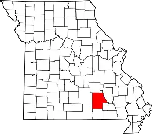 Map of Missouri highlighting Shannon County | |
| Townships | ||
| CDP | ||
| Unincorporated communities | ||
| Ghost towns | ||
| Footnotes | ‡This populated place also has portions in an adjacent county or counties | |
| ||
This article is issued from Wikipedia. The text is licensed under Creative Commons - Attribution - Sharealike. Additional terms may apply for the media files.
