Morgan Draw
Morgan Draw is railroad moveable bridge over the Cheesequake Creek between the Morgan section of Sayreville and Laurence Harbor in Old Bridge in Middlesex County, New Jersey, United States. Located at MP 0.2 near the mouth on the Raritan Bay, the bascule bridge lies just upstream of the New Jersey Route 35 crossing. It is owned and operated by New Jersey Transit Rail Operations (NJT)[2][3] and substantially rehabilitated in 2005-2008.[4][5] A storm surge during Hurricane Sandy in 2012 caused severe damage to the bridge.[6]
Morgan Draw | |
|---|---|
| Coordinates | 40.46161°N 74.25968°W |
| Carries | Conrail North Jersey Coast Line |
| Crosses | Cheesequake Creek |
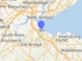
| Locale | Morgan and Laurence Harbor, New Jersey |
| Owner | NJ Transit |
| Bridge Hunter ID | NJT 403 BH 60655[1] |
| Characteristics | |
| Design | Bascule |
| Traversable? | Yes; by train only |
| Longest span | 79 ft (24 m) |
| No. of spans | 6 |
| Piers in water | 5 |
| Clearance below | 3 ft (0.91 m) |
| Rail characteristics | |
| No. of tracks | 2 |
| Electrified | Yes |
| History | |
| Engineering design by | Harry L. Thomas |
| Constructed by | Scherzer Rolling Lift Bridge Co. |
| Construction end | 1912 |
| Rebuilt | 2012 (rehabilitated post-Superstorm Sandy) |
| Location | |
| |
Operations
The Cheesequake Creek is used for recreational boating. The bridge serves the North Jersey Coast Line between the South Amboy and Aberdeen-Matawan stations. It is also used by Conrail. As of 2008 the Code of Federal Regulations stipulated that the it open on signal; except that, at least four hours notice is required rom January 1 through March 31 from 6 p.m. to 6 a.m.; from April 1 through April 30 and November 1 through November 30 (from 10 p.m. to 6 a.m. Monday through Thursday, and midnight Sunday through 6 a.m. Monday; and rom December 1 through December 31 from 10 p.m. to 6 a.m.[7]
References
- "NJT - Morgan Draw". Bridgehunter.com. Retrieved November 5, 2016.
- "Morgan Draw". Bridgehunter. Retrieved June 13, 2015.
- "REHABILITATION PLANNED FOR 94-YEAR-OLD DRAWBRIDGE ON NORTH JERSEY COAST LINE" (Press release). New Jersey Transit. Retrieved June 13, 2015.
- https://www.arema.org/files/library/2012_Conference_Proceedings/Morgan_Draw_Rolling_Lift_Tread_and_Track_Plate_Replacement.pdf
- http://www.ironbc.com/movable-bridges.html
- "ALL BUT ONE NJ TRANSIT RAIL LINES FULLY OR PARTIALLY RESTORED STARTING MONDAY, NOVEMBER 19" (Press release). New Jersey Transit. Retrieved June 13, 2015.
- "eCFR — Code of Federal Regulations". ecfr.gov. Retrieved June 13, 2015.
External links
| Hoboken Division | ||
|---|---|---|
| Newark Division | ||
| Connections | ||
| Current rolling stock | ||
| Bridges and tunnels |
| |
| Stations and yards | ||
| Proposed lines | ||
| Other topics | ||